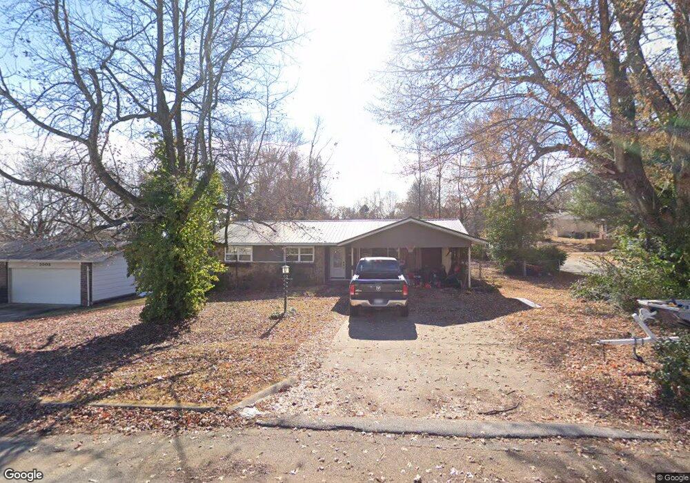
1010 Shorecrest Ave Harrison, AR 72601
Estimated Value: $162,000 - $184,000
Studio
2
Baths
1,027
Sq Ft
$169/Sq Ft
Est. Value
About This Home
This home is located at 1010 Shorecrest Ave, Harrison, AR 72601 and is currently estimated at $173,079, approximately $168 per square foot. 1010 Shorecrest Ave is a home located in Boone County with nearby schools including Skyline Heights Elementary School, Harrison Jr. High School, and Harrison High School.
Ownership History
Date
Name
Owned For
Owner Type
Purchase Details
Closed on
Dec 18, 2025
Sold by
Ruff Mark B and Ruff Sabrina Cheyenne
Bought by
Ruff Mckinley B
Current Estimated Value
Home Financials for this Owner
Home Financials are based on the most recent Mortgage that was taken out on this home.
Original Mortgage
$133,838
Outstanding Balance
$133,582
Interest Rate
6.22%
Mortgage Type
New Conventional
Estimated Equity
$39,497
Purchase Details
Closed on
Nov 3, 2021
Sold by
Ruff Marty L and Ruff Twila
Bought by
Ruff Mark B
Home Financials for this Owner
Home Financials are based on the most recent Mortgage that was taken out on this home.
Original Mortgage
$106,565
Interest Rate
2.88%
Mortgage Type
New Conventional
Purchase Details
Closed on
Oct 13, 2021
Sold by
Ruff Michell R
Bought by
Ruff Marty L
Home Financials for this Owner
Home Financials are based on the most recent Mortgage that was taken out on this home.
Original Mortgage
$106,565
Interest Rate
2.88%
Mortgage Type
New Conventional
Create a Home Valuation Report for This Property
The Home Valuation Report is an in-depth analysis detailing your home's value as well as a comparison with similar homes in the area
Purchase History
| Date | Buyer | Sale Price | Title Company |
|---|---|---|---|
| Ruff Mckinley B | $131,000 | Titlenet Solutions | |
| Ruff Mark B | $105,000 | Accommodation | |
| Ruff Marty L | -- | None Listed On Document |
Source: Public Records
Mortgage History
| Date | Status | Borrower | Loan Amount |
|---|---|---|---|
| Open | Ruff Mckinley B | $133,838 | |
| Previous Owner | Ruff Mark B | $106,565 | |
| Previous Owner | Ruff Marty L | $106,565 |
Source: Public Records
Tax History
| Year | Tax Paid | Tax Assessment Tax Assessment Total Assessment is a certain percentage of the fair market value that is determined by local assessors to be the total taxable value of land and additions on the property. | Land | Improvement |
|---|---|---|---|---|
| 2025 | $1,041 | $20,410 | $1,600 | $18,810 |
| 2024 | $1,041 | $20,410 | $1,600 | $18,810 |
| 2023 | $1,041 | $20,410 | $1,600 | $18,810 |
| 2022 | $1,041 | $20,410 | $1,600 | $18,810 |
| 2021 | $419 | $20,410 | $1,600 | $18,810 |
| 2020 | $381 | $14,820 | $1,600 | $13,220 |
| 2019 | $399 | $14,820 | $1,600 | $13,220 |
| 2018 | $421 | $14,820 | $1,600 | $13,220 |
| 2017 | $337 | $14,820 | $1,600 | $13,220 |
| 2016 | $337 | $13,480 | $1,600 | $11,880 |
| 2015 | $655 | $12,840 | $1,600 | $11,240 |
| 2014 | $305 | $12,840 | $1,600 | $11,240 |
Source: Public Records
Map
Nearby Homes
- 916 Quail Ave
- 307 Prestonwood St
- 26 Ozark Dr
- 0 Gipson Rd
- 0 Corner of Airport Rd & Hwy 65n Unit 146774
- Lot 3 Cornerstone Way
- Lot 1 Cornerstone Way
- Lot 4 Cornerstone Way
- Lot 2 Cornerstone Way
- 602 Oriole Dr
- 203 Glenview St
- 3607 W Overland Cir
- Lot 1 Rains Rd S
- Lot 2 Rains Rd S
- 1800 Airport Rd
- Lot 3 Hawkins Rd
- Lot 4 Hawkins Rd
- Lot 5 Hawkins Rd
- 1903 Daly Dr
- 3000 Belmont Ave
- 1008 Shorecrest Ave
- 107 Prestonwood St
- 110 Prestonwood St
- 1006 Shorecrest Ave
- 112 Prestonwood St
- 108 Prestonwood St
- 1009 Shorecrest Ave
- 105 Prestonwood St
- 1007 Shorecrest Ave
- 214 Prestonwood St
- 6 Melshire Cove
- 1004 Shorecrest Ave
- 1005 Shorecrest Ave
- 106 Prestonwood St
- 103 Prestonwood St
- 1003 Shorecrest Ave
- 7 Melshire Cove
- 104 Prestonwood St
- 4 Melshire Cove
- 1002 Shorecrest Ave
Your Personal Tour Guide
Ask me questions while you tour the home.