B
Seller's Agent in 2025
Barb Groves
Coldwell Banker Groves Real Estate
(517) 320-7325
79 Total Sales
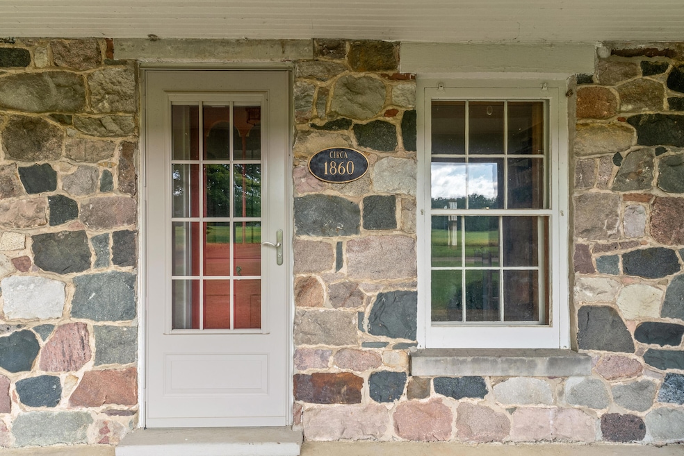


A wonderfully unique blend of historic and country charm STONE home with several freshly painted barns. Amazing wood floors and window trim created from trees from the farm! Many built-ins and storage including a pantry. Epoxy floor in the finished garage, with cedar closet for great storage. 3 full baths, a large loft bedroom, a main floor master suite, upstairs suite with additional built-in heater in your personal bathroom with adorable unique eyebrow window storage A full house generator. So many added touches, a brick patio, brick walks to a covered porch, beautiful landscaping and incredible shade trees for total enjoyment. all sits on 3 + acres.
Last Agent to Sell the Property
Coldwell Banker Groves Real Estate Listed on: 09/06/2025

| Date | Type | Sale Price | Title Company |
|---|---|---|---|
| Warranty Deed | $389,000 | Public Title | |
| Warranty Deed | $525,000 | -- | |
| Deed | -- | -- | |
| Deed | -- | -- | |
| Deed | -- | -- | |
| Deed | -- | -- |
| Date | Status | Loan Amount | Loan Type |
|---|---|---|---|
| Open | $369,550 | New Conventional | |
| Closed | -- | No Value Available |
| Date | Event | Price | List to Sale | Price per Sq Ft |
|---|---|---|---|---|
| 10/03/2025 10/03/25 | Sold | $389,000 | +5.2% | $169 / Sq Ft |
| 09/27/2025 09/27/25 | Pending | -- | -- | -- |
| 09/06/2025 09/06/25 | For Sale | $369,900 | -- | $161 / Sq Ft |
| Year | Tax Paid | Tax Assessment Tax Assessment Total Assessment is a certain percentage of the fair market value that is determined by local assessors to be the total taxable value of land and additions on the property. | Land | Improvement |
|---|---|---|---|---|
| 2025 | $1,010 | $204,200 | $0 | $0 |
| 2024 | $10 | $180,900 | $0 | $0 |
| 2023 | $938 | $162,900 | $0 | $0 |
| 2022 | $2,050 | $149,300 | $0 | $0 |
| 2021 | $1,990 | $133,300 | $0 | $0 |
| 2020 | $1,974 | $137,841 | $0 | $0 |
| 2019 | $1,861 | $136,313 | $0 | $0 |
| 2018 | $1,772 | $131,293 | $0 | $0 |
| 2017 | $1,699 | $125,910 | $0 | $0 |
| 2016 | $1,684 | $115,410 | $0 | $0 |
| 2015 | $790 | $115,410 | $0 | $0 |
| 2013 | $765 | $113,940 | $0 | $0 |
| 2012 | $747 | $99,857 | $0 | $0 |
B
Seller's Agent in 2025
Barb Groves
Coldwell Banker Groves Real Estate
(517) 320-7325
79 Total Sales
Buyer's Agent in 2025
Michelle Wollet
Hillsdale Real Estate
(517) 439-0101
101 Total Sales
Source: MichRIC
MLS Number: 25045774
APN: 01-006-200-006-06-5-4
Disclaimer: Certain information contained herein is derived from information provided by parties other than Homes.com. All information provided is deemed reliable, but is not guaranteed to be accurate and should be independently verified.
![]() Information is deemed reliable but not guaranteed.
Information is deemed reliable but not guaranteed.
Copyright 2026 MichRIC, LLC. All rights reserved.
Ask me questions while you tour the home.