Estimated Value: $785,000 - $1,079,000
3
Beds
2
Baths
1,561
Sq Ft
$584/Sq Ft
Est. Value
About This Home
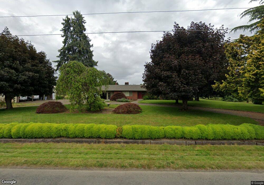
This home is located at 10115 S Bremer Rd, Canby, OR 97013 and is currently estimated at $911,741, approximately $584 per square foot. 10115 S Bremer Rd is a home located in Clackamas County with nearby schools including Cecile Trost Elementary School, Carus School, and Baker Prairie Middle School.
Ownership History
Date
Name
Owned For
Owner Type
Purchase Details
Closed on
Aug 24, 1999
Sold by
Hokenson Ronald C and Hokenson Lea M
Bought by
Lotz Karen M and Isaacs Gregory A
Current Estimated Value
Home Financials for this Owner
Home Financials are based on the most recent Mortgage that was taken out on this home.
Original Mortgage
$190,000
Outstanding Balance
$53,221
Interest Rate
7.56%
Estimated Equity
$858,520
Create a Home Valuation Report for This Property
The Home Valuation Report is an in-depth analysis detailing your home's value as well as a comparison with similar homes in the area
Purchase History
| Date | Buyer | Sale Price | Title Company |
|---|---|---|---|
| Lotz Karen M | $280,000 | Chicago Title Insurance Co |
Source: Public Records
Mortgage History
| Date | Status | Borrower | Loan Amount |
|---|---|---|---|
| Open | Lotz Karen M | $190,000 |
Source: Public Records
Tax History
| Year | Tax Paid | Tax Assessment Tax Assessment Total Assessment is a certain percentage of the fair market value that is determined by local assessors to be the total taxable value of land and additions on the property. | Land | Improvement |
|---|---|---|---|---|
| 2025 | $4,579 | $319,971 | -- | -- |
| 2024 | $4,452 | $310,654 | -- | -- |
| 2023 | $4,452 | $301,608 | $0 | $0 |
| 2022 | $4,071 | $292,825 | $0 | $0 |
| 2021 | $3,912 | $284,300 | $0 | $0 |
| 2020 | $3,853 | $276,020 | $0 | $0 |
| 2019 | $3,651 | $267,982 | $0 | $0 |
| 2018 | $3,576 | $260,178 | $0 | $0 |
| 2017 | $3,489 | $252,599 | $0 | $0 |
| 2016 | $3,369 | $245,244 | $0 | $0 |
Source: Public Records
Map
Nearby Homes
- 105 S Hazel Dell Way
- 1873 N Teakwood St
- 1152 Tansy Ln
- 1156 Tansy Ln
- 1210 N Sycamore St
- 2125 NE Spitz Rd
- 2123 NE Spitz Rd
- 2147 NE Spitz Rd
- 1566 N Spruce St
- 1969 NE 20th Ave
- 1130 Lilium Ln
- 1558 NE 10th Place
- 1947 NE 21st Ave
- 1390 NE 11th Ave
- 1422 NE 18th Place
- 1164 NE 14th Place
- 1200 NE Territorial Rd Unit 72
- 1200 NE Territorial Rd Unit 75
- 32088 SW Peach Cove Rd
- 1004 NE 17th Ave
- 10161 S Bremer Rd
- 10201 S Bremer Rd
- 10211 S Bremer Rd
- 23116 S Haines Rd
- 23040 S Haines Rd
- 0 S Haines Rd
- 23240 S Mulino Rd
- 23031 S Haines Rd
- 22992 S Haines Rd
- 23149 S Haines Rd
- 23240 S Blount Rd
- 2590 SE 1st Ave
- 22962 S Haines Rd
- 22987 S Haines Rd
- 2592 SE 1st Ave
- 22969 S Haines Rd
- 23101 S Haines Rd
- 23300 S Blount Rd
- 22927 S Haines Rd
Your Personal Tour Guide
Ask me questions while you tour the home.