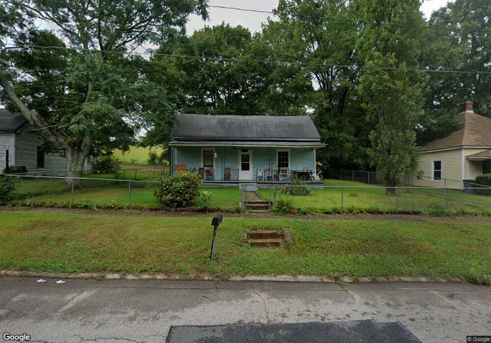
1012 Dunson St Lagrange, GA 30240
LaGrange AreaEstimated Value: $25,712 - $161,000
About This Home
This home is located at 1012 Dunson St, Lagrange, GA 30240 and is currently estimated at $103,428, approximately $91 per square foot. 1012 Dunson St is a home located in Troup County with nearby schools including Berta Weathersbee Elementary School, Whitesville Road Elementary School, and Rosemont Elementary School.
Ownership History
We collect this data history from publicly available records. To have your information removed, we recommend requesting removal directly through your county’s website.
Purchase Details
Purchase Details
Purchase Details
Purchase Details
Purchase Details
Purchase History
We collect this data history from publicly available records. To have your information removed, we recommend requesting removal directly through your county’s website.
| Date | Buyer | Sale Price | Title Company |
|---|---|---|---|
| -- | -- | ||
| $11,000 | -- | ||
| $2,100 | -- | ||
| -- | -- | ||
| -- | -- |
Tax History
We collect this data history from publicly available records. To have your information removed, we recommend requesting removal directly through your county’s website.
| Year | Tax Paid | Tax Assessment Tax Assessment Total Assessment is a certain percentage of the fair market value that is determined by local assessors to be the total taxable value of land and additions on the property. | Land | Improvement |
|---|---|---|---|---|
| 2025 | $673 | $24,680 | $2,360 | $22,320 |
| 2024 | $629 | $23,080 | $2,360 | $20,720 |
| 2023 | $584 | $21,400 | $2,360 | $19,040 |
| 2022 | $549 | $19,680 | $2,360 | $17,320 |
| 2021 | $361 | $11,960 | $2,360 | $9,600 |
| 2020 | $361 | $11,960 | $2,360 | $9,600 |
| 2019 | $340 | $11,280 | $2,360 | $8,920 |
| 2018 | $314 | $10,420 | $2,380 | $8,040 |
| 2017 | $314 | $10,420 | $2,380 | $8,040 |
| 2016 | $313 | $10,368 | $2,380 | $7,988 |
| 2015 | $313 | $10,368 | $2,380 | $7,988 |
| 2014 | $2 | $9,192 | $2,380 | $6,812 |
| 2013 | -- | $9,192 | $2,380 | $6,812 |
Map
- 914 Todd St
- 1005 Callaway Ave
- 606 Poplar St
- 1105 Juniper St
- 501 Milam St
- 1191 Whitesville St
- 0 Bagley St
- 704 S Greenwood St
- 603 Park Ave
- 109 Bell St
- 0 Boggs St Unit 10550243
- 0 Boggs St Unit 10550231
- 0 Boggs St Unit 10550239
- 0 Boggs St Unit 10550250
- 207 Wilkes St
- 304 Butler St
- 1308 Park Ave
- 205 Cherry St
- 600 Park Ave
- 900 B N Pkwy
Ask me questions while you tour the home.