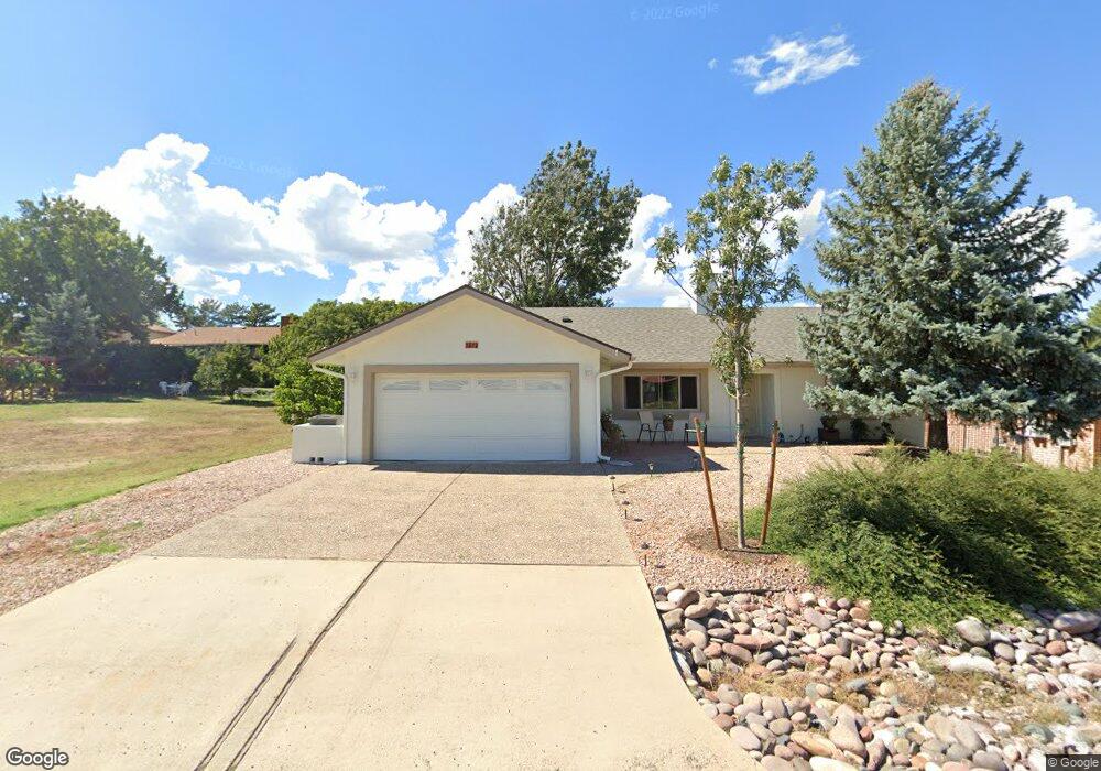
1012 Stirrup High Dr E Dewey, AZ 86327
Prescott Golf & Country Club NeighborhoodEstimated Value: $420,000 - $456,000
3
Beds
2
Baths
1,660
Sq Ft
$265/Sq Ft
Est. Value
About This Home
This home is located at 1012 Stirrup High Dr E, Dewey, AZ 86327 and is currently estimated at $439,720, approximately $264 per square foot. 1012 Stirrup High Dr E is a home located in Yavapai County with nearby schools including Lake Valley Elementary School, Glassford Hill Middle School, and Bradshaw Mountain High School.
Ownership History
Date
Name
Owned For
Owner Type
Purchase Details
Closed on
Mar 3, 2023
Sold by
Greene Janice and Greene Thomas
Bought by
Reyes Andria and Reyes Joseph Raymond
Current Estimated Value
Home Financials for this Owner
Home Financials are based on the most recent Mortgage that was taken out on this home.
Original Mortgage
$418,000
Outstanding Balance
$404,877
Interest Rate
6.13%
Mortgage Type
New Conventional
Estimated Equity
$34,843
Purchase Details
Closed on
Sep 7, 2021
Sold by
French Jack Vernon and French Leslie Ann
Bought by
Greene Janice and Greene Thomas
Purchase Details
Closed on
Jun 11, 2019
Sold by
Jackson Arthur J and Jackson Vivian G
Bought by
French Jack Vernon and French Leslie Ann
Purchase Details
Closed on
Jun 19, 2015
Sold by
Jackson Arthur J and Jackson Vivian G
Bought by
The Arthur & Vivian Jackson Trust
Purchase Details
Closed on
Jul 8, 2014
Sold by
Kurtzman Chad A and The Kurtzman Family Living Tru
Bought by
Jackson Arthur J and Jackson Vivian G
Home Financials for this Owner
Home Financials are based on the most recent Mortgage that was taken out on this home.
Original Mortgage
$59,000
Interest Rate
4.13%
Mortgage Type
New Conventional
Purchase Details
Closed on
Oct 4, 2011
Sold by
Kurtzman William E and Kurtzman Ruthe
Bought by
Kurtzman William E and Kurtzman Ruth E
Purchase Details
Closed on
Nov 25, 1998
Sold by
Crandall Richard C and Crandall Patsy M
Bought by
Kurtzman William E and Kurtzman Ruth E
Home Financials for this Owner
Home Financials are based on the most recent Mortgage that was taken out on this home.
Original Mortgage
$65,750
Interest Rate
6.86%
Purchase Details
Closed on
Jul 11, 1997
Sold by
Crandall Richard C and Crandall Patsy M
Bought by
Crandall Richard C and Crandall Patsy M
Home Financials for this Owner
Home Financials are based on the most recent Mortgage that was taken out on this home.
Original Mortgage
$30,000
Interest Rate
7.58%
Purchase Details
Closed on
Apr 24, 1996
Sold by
Crandall Richard C and Crandall Patsy M
Bought by
Crandall Richard C and Crandall Patsy M
Create a Home Valuation Report for This Property
The Home Valuation Report is an in-depth analysis detailing your home's value as well as a comparison with similar homes in the area
Home Values in the Area
Average Home Value in this Area
Purchase History
| Date | Buyer | Sale Price | Title Company |
|---|---|---|---|
| Reyes Andria | $440,000 | Empire Title | |
| Greene Janice | $425,000 | Pioneer Title Agency Inc | |
| French Jack Vernon | $299,900 | Pioneer Title Agency | |
| The Arthur & Vivian Jackson Trust | -- | None Available | |
| Jackson Arthur J | $195,000 | Lawyers Title | |
| Kurtzman William E | -- | None Available | |
| Kurtzman William E | -- | Capital Title Agency | |
| Crandall Richard C | -- | First American Title Ins | |
| Crandall Richard C | -- | First American Title Ins | |
| Crandall Richard C | -- | -- |
Source: Public Records
Mortgage History
| Date | Status | Borrower | Loan Amount |
|---|---|---|---|
| Open | Reyes Andria | $418,000 | |
| Previous Owner | Jackson Arthur J | $59,000 | |
| Previous Owner | Kurtzman William E | $65,750 | |
| Previous Owner | Crandall Richard C | $30,000 |
Source: Public Records
Tax History
| Year | Tax Paid | Tax Assessment Tax Assessment Total Assessment is a certain percentage of the fair market value that is determined by local assessors to be the total taxable value of land and additions on the property. | Land | Improvement |
|---|---|---|---|---|
| 2026 | $1,701 | $30,261 | -- | -- |
| 2024 | $1,559 | $32,086 | -- | -- |
| 2023 | $1,559 | $26,732 | $4,642 | $22,090 |
| 2022 | $1,534 | $21,657 | $4,061 | $17,596 |
| 2021 | $1,603 | $19,664 | $4,074 | $15,590 |
| 2020 | $1,540 | $0 | $0 | $0 |
| 2019 | $1,521 | $0 | $0 | $0 |
| 2018 | $1,446 | $0 | $0 | $0 |
| 2017 | $1,418 | $0 | $0 | $0 |
| 2016 | $1,370 | $0 | $0 | $0 |
| 2015 | -- | $0 | $0 | $0 |
| 2014 | -- | $0 | $0 | $0 |
Source: Public Records
Map
Nearby Homes
- 1140 N Latigo Ln
- 11516 E Wingfoot Ct
- 969 N Fairway Dr
- 1275 N Tapadero Dr
- 1026 N Fairway Dr Unit 56
- 1283 N Tapadero Dr
- 1200 N Tapadero Dr Unit 1
- 819 N Winchester Way
- 707 N Apache Dr
- 11430 E Manzanita Trail
- 11347 E Manzanita Trail
- 978 N Mountain Brush Dr
- 11487 E Western Sunset Dr
- 749 N Zuni Trail
- 1227 N Buena Vista W
- 11941 E Powderhorn Pass
- 12170 E Obsidian Loop Rd
- 12185 E Stonehenge Way
- 11873 E Turquoise Cir Unit 2
- 2142 Jackrabbit Dr
- 1012 N Stirrup High Dr W
- 1012 N Stirrup High Dr W Unit W
- 11847 N Stirrup High Dr W
- 1020 Stirrup High Dr E
- 1020 N Stirrup High Dr W
- 1029 N Latigo Ln
- 1043 N Latigo Ln
- 1043 N Latigo Ln Unit 1
- 998 N Stirrup High Dr W
- 1028 N Stirrup High Dr W
- 1028 Stirrup High Dr E
- 1013 N Latigo Ln
- 1017 N Stirrup High Dr W
- 1017 N Stirrup High Dr W Unit 1
- 1017 Stirrup High Dr E Unit 1
- 1017 Stirrup High Dr E
- 1057 N Latigo Ln
- 1001 N Stirrup High Dr W
- 0 Latigo Ln
- 999 N Latigo Ln
Your Personal Tour Guide
Ask me questions while you tour the home.