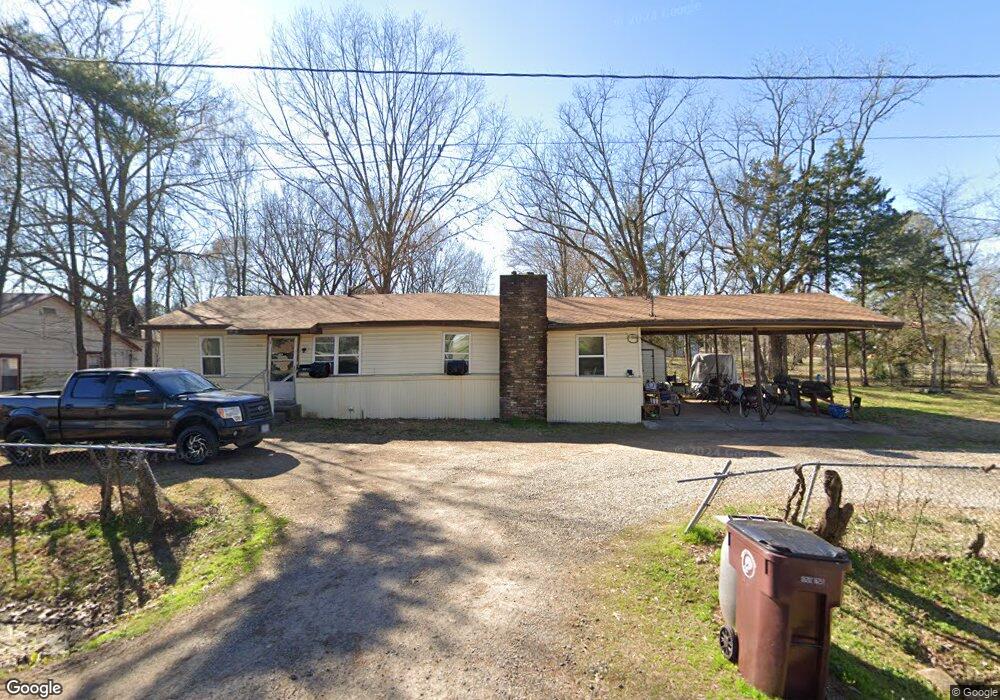
1017 W Hazel St Prescott, AR 71857
Estimated Value: $57,051 - $88,000
Studio
2
Baths
2,179
Sq Ft
$33/Sq Ft
Est. Value
About This Home
This home is located at 1017 W Hazel St, Prescott, AR 71857 and is currently estimated at $71,263, approximately $32 per square foot. 1017 W Hazel St is a home located in Nevada County with nearby schools including Prescott Elementary School, Prescott Junior High School, and Prescott High School.
Ownership History
Date
Name
Owned For
Owner Type
Purchase Details
Closed on
Sep 20, 2019
Bought by
Mcgill Shirley and Harris Melissa
Current Estimated Value
Purchase Details
Closed on
Nov 30, 2009
Sold by
Jones Jean K
Bought by
Mcgill Shirley and Gulley Marcus
Purchase Details
Closed on
Feb 11, 2002
Bought by
Jones, Jean K Family Trust and Ruthie Sims %
Purchase Details
Closed on
Jun 30, 2000
Bought by
Jones, Jean K Family Trust
Purchase Details
Closed on
Oct 17, 1991
Bought by
Jones Billy R and Jones Jean K
Create a Home Valuation Report for This Property
The Home Valuation Report is an in-depth analysis detailing your home's value as well as a comparison with similar homes in the area
Home Values in the Area
Average Home Value in this Area
Purchase History
| Date | Buyer | Sale Price | Title Company |
|---|---|---|---|
| Mcgill Shirley | $26,000 | -- | |
| Mcgill Shirley | $25,249 | -- | |
| Jones, Jean K Family Trust | -- | -- | |
| Jones, Jean K Family Trust | -- | -- | |
| Jones Billy R | $24,000 | -- |
Source: Public Records
Tax History
| Year | Tax Paid | Tax Assessment Tax Assessment Total Assessment is a certain percentage of the fair market value that is determined by local assessors to be the total taxable value of land and additions on the property. | Land | Improvement |
|---|---|---|---|---|
| 2025 | -- | $6,390 | $720 | $5,670 |
| 2023 | $0 | $3,570 | $620 | $2,950 |
| 2022 | $0 | $3,570 | $620 | $2,950 |
| 2021 | $0 | $3,570 | $620 | $2,950 |
| 2020 | $0 | $3,570 | $620 | $2,950 |
| 2019 | $0 | $4,240 | $620 | $3,620 |
| 2018 | $0 | $4,240 | $620 | $3,620 |
| 2017 | $0 | $4,240 | $620 | $3,620 |
| 2016 | $0 | $4,240 | $620 | $3,620 |
| 2015 | -- | $4,240 | $620 | $3,620 |
| 2014 | -- | $4,240 | $620 | $3,620 |
| 2013 | -- | $4,960 | $610 | $4,350 |
Source: Public Records
Map
Nearby Homes
- 1003 W Main St
- 338 W 2nd St N
- 0 3rd St
- 527 E 2nd St S
- 422 E 7th St
- 519 E 4th St S
- 828 E Main St
- 762 Ash St
- 0 Little Missosur River Unit 25050038
- 718 Oak St
- 116 Ridgewood Rd
- 000 Camden Hwy
- 1208 Cale Rd
- 1306 Nevada 261
- 2361 Arkansas 19
- 228 Nevada 66 W
- Nevada Road 41 Unit LotWP001
- 0 Nevada 249 Rd
- 213 Nevada 55
- 206 E 1st St
- 423 Greenlawn St
- 1011 W Hazel St
- 1016 W Hazel St
- 1003 W Hazel St
- 432 Gee St
- 369 Greenlawn St
- 356 Gee St
- 354 Greenlawn St
- 370 Greenlawn St
- 438 Greenlawn St
- 1028 W Walnut St
- 1002 W Walnut St
- 331 W Hazel St
- 340 Gee St
- 1129 W Hazel St
- 342 W Walnut St
- 348 Greenlawn St
- 1029 W Walnut St
- 336 W Walnut St
- 1011 W Walnut St
Your Personal Tour Guide
Ask me questions while you tour the home.