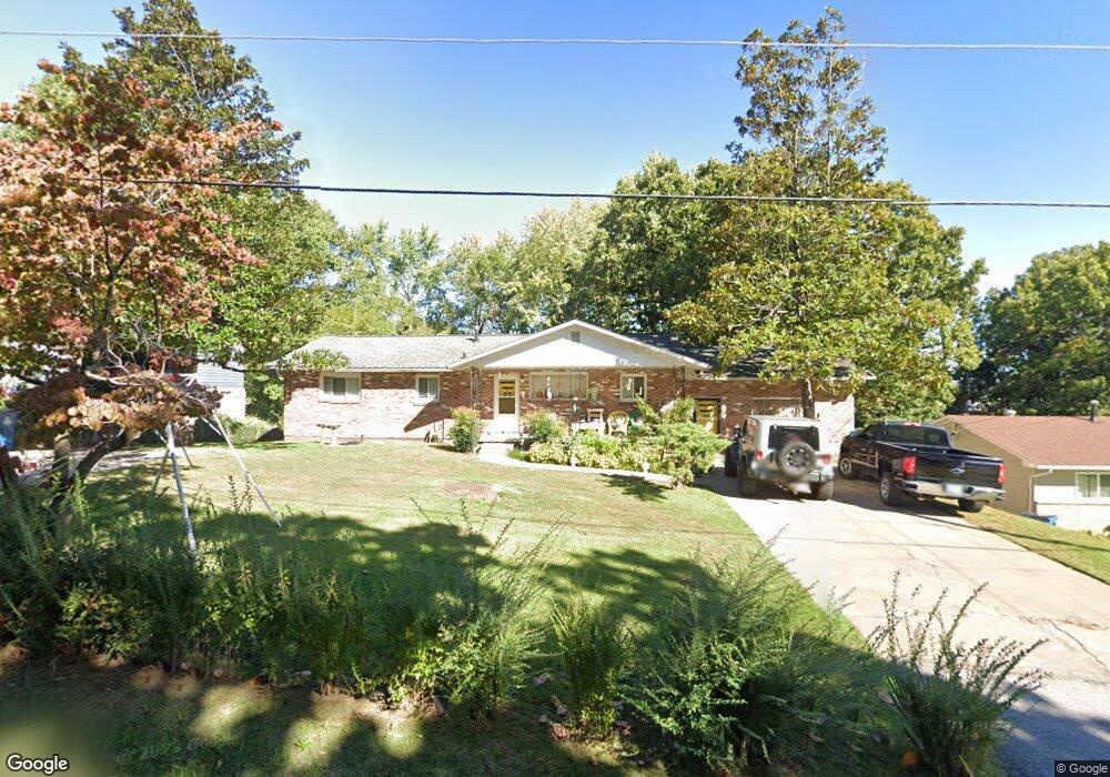
1018 Bond St Neosho, MO 64850
Estimated Value: $202,000 - $231,000
3
Beds
2
Baths
2,350
Sq Ft
$93/Sq Ft
Est. Value
About This Home
This home is located at 1018 Bond St, Neosho, MO 64850 and is currently estimated at $217,487, approximately $92 per square foot. 1018 Bond St is a home located in Newton County with nearby schools including Neosho High School, Ozark Christian Academy, and Neosho Christian Schools.
Create a Home Valuation Report for This Property
The Home Valuation Report is an in-depth analysis detailing your home's value as well as a comparison with similar homes in the area
Home Values in the Area
Average Home Value in this Area
Tax History
We collect this data history from publicly available records. To have your information removed, we recommend requesting removal directly through your county’s website.
| Year | Tax Paid | Tax Assessment Tax Assessment Total Assessment is a certain percentage of the fair market value that is determined by local assessors to be the total taxable value of land and additions on the property. | Land | Improvement |
|---|---|---|---|---|
| 2025 | $1,036 | $17,770 | -- | -- |
| 2024 | $1,033 | $18,810 | -- | -- |
| 2023 | $1,033 | $18,810 | $2,166 | $16,644 |
| 2022 | $1,033 | $18,020 | -- | -- |
| 2021 | $989 | $18,020 | $0 | $0 |
| 2020 | $890 | $16,290 | $0 | $0 |
| 2019 | $811 | $16,290 | $0 | $0 |
| 2018 | $817 | $16,290 | $0 | $0 |
| 2017 | $803 | $16,290 | $0 | $0 |
| 2016 | $803 | $16,000 | $0 | $0 |
| 2015 | -- | $16,000 | $0 | $0 |
| 2014 | -- | $16,000 | $0 | $0 |
Source: Public Records
Map
Nearby Homes
- Tbd W South St
- 1027 Sherry Dr
- Lot 13 14 Sherry Dr
- Lots 13 14 Sherry Dr
- 0 Sherry Dr
- 903 Peterson Rd
- 631 W South St
- Xxx Peterson Rd
- 704 Laurel Cir
- 700 Oak Ridge Dr
- 1015 Peterson Rd
- 1701 Ankney Place
- 1111 Peterson Rd
- 1721 Deer Run Rd
- 620 W South St
- 1243 Peterson Rd
- 613 S Lincoln St
- Xxx Deer Ridge Rd
- Xxx Deer Ridge Rd Unit 36
- 4071 Deer Ridge St
Your Personal Tour Guide
Ask me questions while you tour the home.