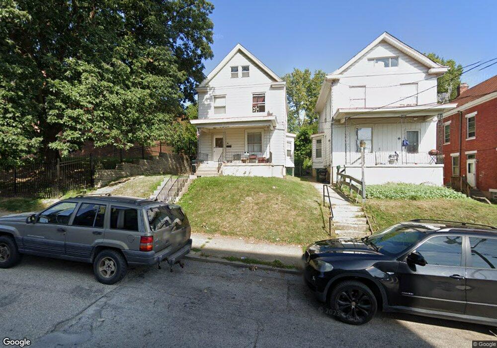
1019 Carson Ave Cincinnati, OH 45205
East Price Hill NeighborhoodEstimated Value: $104,803 - $155,000
3
Beds
1
Bath
1,444
Sq Ft
$95/Sq Ft
Est. Value
About This Home
This home is located at 1019 Carson Ave, Cincinnati, OH 45205 and is currently estimated at $137,701, approximately $95 per square foot. 1019 Carson Ave is a home located in Hamilton County with nearby schools including Gilbert A. Dater High School, Western Hills High School, and Robert A. Taft Information Technology High School.
Ownership History
Date
Name
Owned For
Owner Type
Purchase Details
Closed on
Oct 11, 2003
Sold by
Otten Stephen J and Otten Victoria L
Bought by
Otten Stephen J
Current Estimated Value
Purchase Details
Closed on
Jun 11, 1996
Sold by
Moore Mary B and Finke Rose T
Bought by
Otten Stephen J and Otten Victoria L
Home Financials for this Owner
Home Financials are based on the most recent Mortgage that was taken out on this home.
Original Mortgage
$28,875
Interest Rate
8.05%
Create a Home Valuation Report for This Property
The Home Valuation Report is an in-depth analysis detailing your home's value as well as a comparison with similar homes in the area
Home Values in the Area
Average Home Value in this Area
Purchase History
| Date | Buyer | Sale Price | Title Company |
|---|---|---|---|
| Otten Stephen J | -- | -- | |
| Otten Stephen J | $38,500 | -- |
Source: Public Records
Mortgage History
| Date | Status | Borrower | Loan Amount |
|---|---|---|---|
| Previous Owner | Otten Stephen J | $28,875 |
Source: Public Records
Tax History
| Year | Tax Paid | Tax Assessment Tax Assessment Total Assessment is a certain percentage of the fair market value that is determined by local assessors to be the total taxable value of land and additions on the property. | Land | Improvement |
|---|---|---|---|---|
| 2025 | $1,485 | $23,304 | $2,251 | $21,053 |
| 2023 | $1,486 | $23,304 | $2,251 | $21,053 |
| 2022 | $658 | $9,192 | $1,992 | $7,200 |
| 2021 | $643 | $9,192 | $1,992 | $7,200 |
| 2020 | $645 | $9,192 | $1,992 | $7,200 |
| 2019 | $644 | $8,355 | $1,810 | $6,545 |
| 2018 | $645 | $8,355 | $1,810 | $6,545 |
| 2017 | $621 | $8,355 | $1,810 | $6,545 |
| 2016 | $696 | $9,149 | $2,023 | $7,126 |
| 2015 | $622 | $9,149 | $2,023 | $7,126 |
| 2014 | $626 | $9,149 | $2,023 | $7,126 |
| 2013 | $656 | $9,433 | $2,086 | $7,347 |
Source: Public Records
Map
Nearby Homes
- 3719 Laclede Ave
- 3711 Glenway Ave
- 1231 Ridlen Ave
- 945 Enright Ave
- 3744 Mayfield Ave
- 921 Mcpherson Ave
- 924 Mcpherson Ave
- 966 Fairbanks Ave
- 1613 Wyoming Ave
- 3424 Kensington Place
- 808 Kirbert Ave
- 824 Mcpherson Ave
- 1318 Beech Ave
- 843 Fairbanks Ave
- 962 Mansion Ave
- 1136 Gilsey Ave
- 1124 Elberon Ave
- 3321 Glenway Ave
- 1700 Minion Ave
- 812 Fairbanks Ave
- 1021 Carson Ave
- 1023 Carson Ave
- 3709 Laclede Ave
- 3711 Laclede Ave
- 3715 Laclede Ave
- 3721 Laclede Ave
- 1105 Carson Ave
- 3723 Laclede Ave
- 3712 Laclede Ave
- 3646 Laclede Ave
- 1109 Carson Ave
- 3680 Warsaw Ave
- 1111 Carson Ave
- 3731 Laclede Ave
- 3724 Laclede Ave
- 1110 Carson Ave
- 3640 Laclede Ave
- 1033 Sturm St
- 3718 Laclede Ave
- 3733 Laclede Ave
Your Personal Tour Guide
Ask me questions while you tour the home.