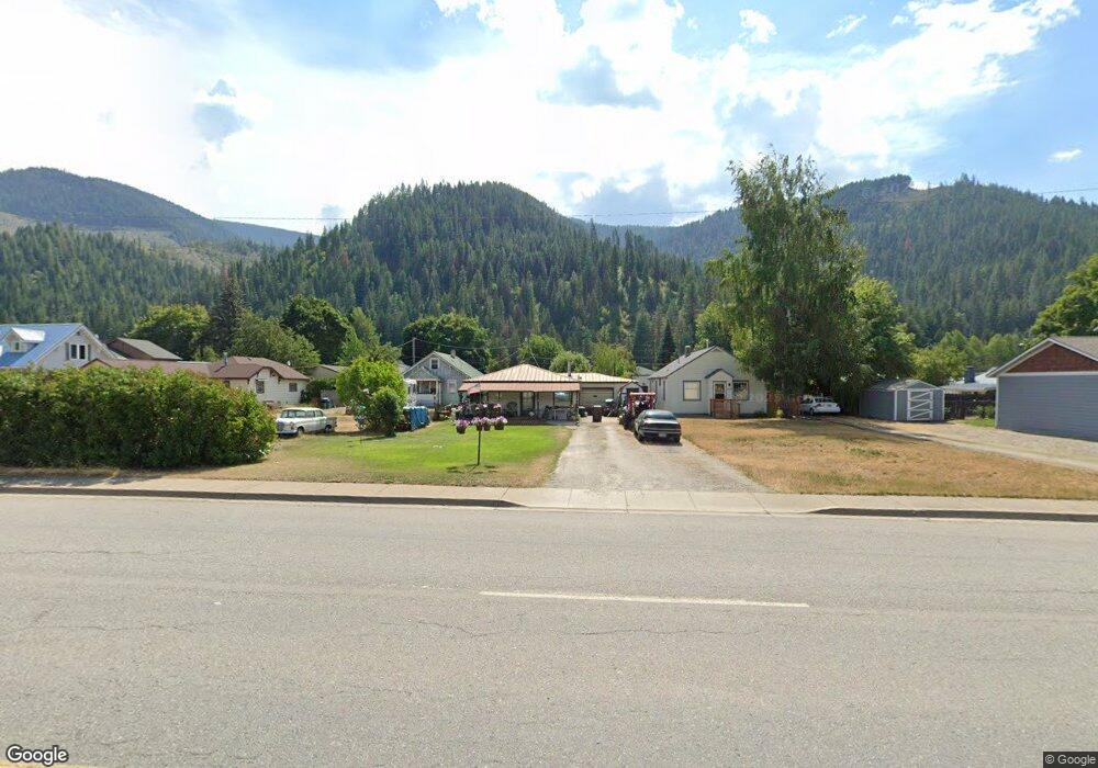
1019 E Mullan Ave Osburn, ID 83849
Estimated Value: $269,595 - $334,000
3
Beds
2
Baths
1,696
Sq Ft
$175/Sq Ft
Est. Value
About This Home
This home is located at 1019 E Mullan Ave, Osburn, ID 83849 and is currently estimated at $296,149, approximately $174 per square foot. 1019 E Mullan Ave is a home with nearby schools including Silver Hills Elementary School and Wallace Junior/Senior High School.
Ownership History
Date
Name
Owned For
Owner Type
Purchase Details
Closed on
Apr 21, 2025
Sold by
Smith David A
Bought by
Smith David A and Smith Brent W
Current Estimated Value
Purchase Details
Closed on
Nov 3, 2010
Sold by
Federal Home Loan Mortgage Corporation
Bought by
Smith David A
Home Financials for this Owner
Home Financials are based on the most recent Mortgage that was taken out on this home.
Original Mortgage
$75,048
Interest Rate
4.5%
Mortgage Type
FHA
Purchase Details
Closed on
Jun 17, 2010
Sold by
Bac Home Loans Servicing Lp
Bought by
Federal Home Loan Mortgage Corporation
Purchase Details
Closed on
Nov 13, 2006
Sold by
Middleton Dan
Bought by
Middleton Daniel A and Middleton Lolita L
Home Financials for this Owner
Home Financials are based on the most recent Mortgage that was taken out on this home.
Original Mortgage
$104,800
Interest Rate
6.28%
Create a Home Valuation Report for This Property
The Home Valuation Report is an in-depth analysis detailing your home's value as well as a comparison with similar homes in the area
Purchase History
| Date | Buyer | Sale Price | Title Company |
|---|---|---|---|
| Smith David A | -- | None Listed On Document | |
| Smith David A | -- | -- | |
| Federal Home Loan Mortgage Corporation | -- | -- | |
| Bac Home Loans Servicing Lp | $65,000 | -- | |
| Middleton Daniel A | -- | -- |
Source: Public Records
Mortgage History
| Date | Status | Borrower | Loan Amount |
|---|---|---|---|
| Previous Owner | Smith David A | $75,048 | |
| Previous Owner | Middleton Daniel A | $104,800 |
Source: Public Records
Tax History
| Year | Tax Paid | Tax Assessment Tax Assessment Total Assessment is a certain percentage of the fair market value that is determined by local assessors to be the total taxable value of land and additions on the property. | Land | Improvement |
|---|---|---|---|---|
| 2025 | $1,402 | $179,324 | $28,228 | $151,096 |
| 2024 | $1,391 | $179,324 | $28,228 | $151,096 |
| 2023 | $1,391 | $167,621 | $28,228 | $139,393 |
| 2022 | $1,659 | $155,122 | $28,116 | $127,006 |
| 2021 | $1,836 | $126,690 | $25,560 | $101,130 |
| 2020 | $1,700 | $96,987 | $23,377 | $73,610 |
| 2019 | $1,651 | $88,401 | $21,921 | $66,480 |
| 2018 | $1,643 | $70,329 | $19,929 | $50,400 |
| 2017 | $1,381 | $70,329 | $19,929 | $50,400 |
| 2016 | $1,397 | $69,869 | $19,929 | $49,940 |
| 2015 | -- | $65,769 | $19,929 | $45,840 |
| 2014 | -- | $70,538 | $19,928 | $50,610 |
Source: Public Records
Map
Nearby Homes
- 807 E Garden Ave
- 1151 E Fir
- 603 E Larch Ave
- 1600 W Yellowstone Ave Unit 45
- 1600 W Yellowstone Ave Unit 31
- 406 E Larch Ave
- 217 S Fourth St
- 704 W Yellowstone Ave
- 905 Terror Gulch Rd
- 235 Rio Vista St
- 208 Rio Vista St
- 498 Revenue Gulch Rd
- 214 Cypress St
- 504 1st St
- 132 King St
- 303 3rd St
- 176 King St
- 928 Polaris Peak Rd Unit Lot 3
- 928 Polaris Peak Rd Unit Lot 2
- 928 Polaris Peak Rd Unit Lot 1
- 1015 E Mullan Ave
- 1023 E Mullan Ave
- 1023 E Mullan Ave
- 1020 E Garden Ave
- 1025 E Mullan Ave
- 1005 E Mullan Ave
- 1008 E Garden Ave
- 1005 Mullan Ave
- 1029 E Mullan Ave
- 1033 E Mullan Ave
- 1001 E Mullan Ave
- 1034 E Garden Ave
- 1021 E Garden Ave
- 1017 Garden
- 1037 E Mullan Ave
- 1041 E Mullan Ave
- 1027 E Garden Ave
- 1043 E Mullan Ave
- 1001 E Garden Ave
- 1005 E Garden Ave
Your Personal Tour Guide
Ask me questions while you tour the home.