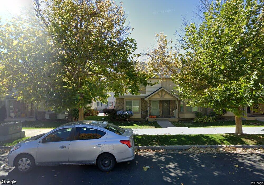
1019 Independence Ave Provo, UT 84604
Rivergrove NeighborhoodEstimated Value: $383,000 - $397,000
3
Beds
3
Baths
1,694
Sq Ft
$230/Sq Ft
Est. Value
About This Home
This home is located at 1019 Independence Ave, Provo, UT 84604 and is currently estimated at $390,220, approximately $230 per square foot. 1019 Independence Ave is a home located in Utah County with nearby schools including Westridge Elementary School, Dixon Middle School, and Provo High School.
Ownership History
Date
Name
Owned For
Owner Type
Purchase Details
Closed on
Oct 15, 2021
Sold by
Basinger Janette Coleman and Basinger David Welborn
Bought by
Basinger Daivd W and Basinger Janette C
Current Estimated Value
Purchase Details
Closed on
Oct 16, 2018
Sold by
Gonzalez Jesus A
Bought by
Basinger Janette Coleman and Basinger David Welborn
Home Financials for this Owner
Home Financials are based on the most recent Mortgage that was taken out on this home.
Original Mortgage
$207,920
Outstanding Balance
$129,139
Interest Rate
4.5%
Mortgage Type
New Conventional
Estimated Equity
$261,081
Purchase Details
Closed on
Apr 23, 2009
Sold by
Independence Avenue Llc
Bought by
Gonzalez Jesus A
Home Financials for this Owner
Home Financials are based on the most recent Mortgage that was taken out on this home.
Original Mortgage
$114,550
Interest Rate
5.02%
Mortgage Type
FHA
Create a Home Valuation Report for This Property
The Home Valuation Report is an in-depth analysis detailing your home's value as well as a comparison with similar homes in the area
Home Values in the Area
Average Home Value in this Area
Purchase History
| Date | Buyer | Sale Price | Title Company |
|---|---|---|---|
| Basinger Daivd W | -- | None Available | |
| Basinger Janette Coleman | -- | Eagle Gate Title Ins Agency | |
| Gonzalez Jesus A | -- | First American |
Source: Public Records
Mortgage History
| Date | Status | Borrower | Loan Amount |
|---|---|---|---|
| Open | Basinger Janette Coleman | $207,920 | |
| Previous Owner | Gonzalez Jesus A | $114,550 |
Source: Public Records
Tax History
| Year | Tax Paid | Tax Assessment Tax Assessment Total Assessment is a certain percentage of the fair market value that is determined by local assessors to be the total taxable value of land and additions on the property. | Land | Improvement |
|---|---|---|---|---|
| 2025 | $2,046 | $373,300 | $54,900 | $318,400 |
| 2024 | $2,046 | $201,410 | $0 | $0 |
| 2023 | $1,958 | $190,025 | $0 | $0 |
| 2022 | $1,994 | $195,140 | $0 | $0 |
| 2021 | $1,563 | $266,800 | $40,000 | $226,800 |
| 2020 | $1,616 | $258,500 | $33,600 | $224,900 |
| 2019 | $1,554 | $258,500 | $33,600 | $224,900 |
| 2018 | $1,393 | $235,000 | $29,000 | $206,000 |
| 2017 | $1,233 | $114,345 | $0 | $0 |
| 2016 | $1,203 | $103,950 | $0 | $0 |
| 2015 | $1,133 | $99,000 | $0 | $0 |
| 2014 | $1,069 | $97,350 | $0 | $0 |
Source: Public Records
Map
Nearby Homes
- 986 Independence Ave
- 962 Independence Ave
- 1107 Independence Ave
- 927 Independence Ave
- 1127 Independence Ave
- 925 N 1760 W
- 1903 W 890 N
- 1234 Uinta Dr
- 1580 W 900 N
- 579 N Geneva Rd
- 1515 N 1830 W
- 1524 Merlin Dr
- 1489 Arthur Dr
- 1441 Arthur Dr
- 1415 Arthur Dr
- 1407 Arthur Dr
- 1271 N 2470 W
- 1616 N 2100 W
- 2507 W 520 N
- 1639 N 2250 W Unit 1
- 1019 Independence Ave Unit 44
- 1065 Independence Ave
- 1065 Independence Ave Unit 54
- 1069 Independence Ave Unit 55
- 1061 Independence Ave
- 1061 Independence Ave Unit 53
- 1073 Independence Ave
- 1073 Independence Ave Unit 56
- 1057 Independence Ave
- 1057 Independence Ave Unit 52
- 1077 Independence Ave
- 1077 Independence Ave Unit 57
- 1053 Independence Ave
- 1053 Independence Ave Unit 51
- 1041 Independence Ave
- 1041 Independence Ave Unit 50
- 1037 Independence Ave
- 1037 Independence Ave Unit 49
- 1059 N 1880 W
- 1059 N 1880 W Unit 42
Your Personal Tour Guide
Ask me questions while you tour the home.