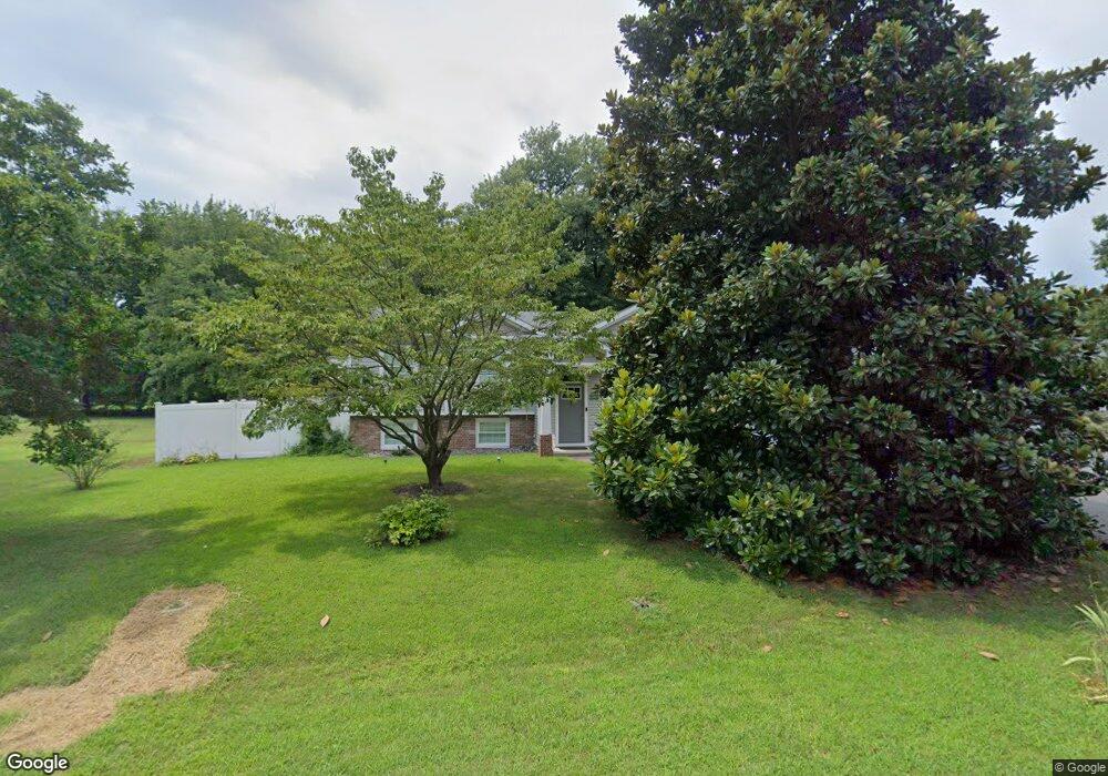
102 Chestnut Rd Stevensville, MD 21666
Estimated Value: $364,988 - $533,000
Studio
1
Bath
1,136
Sq Ft
$400/Sq Ft
Est. Value
About This Home
This home is located at 102 Chestnut Rd, Stevensville, MD 21666 and is currently estimated at $454,747, approximately $400 per square foot. 102 Chestnut Rd is a home located in Queen Anne's County with nearby schools including Matapeake Elementary School, Matapeake Middle School, and Kent Island High School.
Ownership History
Date
Name
Owned For
Owner Type
Purchase Details
Closed on
Jun 1, 1984
Sold by
King William D and King Ann T
Bought by
Fogle Stephen M and Fogle Deborah A
Current Estimated Value
Purchase Details
Closed on
Mar 16, 1983
Sold by
Lopez Allan T and Lopez Deborah
Bought by
King William D and King Ann T
Home Financials for this Owner
Home Financials are based on the most recent Mortgage that was taken out on this home.
Original Mortgage
$56,000
Interest Rate
12.79%
Create a Home Valuation Report for This Property
The Home Valuation Report is an in-depth analysis detailing your home's value as well as a comparison with similar homes in the area
Purchase History
| Date | Buyer | Sale Price | Title Company |
|---|---|---|---|
| Fogle Stephen M | $62,900 | -- | |
| King William D | $59,000 | -- |
Source: Public Records
Mortgage History
| Date | Status | Borrower | Loan Amount |
|---|---|---|---|
| Previous Owner | King William D | $56,000 |
Source: Public Records
Tax History
| Year | Tax Paid | Tax Assessment Tax Assessment Total Assessment is a certain percentage of the fair market value that is determined by local assessors to be the total taxable value of land and additions on the property. | Land | Improvement |
|---|---|---|---|---|
| 2025 | $2,568 | $345,300 | $0 | $0 |
| 2024 | $2,472 | $319,900 | $0 | $0 |
| 2023 | $2,345 | $294,500 | $151,000 | $143,500 |
| 2022 | $2,797 | $290,600 | $0 | $0 |
| 2021 | $2,732 | $286,700 | $0 | $0 |
| 2020 | $2,732 | $282,800 | $147,100 | $135,700 |
| 2019 | $2,604 | $268,600 | $0 | $0 |
| 2018 | $2,481 | $254,400 | $0 | $0 |
| 2017 | $2,364 | $240,200 | $0 | $0 |
| 2016 | -- | $240,200 | $0 | $0 |
| 2015 | $2,130 | $240,200 | $0 | $0 |
| 2014 | $2,130 | $261,000 | $0 | $0 |
Source: Public Records
Map
Nearby Homes
- 101 Chestnut Rd
- 202 Baltimore Dr
- 117 Bay Dr
- 108 Lagorce Dr
- Lot 7 Maple Rd
- 103 Chesapeake Estates Dr
- 0 Romancoke Rd Unit MDQA2016902
- 1709 Batts Neck Rd
- 64 Long Creek Dr
- 0 Reynolds Ave
- 203 Wineland Way
- 0 Allen Ave
- 114 Queens Colony High Rd
- 312 Queens Colony High Rd
- 111 Holly Ct
- 108 Holly Ct
- 211 Queen Anne Club Dr
- 410 5 Farms Dr
- 303 Queen Anne Club Dr
- 307 Columbia Ln
- 100 Chestnut Rd
- 103 Birch Rd
- 101 Birch Rd
- 107 Birch Rd
- 103 Chestnut Rd
- 105 Chestnut Rd
- 108 Chestnut Rd
- 126 Chesapeake Estates Dr
- 128 Chesapeake Estates Dr
- 124 Chesapeake Estates Dr
- 130 Chesapeake Estates Dr
- 0 Chestnut Rd
- 111 Birch Rd
- 122 Chesapeake Estates Dr
- 104 Birch Rd
- 125 Chesapeake Estates Dr
- 100 Dogwood Rd
- 100 Dogwood Rd
- 118 Baltimore Dr
- 106 Birch Rd
Your Personal Tour Guide
Ask me questions while you tour the home.