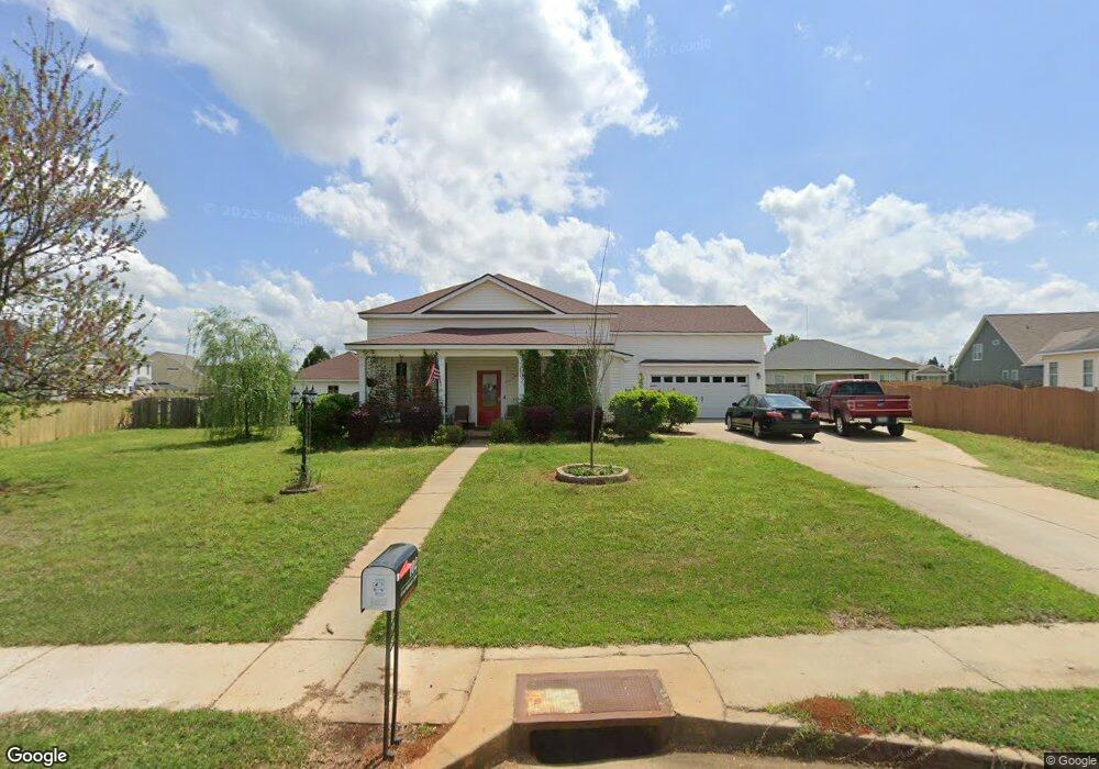
102 Courthouse Ln Warner Robins, GA 31088
Estimated Value: $281,656 - $302,000
About This Home
This home is located at 102 Courthouse Ln, Warner Robins, GA 31088 and is currently estimated at $287,914, approximately $160 per square foot. 102 Courthouse Ln is a home located in Houston County with nearby schools including David A. Perdue Primary School, David A. Perdue Elementary School, and Feagin Mill Middle School.
Ownership History
We collect this data history from publicly available records. To have your information removed, we recommend requesting removal directly through your county’s website.
Purchase Details
Purchase Details
Home Financials for this Owner
Home Financials are based on the most recent Mortgage that was taken out on this home.Purchase Details
Home Financials for this Owner
Home Financials are based on the most recent Mortgage that was taken out on this home.Purchase Details
Home Values in the Area
Average Home Value in this Area
Purchase History
We collect this data history from publicly available records. To have your information removed, we recommend requesting removal directly through your county’s website.
| Date | Buyer | Sale Price | Title Company |
|---|---|---|---|
| -- | None Listed On Document | ||
| -- | None Listed On Document | ||
| $188,800 | None Available | ||
| $29,000 | None Available | ||
| $25,000 | -- |
Mortgage History
We collect this data history from publicly available records. To have your information removed, we recommend requesting removal directly through your county’s website.
| Date | Status | Borrower | Loan Amount |
|---|---|---|---|
| Previous Owner | $151,000 | ||
| Previous Owner | $28,300 | ||
| Previous Owner | $139,920 |
Tax History
We collect this data history from publicly available records. To have your information removed, we recommend requesting removal directly through your county’s website.
| Year | Tax Paid | Tax Assessment Tax Assessment Total Assessment is a certain percentage of the fair market value that is determined by local assessors to be the total taxable value of land and additions on the property. | Land | Improvement |
|---|---|---|---|---|
| 2025 | $2,744 | $96,600 | $10,000 | $86,600 |
| 2024 | $3,061 | $94,920 | $10,000 | $84,920 |
| 2023 | $2,904 | $89,480 | $10,000 | $79,480 |
| 2022 | $1,650 | $73,760 | $9,200 | $64,560 |
| 2021 | $1,431 | $63,880 | $9,200 | $54,680 |
| 2020 | $1,372 | $61,040 | $9,200 | $51,840 |
| 2019 | $1,372 | $61,040 | $9,200 | $51,840 |
| 2018 | $1,372 | $61,040 | $9,200 | $51,840 |
| 2017 | $1,373 | $61,040 | $9,200 | $51,840 |
| 2016 | $1,416 | $62,800 | $9,200 | $53,600 |
| 2015 | -- | $65,440 | $9,200 | $56,240 |
| 2014 | $654 | $65,440 | $9,200 | $56,240 |
| 2013 | $654 | $65,440 | $9,200 | $56,240 |
Map
- 216 Raleigh Dr
- 205 Courthouse Ln
- 0 Wrasling Way Unit 24497698
- 401 Bella Notte Cir
- 401 Bella Notte Cir Unit 5D
- 102 Tug Ct
- 103 Bella Notte Cir
- 103 Bella Notte Cir Unit 1A
- 112 Ballyhara
- 312 Twelve Oaks Dr
- 102 Grindstaff Dr
- 206 Rhett Ct
- 507 Scarlett Dr
- 0 Feagin Mill Rd Unit 10572748
- 0 Feagin Mill Rd Unit 254957
- 208 Twelve Oaks Dr
- 131 Ben Edwards Rd
- 123 Galaxy Ave
- 608 Twelve Oaks Dr
- 121 Black Birch Ln
- 104 Mount Pilot Ct
- 201 Meyers Lake Dr
- 102 Mount Pilot Ct
- 203 Meyers Lake Dr
- 106 Mount Pilot Ct
- 100 Mount Pilot Ct
- 119 Meyers Lake Dr
- 205 Meyers Lake Dr
- 333 Clairemore Ct
- 105 Courthouse Ln
- 207 Meyers Lake Dr
- 117 Meyers Lake Dr
- 108 Mount Pilot Ct
- 117 Meyers Lake Dr
- 202 Meyers Lake Dr
- 200 Meyers Lake Dr
- 103 Mount Pilot Ct
- 204 Meyers Lake Dr
- 105 Mount Pilot Ct
- 403 Latham Dr Unit 164
Ask me questions while you tour the home.