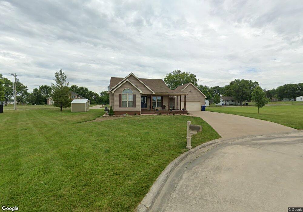
102 Covey Ct Brookfield, MO 64628
Estimated Value: $183,000 - $288,064
3
Beds
3
Baths
1,397
Sq Ft
$168/Sq Ft
Est. Value
About This Home
This home is located at 102 Covey Ct, Brookfield, MO 64628 and is currently estimated at $234,016, approximately $167 per square foot. 102 Covey Ct is a home with nearby schools including Brookfield Elementary School, Brookfield Middle School, and Brookfield High School.
Ownership History
Date
Name
Owned For
Owner Type
Purchase Details
Closed on
Dec 30, 2021
Sold by
Edwards Joshua
Bought by
Holland Robert Floyd
Current Estimated Value
Home Financials for this Owner
Home Financials are based on the most recent Mortgage that was taken out on this home.
Original Mortgage
$199,500
Outstanding Balance
$183,085
Interest Rate
3.1%
Mortgage Type
Construction
Estimated Equity
$50,931
Purchase Details
Closed on
Sep 12, 2011
Sold by
Saale Clifford E and Saale Bonnie L
Bought by
Edwards Joshua
Purchase Details
Closed on
Sep 5, 2006
Bought by
Bonnie Lou and Saale Clifford Earl
Create a Home Valuation Report for This Property
The Home Valuation Report is an in-depth analysis detailing your home's value as well as a comparison with similar homes in the area
Home Values in the Area
Average Home Value in this Area
Purchase History
We collect this data history from publicly available records. To have your information removed, we recommend requesting removal directly through your county’s website.
| Date | Buyer | Sale Price | Title Company |
|---|---|---|---|
| Holland Robert Floyd | $249,375 | Monarch Title Co Inc | |
| Edwards Joshua | $165,000 | -- | |
| Bonnie Lou | $130,000 | -- |
Source: Public Records
Mortgage History
We collect this data history from publicly available records. To have your information removed, we recommend requesting removal directly through your county’s website.
| Date | Status | Borrower | Loan Amount |
|---|---|---|---|
| Open | Holland Robert Floyd | $199,500 |
Source: Public Records
Tax History
| Year | Tax Paid | Tax Assessment Tax Assessment Total Assessment is a certain percentage of the fair market value that is determined by local assessors to be the total taxable value of land and additions on the property. | Land | Improvement |
|---|---|---|---|---|
| 2025 | $1,748 | $29,093 | $4,275 | $24,818 |
| 2024 | $17 | $27,911 | $4,275 | $23,636 |
| 2023 | $1,742 | $27,911 | $4,275 | $23,636 |
| 2022 | $1,749 | $27,911 | $4,275 | $23,636 |
| 2021 | $1,686 | $27,911 | $4,275 | $23,636 |
| 2020 | $1,752 | $27,911 | $4,275 | $23,636 |
| 2019 | $1,752 | $27,911 | $4,275 | $23,636 |
| 2018 | $1,702 | $27,246 | $4,275 | $22,971 |
| 2015 | -- | $27,075 | $5,320 | $21,755 |
| 2011 | -- | $125,600 | $26,800 | $98,800 |
Source: Public Records
Map
Nearby Homes
- 1101 Sunset Hill Rd
- 420 Mcgowan St
- 627 Mcgowan St
- 119 W Dake St
- 721 Lincoln St
- 25972 County Road M
- 515 Shelby St
- 316 Macon St
- 303 Shelby St
- 117 N Main St
- 117 E Clark St
- 227 S Brunswick St
- 412 S Main St
- 415 S Livingston St
- 419 Nichols St
- 430 S Livingston St
- 131 Silver Ln
- 0 S State St
- 547 Harrison St
- 27022 Index Dr
- Lot #82 Covey Ct
- Lot #83 Covey Ct
- Lot #85 Covey Ct
- 100 Covey Ct
- 101 Quail Dr
- 101 Covey Ct
- 224 Prospect St
- 325 Prospect St
- 1510 N State St
- 210 Prospect St
- 104 Brittany Ln
- 102 Brittany Ln
- Lot #25 Quail Dr
- Lot #23 Quail Dr
- Lot #22 Quail Dr
- Lot #24 Quail Dr
- 1311 N State St
- 106 Quail Dr
- 100 Brittany Ln
- 108 Brittany Ln
Your Personal Tour Guide
Ask me questions while you tour the home.