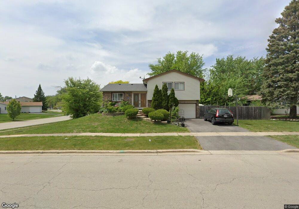
102 E Stevenson Dr Glendale Heights, IL 60139
Estimated Value: $330,000 - $345,951
About This Home
This home is located at 102 E Stevenson Dr, Glendale Heights, IL 60139 and is currently estimated at $335,738, approximately $223 per square foot. 102 E Stevenson Dr is a home located in DuPage County with nearby schools including Americana Intermediate School, Glenside Middle School, and Glenbard North High School.
Ownership History
We collect this data history from publicly available records. To have your information removed, we recommend requesting removal directly through your county’s website.
Purchase Details
Home Financials for this Owner
Home Financials are based on the most recent Mortgage that was taken out on this home.Purchase Details
Purchase Details
Home Financials for this Owner
Home Financials are based on the most recent Mortgage that was taken out on this home.Home Values in the Area
Average Home Value in this Area
Purchase History
We collect this data history from publicly available records. To have your information removed, we recommend requesting removal directly through your county’s website.
| Date | Buyer | Sale Price | Title Company |
|---|---|---|---|
| $149,000 | -- | ||
| -- | -- | ||
| $128,500 | -- |
Mortgage History
We collect this data history from publicly available records. To have your information removed, we recommend requesting removal directly through your county’s website.
| Date | Status | Borrower | Loan Amount |
|---|---|---|---|
| Open | $119,200 | ||
| Previous Owner | $125,700 |
Tax History
We collect this data history from publicly available records. To have your information removed, we recommend requesting removal directly through your county’s website.
| Year | Tax Paid | Tax Assessment Tax Assessment Total Assessment is a certain percentage of the fair market value that is determined by local assessors to be the total taxable value of land and additions on the property. | Land | Improvement |
|---|---|---|---|---|
| 2024 | $7,767 | $92,892 | $24,647 | $68,245 |
| 2023 | $7,492 | $84,950 | $22,540 | $62,410 |
| 2022 | $7,438 | $80,130 | $22,030 | $58,100 |
| 2021 | $7,035 | $76,130 | $20,930 | $55,200 |
| 2020 | $6,770 | $74,270 | $20,420 | $53,850 |
| 2019 | $6,553 | $71,370 | $19,620 | $51,750 |
| 2018 | $5,997 | $59,320 | $19,110 | $40,210 |
| 2017 | $6,593 | $61,580 | $17,710 | $43,870 |
| 2016 | $6,338 | $56,990 | $16,390 | $40,600 |
| 2015 | $6,218 | $53,180 | $15,290 | $37,890 |
| 2014 | $6,034 | $51,390 | $16,300 | $35,090 |
| 2013 | $5,958 | $53,150 | $16,860 | $36,290 |
Map
- 1738 Newport St
- 32 E Schubert Ave
- 1751 President St
- 156 E Lincoln Ave
- 210 Balmoral Ct
- 32 W Schubert Ave
- 1673 Bloomingdale Rd
- 1749 Avalon Ct
- 218 Polo Club Dr
- 88 Hesterman Dr
- 1914 N Alpine Dr
- 1953 Burr Oak Ln
- 1774 English Dr
- 290 Loveland Dr
- 2021 Cypress Ct
- 404 E Lincoln Ave
- 400 E Altgeld Ave
- 119 Garland Ct
- 1428 President St
- 440 E Fullerton Ave
- 97 E Stevenson Dr
- 93 E Stevenson Dr
- 101 E Stevenson Dr
- 106 Poplar Ct
- 102 Poplar St
- 105 E Stevenson Dr
- 98 Poplar St
- 1763 Newport St
- 110 Poplar St
- 95 Opal Ave
- 109 E Stevenson Dr
- 1759 Newport St
- 114 Poplar St
- 88 E Stevenson Dr
- 1755 Newport St
- 1780 Mimosa Ct Unit 1
- 89 Opal Ave
- 94 Opal Ave
- 113 E Stevenson Dr
- 107 Poplar St
Ask me questions while you tour the home.