Estimated Value: $213,000 - $226,428
About This Home
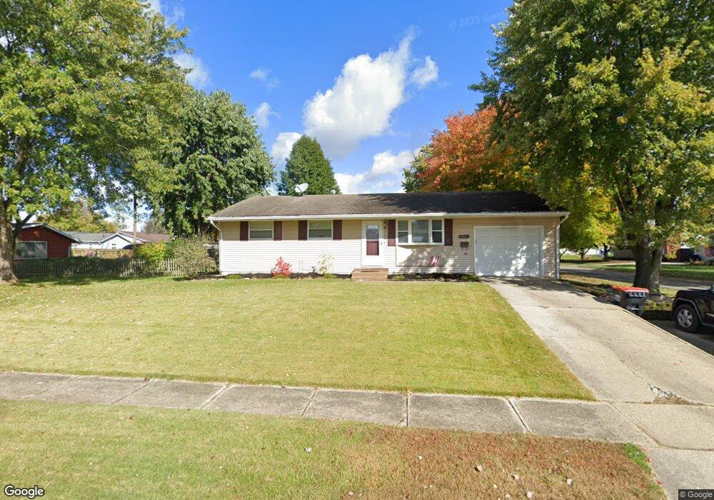
This home is located at 102 Fieldpoint Rd, Heath, OH 43056 and is currently estimated at $217,107, approximately $231 per square foot. 102 Fieldpoint Rd is a home located in Licking County with nearby schools including Garfield Elementary School, Stevenson Elementary School, and Heath Middle School.
Ownership History
We collect this data history from publicly available records. To have your information removed, we recommend requesting removal directly through your county’s website.
Purchase Details
Home Financials for this Owner
Home Financials are based on the most recent Mortgage that was taken out on this home.Purchase Details
Home Financials for this Owner
Home Financials are based on the most recent Mortgage that was taken out on this home.Purchase Details
Purchase Details
Purchase Details
Home Financials for this Owner
Home Financials are based on the most recent Mortgage that was taken out on this home.Purchase Details
Purchase Details
Home Financials for this Owner
Home Financials are based on the most recent Mortgage that was taken out on this home.Home Values in the Area
Average Home Value in this Area
Purchase History
We collect this data history from publicly available records. To have your information removed, we recommend requesting removal directly through your county’s website.
| Date | Buyer | Sale Price | Title Company |
|---|---|---|---|
| $120,000 | None Available | ||
| $77,257 | Lakeside Title & Escrow Agen | ||
| -- | None Available | ||
| $75,000 | None Available | ||
| $86,900 | -- | ||
| $78,000 | -- | ||
| $69,000 | -- |
Mortgage History
We collect this data history from publicly available records. To have your information removed, we recommend requesting removal directly through your county’s website.
| Date | Status | Borrower | Loan Amount |
|---|---|---|---|
| Open | $114,000 | ||
| Previous Owner | $78,245 | ||
| Previous Owner | $86,189 | ||
| Previous Owner | $68,916 |
Tax History
We collect this data history from publicly available records. To have your information removed, we recommend requesting removal directly through your county’s website.
| Year | Tax Paid | Tax Assessment Tax Assessment Total Assessment is a certain percentage of the fair market value that is determined by local assessors to be the total taxable value of land and additions on the property. | Land | Improvement |
|---|---|---|---|---|
| 2025 | $2,531 | $57,230 | $17,570 | $39,660 |
| 2024 | $2,463 | $57,230 | $17,570 | $39,660 |
| 2023 | $2,725 | $57,230 | $17,570 | $39,660 |
| 2022 | $2,219 | $40,920 | $8,960 | $31,960 |
| 2021 | $2,264 | $40,920 | $8,960 | $31,960 |
| 2020 | $2,279 | $40,920 | $8,960 | $31,960 |
| 2019 | $1,907 | $34,860 | $11,200 | $23,660 |
| 2018 | $1,928 | $0 | $0 | $0 |
| 2017 | $1,901 | $0 | $0 | $0 |
| 2016 | $1,844 | $0 | $0 | $0 |
| 2015 | $1,875 | $0 | $0 | $0 |
| 2014 | $2,636 | $0 | $0 | $0 |
| 2013 | $1,822 | $0 | $0 | $0 |
Map
- 514 S 30th St
- 256 Walden Rd
- 86 Lancaster Dr
- 59 Carey Ln
- 153 Swainford Dr
- 974 Miller Ave
- 142 S 32nd St
- 159 S 33rd St
- 944 Fieldson Dr
- 164 Licking View Dr
- 97 S 34th St
- 643 Kensington Dr Unit 643
- 71 S 32nd St
- 267 Wildwood Ct
- 28 S 33rd St
- 95 S 24th St
- 1079 W Main St
- 28 S 28th St
- 35 S 27th St
- 193 Decrow Ave
- 599 Partridge Rd
- 100 Fieldpoint Rd
- 593 Partridge Rd
- 98 Fieldpoint Rd
- 621 Partridge Rd
- 604 Partridge Rd
- 103 Fieldpoint Rd
- 96 Fieldpoint Rd
- 587 Partridge Rd
- 594 Partridge Rd
- 622 Partridge Rd
- 124 Fieldpoint Rd
- 94 Fieldpoint Rd
- 99 Fieldpoint Rd
- 581 Partridge Rd
- 123 Fieldpoint Rd
- 125 Quaker Rd
- 631 Partridge Rd
- 96 Custer Rd
- 97 Fieldpoint Rd
Ask me questions while you tour the home.