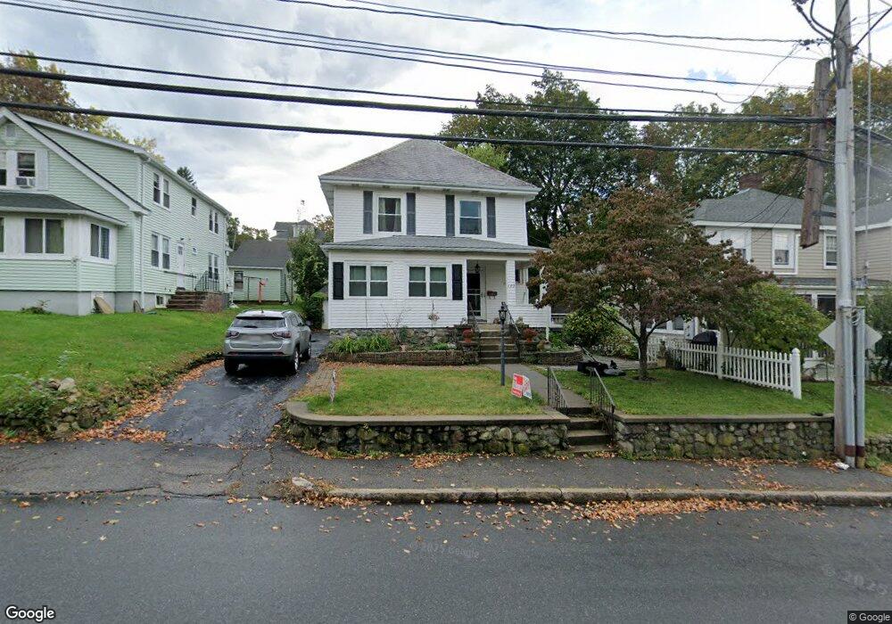
102 Stow St Waltham, MA 02453
Estimated Value: $734,000 - $785,000
2
Beds
1
Bath
1,740
Sq Ft
$437/Sq Ft
Est. Value
About This Home
This home is located at 102 Stow St, Waltham, MA 02453 and is currently estimated at $761,074, approximately $437 per square foot. 102 Stow St is a home located in Middlesex County with nearby schools including Thomas R Plympton Elementary School, John F Kennedy Middle School, and Waltham Sr High School.
Ownership History
Date
Name
Owned For
Owner Type
Purchase Details
Closed on
Dec 4, 2024
Sold by
Umbrello Paul F and Umbrello Karen
Bought by
P K U Irt 2024 and Umbrello
Current Estimated Value
Purchase Details
Closed on
May 15, 2000
Sold by
Umbrello Francis and Umbrello Florence
Bought by
Umbrello Paul F and Umbrello Karen
Home Financials for this Owner
Home Financials are based on the most recent Mortgage that was taken out on this home.
Original Mortgage
$125,000
Interest Rate
8.21%
Mortgage Type
Purchase Money Mortgage
Create a Home Valuation Report for This Property
The Home Valuation Report is an in-depth analysis detailing your home's value as well as a comparison with similar homes in the area
Purchase History
| Date | Buyer | Sale Price | Title Company |
|---|---|---|---|
| P K U Irt 2024 | -- | None Available | |
| P K U Irt 2024 | -- | None Available | |
| Umbrello Paul F | $175,000 | -- |
Source: Public Records
Mortgage History
| Date | Status | Borrower | Loan Amount |
|---|---|---|---|
| Previous Owner | Umbrello Paul F | $25,000 | |
| Previous Owner | Umbrello Paul F | $125,000 |
Source: Public Records
Tax History
| Year | Tax Paid | Tax Assessment Tax Assessment Total Assessment is a certain percentage of the fair market value that is determined by local assessors to be the total taxable value of land and additions on the property. | Land | Improvement |
|---|---|---|---|---|
| 2025 | $6,513 | $663,200 | $394,600 | $268,600 |
| 2024 | $6,301 | $653,600 | $387,300 | $266,300 |
| 2023 | $6,116 | $592,600 | $350,800 | $241,800 |
| 2022 | $6,231 | $559,300 | $321,600 | $237,700 |
| 2021 | $6,207 | $548,300 | $321,600 | $226,700 |
| 2020 | $6,201 | $518,900 | $299,600 | $219,300 |
| 2019 | $5,656 | $446,800 | $282,500 | $164,300 |
| 2018 | $5,198 | $412,200 | $261,600 | $150,600 |
| 2017 | $4,883 | $388,800 | $238,200 | $150,600 |
| 2016 | $4,706 | $384,500 | $233,900 | $150,600 |
| 2015 | $4,664 | $355,200 | $204,600 | $150,600 |
Source: Public Records
Map
Nearby Homes
- 8 Keach Terrace
- 15 Flagg Cir
- 19 Everett St Unit 2
- 55 Forest Ridge Rd
- 20 Jennings Rd
- 41 Auburn St
- 7 Pearl St
- 31 Weston St Unit 2
- 103-105 Columbus Ave
- 69 Jennings Rd
- 23 Palmer St Unit 1
- 54-56 South St
- 55 Hillcrest Rd
- 149-151 South St
- 25 Wellington St Unit 1
- 32 Vernon St
- 43-45 Wellington St Unit 3
- 50 Hammond St
- 39 Floyd St Unit 2
- 11 Hillcrest Rd
Your Personal Tour Guide
Ask me questions while you tour the home.