Estimated Value: $162,000 - $250,975
3
Beds
3
Baths
1,704
Sq Ft
$127/Sq Ft
Est. Value
About This Home
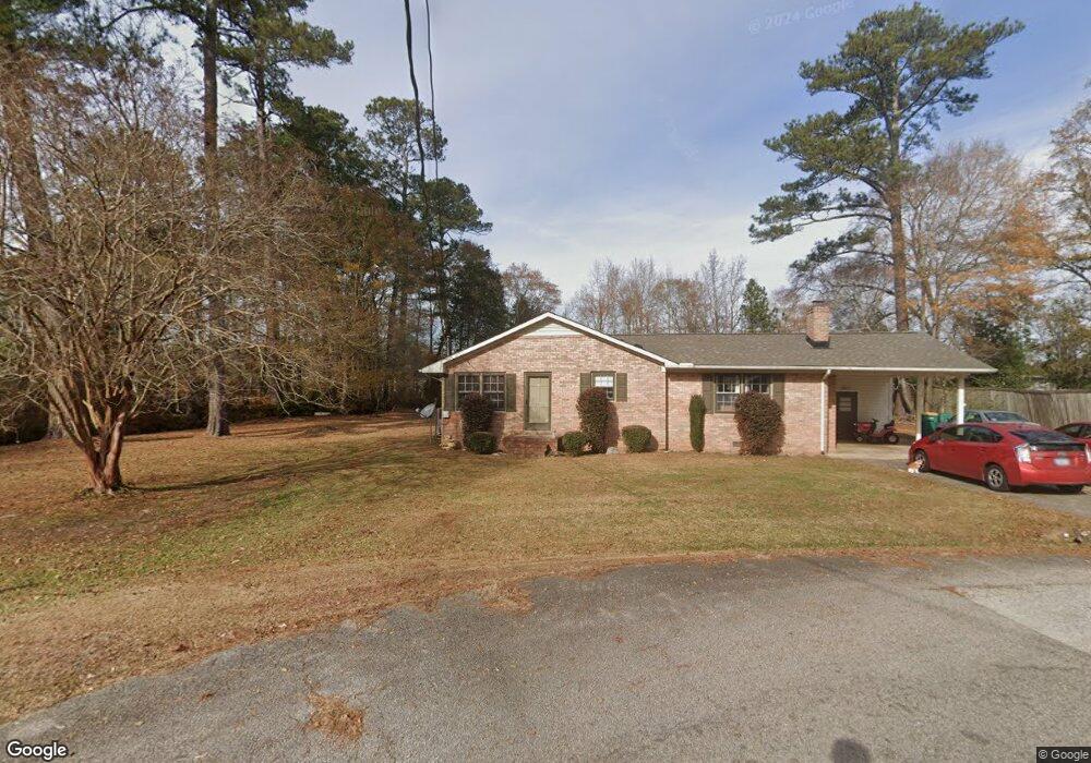
This home is located at 102 W Dwight Dr, Selma, NC 27576 and is currently estimated at $216,494, approximately $127 per square foot. 102 W Dwight Dr is a home located in Johnston County with nearby schools including Micro Elementary School, North Johnston Middle School, and North Johnston High School.
Ownership History
Date
Name
Owned For
Owner Type
Purchase Details
Closed on
Dec 16, 2016
Sold by
Beers Richard and Beers Elora
Bought by
Runyon Jennifer Mae and Runyon James Walter
Current Estimated Value
Home Financials for this Owner
Home Financials are based on the most recent Mortgage that was taken out on this home.
Original Mortgage
$127,676
Outstanding Balance
$103,160
Interest Rate
3.54%
Mortgage Type
New Conventional
Estimated Equity
$113,334
Purchase Details
Closed on
May 12, 2016
Sold by
Dixon Johnny J and Dixon Kymberly B
Bought by
Beers Richard
Create a Home Valuation Report for This Property
The Home Valuation Report is an in-depth analysis detailing your home's value as well as a comparison with similar homes in the area
Home Values in the Area
Average Home Value in this Area
Purchase History
We collect this data history from publicly available records. To have your information removed, we recommend requesting removal directly through your county’s website.
| Date | Buyer | Sale Price | Title Company |
|---|---|---|---|
| Runyon Jennifer Mae | $76,500 | None Available | |
| Beers Richard | $73,872 | None Available |
Source: Public Records
Mortgage History
We collect this data history from publicly available records. To have your information removed, we recommend requesting removal directly through your county’s website.
| Date | Status | Borrower | Loan Amount |
|---|---|---|---|
| Open | Runyon Jennifer Mae | $127,676 |
Source: Public Records
Tax History
| Year | Tax Paid | Tax Assessment Tax Assessment Total Assessment is a certain percentage of the fair market value that is determined by local assessors to be the total taxable value of land and additions on the property. | Land | Improvement |
|---|---|---|---|---|
| 2025 | $1,723 | $189,370 | $34,980 | $154,390 |
| 2024 | $1,602 | $124,210 | $22,390 | $101,820 |
| 2023 | $1,627 | $124,210 | $22,390 | $101,820 |
| 2022 | $1,677 | $124,210 | $22,390 | $101,820 |
| 2021 | $1,615 | $124,210 | $22,390 | $101,820 |
| 2020 | $1,627 | $124,210 | $22,390 | $101,820 |
| 2019 | $1,627 | $124,210 | $22,390 | $101,820 |
| 2018 | $1,380 | $103,770 | $15,390 | $88,380 |
| 2017 | $1,380 | $103,770 | $15,390 | $88,380 |
| 2016 | $1,382 | $103,770 | $15,390 | $88,380 |
| 2015 | $1,381 | $103,770 | $15,390 | $88,380 |
| 2014 | $1,381 | $103,770 | $15,390 | $88,380 |
Source: Public Records
Map
Nearby Homes
- 414 W Main St
- 414 W Main St
- 924 Micro Rd W
- 926 Micro Rd W
- 203 E Fayetteville St
- 204 W Wilson St
- 509 W Main St
- 00 E Fayetteville St
- Nc Hwy 301
- 210 Maxwell Farm Ln
- 210 Maxwell Farm Ln Unit (Lot 6)
- 61 Maxwell Farm Ln Unit (Lot 16)
- 61 Maxwell Farm Ln
- 48 Laramie Ln
- 117 Bryant Farm Dr
- 117 Bryant Farm Dr Unit 5
- 136 Charles Point Ln
- 18 Charles Point (Lot 21) Ln
- 135 Bryant Farm Dr Unit 6
- 124 Charles Point Ln Unit 15
Your Personal Tour Guide
Ask me questions while you tour the home.