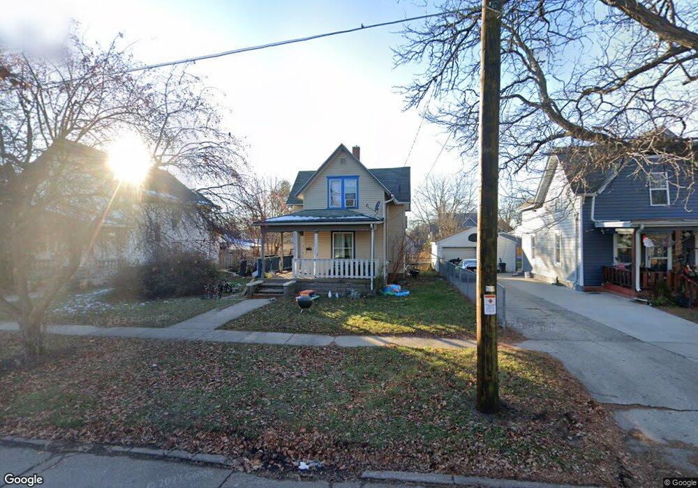
1020 8th St Beloit, WI 53511
Estimated Value: $102,000 - $171,000
3
Beds
1
Bath
997
Sq Ft
$131/Sq Ft
Est. Value
About This Home
This home is located at 1020 8th St, Beloit, WI 53511 and is currently estimated at $130,985, approximately $131 per square foot. 1020 8th St is a home located in Rock County with nearby schools including Hackett Elementary School, McNeel Middle School, and Memorial High School.
Ownership History
Date
Name
Owned For
Owner Type
Purchase Details
Closed on
Oct 31, 2024
Sold by
Swain Meagen Hawthorne
Bought by
Lancaster Investments Llc
Current Estimated Value
Purchase Details
Closed on
Nov 10, 2015
Sold by
Swain Luke William
Bought by
Swain Meagen Hawthorne
Purchase Details
Closed on
Oct 13, 2010
Sold by
First American Credit Union
Bought by
Swain Luke W
Purchase Details
Closed on
Nov 23, 2009
Sold by
Howe Gerald and Case #09-Cv-491
Bought by
First American Credit Union
Create a Home Valuation Report for This Property
The Home Valuation Report is an in-depth analysis detailing your home's value as well as a comparison with similar homes in the area
Home Values in the Area
Average Home Value in this Area
Purchase History
We collect this data history from publicly available records. To have your information removed, we recommend requesting removal directly through your county’s website.
| Date | Buyer | Sale Price | Title Company |
|---|---|---|---|
| Lancaster Investments Llc | $65,000 | Knight Barry Title Services Ll | |
| Swain Meagen Hawthorne | $80,000 | -- | |
| Swain Luke W | $25,000 | None Available | |
| First American Credit Union | $43,189 | None Available |
Source: Public Records
Tax History
| Year | Tax Paid | Tax Assessment Tax Assessment Total Assessment is a certain percentage of the fair market value that is determined by local assessors to be the total taxable value of land and additions on the property. | Land | Improvement |
|---|---|---|---|---|
| 2025 | $1,594 | $98,200 | $12,700 | $85,500 |
| 2024 | $1,130 | $98,200 | $12,700 | $85,500 |
| 2023 | $1,144 | $81,700 | $12,800 | $68,900 |
| 2022 | $1,797 | $81,700 | $12,800 | $68,900 |
| 2021 | $1,573 | $42,100 | $10,100 | $32,000 |
| 2020 | $1,543 | $42,100 | $10,100 | $32,000 |
| 2019 | $2,003 | $42,100 | $10,100 | $32,000 |
| 2018 | $1,509 | $42,100 | $10,100 | $32,000 |
| 2017 | $1,003 | $42,100 | $10,100 | $32,000 |
| 2016 | $1,524 | $42,100 | $10,100 | $32,000 |
| 2015 | $1,137 | $42,100 | $10,100 | $32,000 |
| 2014 | $1,097 | $42,100 | $10,100 | $32,000 |
| 2013 | $1,072 | $42,100 | $10,100 | $32,000 |
Source: Public Records
Map
Nearby Homes
- 1020 Oak St
- 953 Oak St
- 925 Portland Ave
- 828 9th St
- 1207 Oak St
- 1015 Bluff St
- 743 8th St
- 737 10th St
- 1123 6th St
- 519 Saint Lawrence Ave
- 423 Saint Lawrence Ave
- 1330 6th St
- 506 Locust St
- 905 W Grand Ave
- 359 W Grand Ave
- 1121 Cleveland St
- 921 Cleveland St
- 220 Trush Ct
- 1347 Mckinley Ave
- 1520 Lincoln Heights
Your Personal Tour Guide
Ask me questions while you tour the home.