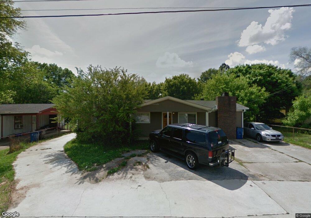
1021 Maxham Rd Austell, GA 30168
Estimated Value: $199,000 - $261,000
About This Home
This home is located at 1021 Maxham Rd, Austell, GA 30168 and is currently estimated at $230,946, approximately $171 per square foot. 1021 Maxham Rd is a home located in Cobb County with nearby schools including Austell Elementary School, Garrett Middle School, and South Cobb High School.
Ownership History
We collect this data history from publicly available records. To have your information removed, we recommend requesting removal directly through your county’s website.
Purchase Details
Purchase Details
Purchase Details
Home Financials for this Owner
Home Financials are based on the most recent Mortgage that was taken out on this home.Purchase Details
Home Financials for this Owner
Home Financials are based on the most recent Mortgage that was taken out on this home.Purchase Details
Home Financials for this Owner
Home Financials are based on the most recent Mortgage that was taken out on this home.Purchase Details
Home Financials for this Owner
Home Financials are based on the most recent Mortgage that was taken out on this home.Purchase Details
Home Financials for this Owner
Home Financials are based on the most recent Mortgage that was taken out on this home.Home Values in the Area
Average Home Value in this Area
Purchase History
We collect this data history from publicly available records. To have your information removed, we recommend requesting removal directly through your county’s website.
| Date | Buyer | Sale Price | Title Company |
|---|---|---|---|
| $32,800 | -- | ||
| $51,900 | -- | ||
| -- | -- | ||
| -- | -- | ||
| -- | -- | ||
| -- | -- | ||
| $53,500 | -- |
Mortgage History
We collect this data history from publicly available records. To have your information removed, we recommend requesting removal directly through your county’s website.
| Date | Status | Borrower | Loan Amount |
|---|---|---|---|
| Previous Owner | $114,000 | ||
| Previous Owner | $95,250 | ||
| Previous Owner | $52,479 |
Tax History
We collect this data history from publicly available records. To have your information removed, we recommend requesting removal directly through your county’s website.
| Year | Tax Paid | Tax Assessment Tax Assessment Total Assessment is a certain percentage of the fair market value that is determined by local assessors to be the total taxable value of land and additions on the property. | Land | Improvement |
|---|---|---|---|---|
| 2025 | $2,483 | $91,416 | $18,000 | $73,416 |
| 2024 | $2,483 | $91,416 | $18,000 | $73,416 |
| 2023 | $2,483 | $91,416 | $18,000 | $73,416 |
| 2022 | $1,746 | $63,816 | $12,000 | $51,816 |
| 2021 | $1,282 | $46,620 | $9,200 | $37,420 |
| 2020 | $965 | $35,104 | $8,000 | $27,104 |
| 2019 | $782 | $28,436 | $8,000 | $20,436 |
| 2018 | $783 | $28,492 | $6,400 | $22,092 |
| 2017 | $639 | $24,784 | $5,600 | $19,184 |
| 2016 | $308 | $11,940 | $2,400 | $9,540 |
| 2015 | $315 | $11,940 | $2,400 | $9,540 |
| 2014 | $318 | $11,940 | $0 | $0 |
Map
- 5983 Hidden Holm Ln
- 2182 Apple Orchard Way
- 2290 Salt Springs Place Unit 2
- 2080 Apple Orchard Way
- 1370 Elowen Dr
- 1150 Elowen Dr Unit 109
- 3044 Creekside Overlook Way
- 6146 Hill St
- 1210 Elowen Dr Unit 115
- 1200 Elowen Dr Unit 114
- 5790 Maxham Rd
- 1180 Ravencliff Dr Unit 112
- 1140 Elowen Dr Unit 108
- 1140 Elowen Dr
- 2030 Linda Dr
- 2390 Ravencliff Dr
- 2370 Ravencliff Dr
- 2360 Ravencliff Dr
- 1984 Brenda Dr
- 110 Creekway Dr
- 1019 Maxham Rd
- 1023 Maxham Rd
- 1017 Maxham Rd
- 1103 Pontiac Cir
- 1220 Hiawatha Ln
- 1222 Hiawatha Ln
- 1218 Hiawatha Ln
- 6136 Glade Ct
- 6136 Glade Ct Unit 92
- 1105 Pontiac Cir
- 1015 Maxham Rd
- 2259 Polder Way Unit 95
- 2259 Polder Way
- 1216 Hiawatha Ln
- 6145 Glade Ct Unit 88
- 6145 Glade Ct
- 6130 Glade Ct
- 1013 Maxham Rd
- 6151 Glade Ct Unit 89
- 6151 Glade Ct
Ask me questions while you tour the home.