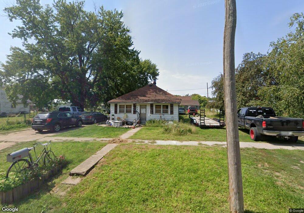
1021 N Locust St Red Cloud, NE 68970
Estimated Value: $65,663 - $120,000
2
Beds
1
Bath
1,052
Sq Ft
$79/Sq Ft
Est. Value
About This Home
This home is located at 1021 N Locust St, Red Cloud, NE 68970 and is currently estimated at $83,416, approximately $79 per square foot. 1021 N Locust St is a home located in Webster County with nearby schools including Red Cloud Elementary School and Red Cloud High School.
Ownership History
Date
Name
Owned For
Owner Type
Purchase Details
Closed on
Sep 4, 2018
Sold by
Dell Melba L
Bought by
Kennedy Samuel
Current Estimated Value
Home Financials for this Owner
Home Financials are based on the most recent Mortgage that was taken out on this home.
Original Mortgage
$6,000
Outstanding Balance
$5,200
Interest Rate
4.5%
Mortgage Type
Purchase Money Mortgage
Estimated Equity
$78,216
Purchase Details
Closed on
Jul 13, 2018
Sold by
Akins Tammy and Akins Roger
Bought by
Dell Melba L
Home Financials for this Owner
Home Financials are based on the most recent Mortgage that was taken out on this home.
Original Mortgage
$6,000
Outstanding Balance
$5,200
Interest Rate
4.5%
Mortgage Type
Purchase Money Mortgage
Estimated Equity
$78,216
Purchase Details
Closed on
May 16, 2014
Sold by
Donehey Robert G
Bought by
Dell Hugh A and Dell Melba L
Purchase Details
Closed on
May 20, 2013
Sold by
Dell Hugh A and Dell Melba L
Bought by
Danehey Robert G
Purchase Details
Closed on
Aug 25, 2008
Sold by
Kugler Neil L
Bought by
Swanson Jimmie L and Swanson Carolyn J
Purchase Details
Closed on
Jul 10, 2007
Sold by
Wells Fargo Bank Na
Bought by
Kugler Neil L
Purchase Details
Closed on
Mar 7, 2007
Sold by
Gordet Michael D
Bought by
Wells Fargo Bank Na
Purchase Details
Closed on
Mar 5, 2007
Sold by
Phoenix Bree
Bought by
Gordet Michael D
Purchase Details
Closed on
Jun 5, 2006
Sold by
Gordet Michael D
Bought by
Phonix Bree
Home Financials for this Owner
Home Financials are based on the most recent Mortgage that was taken out on this home.
Original Mortgage
$23,700
Interest Rate
10.62%
Mortgage Type
Adjustable Rate Mortgage/ARM
Purchase Details
Closed on
May 9, 2006
Sold by
Thrnton Donald P
Bought by
Gordet Michael D
Home Financials for this Owner
Home Financials are based on the most recent Mortgage that was taken out on this home.
Original Mortgage
$23,700
Interest Rate
10.62%
Mortgage Type
Adjustable Rate Mortgage/ARM
Purchase Details
Closed on
Feb 16, 2006
Sold by
Brown Harold E and Brown Erna
Bought by
Thornton Donald P
Create a Home Valuation Report for This Property
The Home Valuation Report is an in-depth analysis detailing your home's value as well as a comparison with similar homes in the area
Purchase History
| Date | Buyer | Sale Price | Title Company |
|---|---|---|---|
| Kennedy Samuel | $6,044 | None Available | |
| Dell Melba L | -- | None Available | |
| Dell Hugh A | -- | None Available | |
| Danehey Robert G | $4,000 | None Available | |
| Swanson Jimmie L | -- | -- | |
| Kugler Neil L | $10,000 | -- | |
| Wells Fargo Bank Na | $13,000 | -- | |
| Gordet Michael D | -- | -- | |
| Phonix Bree | $24,000 | -- | |
| Gordet Michael D | $23,700 | -- | |
| Thornton Donald P | $11,000 | -- |
Source: Public Records
Mortgage History
| Date | Status | Borrower | Loan Amount |
|---|---|---|---|
| Open | Kennedy Samuel | $6,000 | |
| Previous Owner | Gordet Michael D | $23,700 |
Source: Public Records
Tax History
| Year | Tax Paid | Tax Assessment Tax Assessment Total Assessment is a certain percentage of the fair market value that is determined by local assessors to be the total taxable value of land and additions on the property. | Land | Improvement |
|---|---|---|---|---|
| 2025 | $307 | $26,980 | $1,970 | $25,010 |
| 2024 | $355 | $27,120 | $1,640 | $25,480 |
| 2023 | $355 | $23,735 | $1,640 | $22,095 |
| 2022 | $244 | $13,910 | $830 | $13,080 |
| 2021 | $188 | $10,695 | $830 | $9,865 |
| 2020 | $234 | $12,880 | $1,020 | $11,860 |
| 2019 | $335 | $17,180 | $935 | $16,245 |
| 2018 | $267 | $13,300 | $940 | $12,360 |
| 2017 | $204 | $10,315 | $940 | $9,375 |
| 2016 | $213 | $10,405 | $940 | $9,465 |
| 2015 | $287 | $12,780 | $940 | $11,840 |
| 2014 | $304 | $12,780 | $940 | $11,840 |
Source: Public Records
Map
Nearby Homes
- 930 N Cedar St
- 530 N Locust St
- 838 N Chestnut St
- 630 N Cherry St
- 905 N Franklin St
- 442 N Franklin St
- 817 W 4th Ave
- 51 N Seward St
- Red Cloud Unit NE 68970
- 0 Tbd A Rd
- 000 US Highway 136
- X Rd
- 310 N Thorne St
- 223 Mariel St
- 1005 W Maple St
- Franklin Unit NE 68939
- 502 W Nemaha St
- 110 W Nemaha St
- 205 N Webster St
- 522 N Wilson St
- 1041 N Locust St
- 1005 N Locust St
- 1036 N Elm St
- 1022 N Elm St
- 1006 N Elm St
- 941 N Locust St
- 1043 N Locust St
- 934 N Elm St
- 1005 N Elm St
- 925 N Locust St
- 1017 N Elm St
- 930 N Elm St
- 905 N Locust St
- 906 N Elm St
- 918 N Locust St
- 1022 N Webster St
- 1006 N Webster St
- 902 N Locust St
- 936 N Webster St
- 905 N Elm St
Your Personal Tour Guide
Ask me questions while you tour the home.