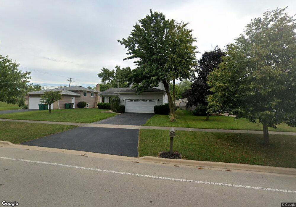
1022 Macgregor Rd Lockport, IL 60441
Estimated Value: $285,000 - $408,000
About This Home
This home is located at 1022 Macgregor Rd, Lockport, IL 60441 and is currently estimated at $352,917, approximately $182 per square foot. 1022 Macgregor Rd is a home located in Will County with nearby schools including Walsh Elementary School, Ludwig Elementary School, and Reed Elementary School.
Ownership History
We collect this data history from publicly available records. To have your information removed, we recommend requesting removal directly through your county’s website.
Purchase Details
Purchase Details
Home Financials for this Owner
Home Financials are based on the most recent Mortgage that was taken out on this home.Purchase Details
Home Financials for this Owner
Home Financials are based on the most recent Mortgage that was taken out on this home.Purchase Details
Home Financials for this Owner
Home Financials are based on the most recent Mortgage that was taken out on this home.Home Values in the Area
Average Home Value in this Area
Purchase History
We collect this data history from publicly available records. To have your information removed, we recommend requesting removal directly through your county’s website.
| Date | Buyer | Sale Price | Title Company |
|---|---|---|---|
| -- | None Listed On Document | ||
| $188,000 | -- | ||
| $160,000 | Lawyers Title Pick Up | ||
| $156,500 | -- |
Mortgage History
We collect this data history from publicly available records. To have your information removed, we recommend requesting removal directly through your county’s website.
| Date | Status | Borrower | Loan Amount |
|---|---|---|---|
| Previous Owner | $150,400 | ||
| Previous Owner | $128,000 | ||
| Previous Owner | $140,750 |
Tax History
We collect this data history from publicly available records. To have your information removed, we recommend requesting removal directly through your county’s website.
| Year | Tax Paid | Tax Assessment Tax Assessment Total Assessment is a certain percentage of the fair market value that is determined by local assessors to be the total taxable value of land and additions on the property. | Land | Improvement |
|---|---|---|---|---|
| 2024 | $9,814 | $120,325 | $26,671 | $93,654 |
| 2023 | $9,331 | $108,022 | $23,944 | $84,078 |
| 2022 | $8,507 | $102,779 | $22,782 | $79,997 |
| 2021 | $8,007 | $96,588 | $21,410 | $75,178 |
| 2020 | $7,793 | $93,412 | $20,706 | $72,706 |
| 2019 | $7,351 | $88,543 | $19,627 | $68,916 |
| 2018 | $6,983 | $82,666 | $18,325 | $64,341 |
| 2017 | $6,450 | $75,765 | $16,795 | $58,970 |
| 2016 | $6,107 | $71,007 | $15,740 | $55,267 |
| 2015 | $6,289 | $66,236 | $14,682 | $51,554 |
| 2014 | $6,289 | $64,306 | $14,254 | $50,052 |
| 2013 | $6,289 | $70,666 | $15,664 | $55,002 |
Map
- 15018 Archer Ave
- 1013 Northern Dr
- 0 151st & MacGregor St Unit MRD11873272
- 0 N State St Unit 10995892
- 1244 Newbridge Ave
- 1024 Kylemore Ct
- 1104 Basin Dr
- 800 Lisdowney Dr
- 1309 E North St
- 700 Maryknoll Dr Unit 2
- 15303 S Oak Run Ct
- 16656 W Huntington Dr
- 14934 S Hillside Dr
- 927 Treeline Ct Unit A
- 307 Laurie Dr
- 9.5 Acres S Archer Ave
- 14809 S Hillside Dr
- 14813 S Hillside Dr
- 14767 S Hillside Dr
- 14815 S Hillside Dr
- 1020 Macgregor Rd
- 1024 Macgregor Rd
- 1018 Macgregor Rd
- 1023 Cove Ave
- 1021 Cove Ave
- 1025 Cove Ave
- 1019 Cove Ave
- 1041 W 151st St
- 1017 Cove Ave
- 1014 Macgregor Rd
- 1015 Cove Ave
- 1022 Cove Ave
- 1020 Cove Ave
- 1024 Cove Ave
- 1012 Macgregor Rd
- 1013 Cove Ave
- 1018 Cove Ave
- 1023 W 151st St
- 1040 W 151st St
- 1016 Cove Ave
Ask me questions while you tour the home.