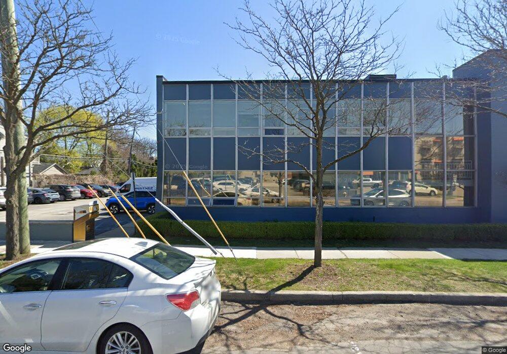
1025 E Maple Rd Unit B11 Birmingham, MI 48009
Studio
--
Bath
601
Sq Ft
20,473
Sq Ft Lot
About This Home
This home is located at 1025 E Maple Rd Unit B11, Birmingham, MI 48009. 1025 E Maple Rd Unit B11 is a home located in Oakland County with nearby schools including Harlan Elementary School, Derby Middle School, and Ernest W. Seaholm High School.
Ownership History
Date
Name
Owned For
Owner Type
Purchase Details
Closed on
Jul 24, 2013
Sold by
Maple Smarter Bears Llc
Bought by
Osos Tontos Llc
Home Financials for this Owner
Home Financials are based on the most recent Mortgage that was taken out on this home.
Original Mortgage
$1,220,000
Interest Rate
4.38%
Mortgage Type
Commercial
Purchase Details
Closed on
Dec 12, 2012
Sold by
Bsp Realty Enterprises Limited Liability
Bought by
Maple Smarter Bears Llc
Home Financials for this Owner
Home Financials are based on the most recent Mortgage that was taken out on this home.
Original Mortgage
$1,347,800
Interest Rate
3.28%
Mortgage Type
Commercial
Purchase Details
Closed on
Mar 12, 1998
Sold by
Web Associates
Bought by
Bsp Realty Ent
Create a Home Valuation Report for This Property
The Home Valuation Report is an in-depth analysis detailing your home's value as well as a comparison with similar homes in the area
Home Values in the Area
Average Home Value in this Area
Purchase History
| Date | Buyer | Sale Price | Title Company |
|---|---|---|---|
| Osos Tontos Llc | -- | Liberty Title | |
| Osos Tontos Llc | -- | Liberty Title | |
| Maple Smarter Bears Llc | $1,525,000 | None Available | |
| Maple Smarter Bears Llc | $1,525,000 | None Available | |
| Bsp Realty Ent | -- | -- | |
| Bsp Realty Ent | -- | -- |
Source: Public Records
Mortgage History
| Date | Status | Borrower | Loan Amount |
|---|---|---|---|
| Previous Owner | Osos Tontos Llc | $1,220,000 | |
| Previous Owner | Maple Smarter Bears Llc | $1,347,800 |
Source: Public Records
Tax History
| Year | Tax Paid | Tax Assessment Tax Assessment Total Assessment is a certain percentage of the fair market value that is determined by local assessors to be the total taxable value of land and additions on the property. | Land | Improvement |
|---|---|---|---|---|
| 2025 | $42,548 | $1,691,810 | $0 | $0 |
| 2024 | $33,430 | $1,656,100 | $0 | $0 |
| 2023 | $31,902 | $1,548,190 | $0 | $0 |
| 2022 | $38,458 | $1,339,390 | $0 | $0 |
| 2021 | $37,490 | $1,297,260 | $0 | $0 |
| 2020 | $29,729 | $1,263,990 | $0 | $0 |
| 2019 | $36,831 | $1,144,130 | $0 | $0 |
| 2017 | $35,494 | $912,820 | $0 | $0 |
| 2015 | -- | $774,890 | $0 | $0 |
| 2014 | -- | $868,080 | $0 | $0 |
| 2011 | -- | $1,182,980 | $0 | $0 |
Source: Public Records
Map
Nearby Homes
- 1235 Yorkshire Rd
- 750 Forest Ave Unit 502
- 475 S Adams Rd
- 1397 Hazel St
- 411 S Old Woodward Ave Unit 821
- 411 S Old Woodward Ave Unit 907
- 411 S Old Woodward Ave Unit 1007
- 411 S Old Woodward Ave Unit 924
- 411 S Old Woodward Ave Unit 608
- 1447 Buckingham Ave
- 1180 Manchester Rd
- 1292 Holland St
- 787 Ann St
- 1324 Holland St
- 1850 Dorchester Rd
- 1489 Holland St
- 1777 Hazel St
- 1267 Webster St
- 484 Park St
- 608 Purdy St
- 1025 E Maple Rd Unit 201
- 1025 E Maple Rd
- 1025 E Maple Rd Unit 210
- 1025 E Maple Rd Unit B4
- 1083 E Maple Rd
- 156 N Worth St Unit 1N
- 156 N Worth St Unit 2S
- 156 N Worth St Unit 2S
- 156 N Worth St
- 156 N Worth St Unit 1 St
- 156 N Worth St
- 156 N Worth St Unit 2N
- 165 N Adams Rd
- 175 N Adams Rd
- 1044 Knox St
- 159 N Worth St
- 925 E Maple Rd
- 975 E Maple Rd Unit Suite 214
- 171 N Worth St
- 187 N Adams Rd
Your Personal Tour Guide
Ask me questions while you tour the home.