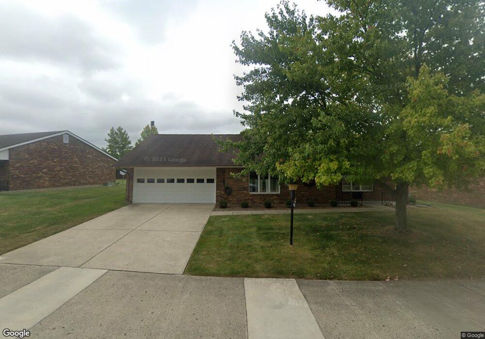
1026 Armsgate Rd Springfield, OH 45503
Estimated Value: $194,000 - $203,311
2
Beds
2
Baths
1,300
Sq Ft
$154/Sq Ft
Est. Value
About This Home
This home is located at 1026 Armsgate Rd, Springfield, OH 45503 and is currently estimated at $200,078, approximately $153 per square foot. 1026 Armsgate Rd is a home located in Clark County with nearby schools including Northridge Elementary School, Kenton Ridge Middle & High School, and Emmanuel Christian Academy.
Ownership History
Date
Name
Owned For
Owner Type
Purchase Details
Closed on
Jun 9, 2016
Sold by
Crist Donald and Crist Betty
Bought by
Crist Donald L and Crist Betty L
Current Estimated Value
Purchase Details
Closed on
May 12, 2016
Sold by
Shipton Eric
Bought by
Crist Donald and Crist Betty
Purchase Details
Closed on
Dec 18, 2003
Sold by
Shipton Rachel and Grove Rachael
Bought by
Livin Shipton Rachel and Livin Rachel Shipton Revocable
Purchase Details
Closed on
Mar 9, 1994
Create a Home Valuation Report for This Property
The Home Valuation Report is an in-depth analysis detailing your home's value as well as a comparison with similar homes in the area
Home Values in the Area
Average Home Value in this Area
Purchase History
We collect this data history from publicly available records. To have your information removed, we recommend requesting removal directly through your county’s website.
| Date | Buyer | Sale Price | Title Company |
|---|---|---|---|
| Crist Donald L | -- | None Available | |
| Crist Donald | $99,000 | None Available | |
| Livin Shipton Rachel | -- | -- | |
| -- | $84,900 | -- |
Source: Public Records
Tax History
| Year | Tax Paid | Tax Assessment Tax Assessment Total Assessment is a certain percentage of the fair market value that is determined by local assessors to be the total taxable value of land and additions on the property. | Land | Improvement |
|---|---|---|---|---|
| 2025 | $1,250 | $53,330 | $7,350 | $45,980 |
| 2024 | $1,234 | $39,260 | $6,300 | $32,960 |
| 2023 | $1,234 | $39,260 | $6,300 | $32,960 |
| 2022 | $1,256 | $39,260 | $6,300 | $32,960 |
| 2021 | $1,427 | $38,370 | $5,250 | $33,120 |
| 2020 | $1,428 | $38,370 | $5,250 | $33,120 |
| 2019 | $1,457 | $38,370 | $5,250 | $33,120 |
| 2018 | $1,125 | $30,950 | $5,570 | $25,380 |
| 2017 | $956 | $30,279 | $5,565 | $24,714 |
| 2016 | $1,360 | $30,279 | $5,565 | $24,714 |
| 2015 | $2,856 | $29,964 | $5,250 | $24,714 |
| 2014 | $848 | $29,964 | $5,250 | $24,714 |
| 2013 | $846 | $29,964 | $5,250 | $24,714 |
Source: Public Records
Map
Nearby Homes
- 1031 Armsgate Rd Unit 11
- 1039 Bradford Dr Unit 42
- 1013 Abington Place
- 1136 Foxboro Rd Unit 202
- 1141 Brixton Dr W
- 3113 Brixton Dr E
- 3124 El Camino Dr
- 1404 Providence Ave
- 1405 Providence Ave
- 3135 Imperial Blvd
- 3211 Haverhill St
- 3138 Glouster St
- 615 Villa Rd Unit B
- 3223 Nantucket St
- 1404 Attleboro Ave
- 3008 Imperial Blvd
- 2943 Tarryton Ln
- 837 Santa Monica Ave
- 732 Grandview Dr Unit 732
- 2014 Westboro Ave
- 1030 Armsgate Rd Unit 29
- 1030 Armsgate Rd
- 3028 Armsgate Rd
- 3028 Armsgate Rd
- 1025 Armsgate Rd
- 1027 Armsgate Rd Unit 13
- 1027 Armsgate Rd Unit VILLA
- 3027 Armsgate Rd
- 1029 Armsgate Rd Unit 12
- 3030 Armsgate Rd Unit 26
- 1033 Bradford Dr Unit 45
- 3029 Armsgate Rd
- 3029 Armsgate Rd
- 1034 Armsgate Rd
- 1033 Armsgate Rd
- 3031 Armsgate Rd Unit 17
- 1034 Bradford Dr
- 1034 Bradford Dr Unit 53
- 1037 Bradford Dr Unit 43
- 3030 Bradford Dr
Your Personal Tour Guide
Ask me questions while you tour the home.