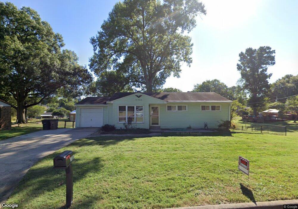
1026 W Mount Dr Cape Girardeau, MO 63701
Estimated Value: $179,000 - $218,000
3
Beds
2
Baths
960
Sq Ft
$203/Sq Ft
Est. Value
About This Home
This home is located at 1026 W Mount Dr, Cape Girardeau, MO 63701 and is currently estimated at $195,187, approximately $203 per square foot. 1026 W Mount Dr is a home with nearby schools including Clippard Elementary School, Central Middle School, and Central Junior High School.
Ownership History
Date
Name
Owned For
Owner Type
Purchase Details
Closed on
Apr 17, 2014
Sold by
Kulenguski Trust
Bought by
Johnson Trust
Current Estimated Value
Purchase Details
Closed on
Dec 27, 2012
Sold by
Kulenguski Wanda Lou
Bought by
Kulenguski Wanda Lou and The Wanda Lou Kulenguski Revocable Trust
Purchase Details
Closed on
Aug 29, 2006
Sold by
Kulenguski Wanda and Johnson Diane P
Bought by
Kulenguski Wanda and Johnson Diane P
Purchase Details
Closed on
Aug 24, 2005
Sold by
Kulenguski Joseph A
Bought by
Johnson Dianne P
Create a Home Valuation Report for This Property
The Home Valuation Report is an in-depth analysis detailing your home's value as well as a comparison with similar homes in the area
Purchase History
We collect this data history from publicly available records. To have your information removed, we recommend requesting removal directly through your county’s website.
| Date | Buyer | Sale Price | Title Company |
|---|---|---|---|
| Johnson Trust | -- | -- | |
| Kulenguski Wanda Lou | -- | None Available | |
| Kulenguski Wanda | -- | None Available | |
| Johnson Dianne P | -- | None Available |
Source: Public Records
Tax History
| Year | Tax Paid | Tax Assessment Tax Assessment Total Assessment is a certain percentage of the fair market value that is determined by local assessors to be the total taxable value of land and additions on the property. | Land | Improvement |
|---|---|---|---|---|
| 2025 | $858 | $16,420 | $2,350 | $14,070 |
| 2024 | $8 | $15,640 | $2,240 | $13,400 |
| 2023 | $813 | $15,640 | $2,240 | $13,400 |
| 2022 | $749 | $14,410 | $2,060 | $12,350 |
| 2021 | $749 | $14,410 | $2,060 | $12,350 |
| 2020 | $751 | $14,410 | $2,060 | $12,350 |
| 2019 | $750 | $14,410 | $0 | $0 |
| 2018 | $749 | $14,410 | $0 | $0 |
| 2017 | $751 | $14,410 | $0 | $0 |
| 2016 | $748 | $14,410 | $0 | $0 |
| 2015 | $748 | $14,410 | $0 | $0 |
| 2014 | $752 | $14,410 | $0 | $0 |
Source: Public Records
Map
Nearby Homes
- 3828 Silverton Cir
- 983 Rifle Dr
- 830 Lochinvar Ln
- 2854 Hopper Rd
- 2637 Hopper Rd
- 2625 Hopper Rd
- 2729 Adeline St
- 2935 & 2937 Shadow Wood Ln
- 2902 & 2904 Shadow Cir
- 2901 & 2903 Shadow Cir
- 2917 Shadow Cir
- 2910 & 2912 Shadow Cir
- 2911 & 2913 Shadow Cir
- 2916 & 2918 Shadow Cir
- 844 Rodney Vista Blvd
- 2533 Tulip Ln
- 3269 Hopper Rd
- 2506 Ford Dr
- 1515 Kingsbury Rd
- 2416 Terrie Hill Rd
- 1028 W Mount Dr
- 1024 W Mount Dr
- 1029 W Mount Dr
- 1031 W Mount Dr
- 1030 W Mount Dr
- 2722 Hopper Rd
- 1033 W Mount Dr
- 2724 Hopper Rd
- 2744 Hopper Rd
- 2743 Caufield Dr
- 1032 W Mount Dr
- 1029 Stewart Dr
- 1055 Stewart Dr
- 1035 W Mount Dr
- 1024 Caufield Dr
- 1059 Stewart Dr
- 1039 Stewart Dr
- 2806 Hopper Rd
- 1034 W Mount Dr
- 2718 Hopper Rd
Your Personal Tour Guide
Ask me questions while you tour the home.