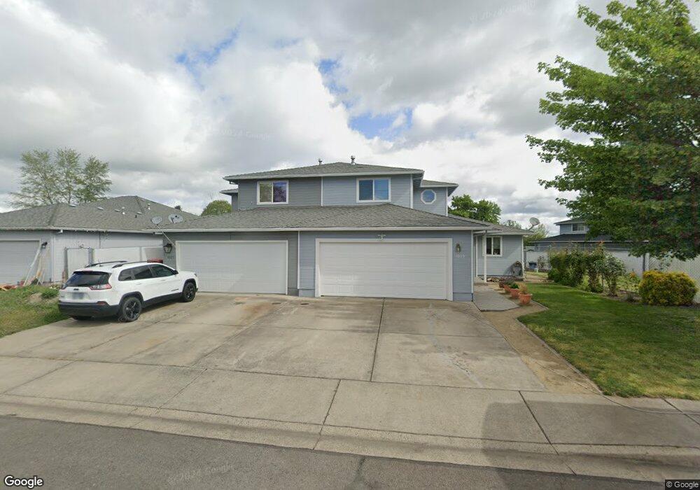
1029 Brandi Way Central Point, OR 97502
Estimated Value: $337,000 - $384,730
About This Home
This home is located at 1029 Brandi Way, Central Point, OR 97502 and is currently estimated at $367,933, approximately $242 per square foot. 1029 Brandi Way is a home located in Jackson County with nearby schools including Central Point Elementary School, Scenic Middle School, and Crater High School.
Ownership History
We collect this data history from publicly available records. To have your information removed, we recommend requesting removal directly through your county’s website.
Purchase Details
Home Financials for this Owner
Home Financials are based on the most recent Mortgage that was taken out on this home.Purchase Details
Home Financials for this Owner
Home Financials are based on the most recent Mortgage that was taken out on this home.Purchase Details
Home Financials for this Owner
Home Financials are based on the most recent Mortgage that was taken out on this home.Purchase Details
Home Financials for this Owner
Home Financials are based on the most recent Mortgage that was taken out on this home.Purchase Details
Purchase Details
Purchase History
We collect this data history from publicly available records. To have your information removed, we recommend requesting removal directly through your county’s website.
| Date | Buyer | Sale Price | Title Company |
|---|---|---|---|
| $128,500 | First American Title Ins Co | ||
| $96,162 | Amerititle | ||
| $166,000 | Amerititle | ||
| $38,000 | Amerititle | ||
| -- | Amerititle | ||
| -- | Amerititle | ||
| -- | Amerititle | ||
| $114,000 | Amerititle | ||
| $152,000 | Amerititle |
Mortgage History
We collect this data history from publicly available records. To have your information removed, we recommend requesting removal directly through your county’s website.
| Date | Status | Borrower | Loan Amount |
|---|---|---|---|
| Open | $123,906 | ||
| Previous Owner | $91,350 | ||
| Previous Owner | $141,100 |
Tax History
We collect this data history from publicly available records. To have your information removed, we recommend requesting removal directly through your county’s website.
| Year | Tax Paid | Tax Assessment Tax Assessment Total Assessment is a certain percentage of the fair market value that is determined by local assessors to be the total taxable value of land and additions on the property. | Land | Improvement |
|---|---|---|---|---|
| 2026 | $3,271 | $197,640 | -- | -- |
| 2025 | $3,190 | $191,890 | $79,320 | $112,570 |
| 2024 | $3,190 | $186,310 | $77,010 | $109,300 |
| 2023 | $3,088 | $180,890 | $74,770 | $106,120 |
| 2022 | $3,016 | $180,890 | $74,770 | $106,120 |
| 2021 | $2,930 | $175,630 | $72,600 | $103,030 |
| 2020 | $2,844 | $170,520 | $70,480 | $100,040 |
| 2019 | $2,774 | $160,740 | $66,440 | $94,300 |
| 2018 | $2,690 | $156,060 | $64,500 | $91,560 |
| 2017 | $2,622 | $156,060 | $64,500 | $91,560 |
| 2016 | $2,546 | $147,110 | $60,800 | $86,310 |
| 2015 | $2,439 | $147,110 | $60,800 | $86,310 |
| 2014 | $2,377 | $138,670 | $57,310 | $81,360 |
Map
- 566 Village Dr Unit F23
- 512 Village Dr Unit B5
- 1104 Coachman Dr
- 1111 Looking Glass Way
- 460 Federal Way
- 786 Pittview Ave
- 230 Peninger Rd
- 959 Westrop Dr
- 3364 Bursell Rd
- 301 Freeman Rd Unit 92
- 301 Freeman Rd Unit 91
- 301 Freeman Rd Unit 70
- 301 Freeman Rd Unit 90
- 1840 E Pine St
- 1600 E Pine St
- 1379 Circle Wood Dr
- 3358 Bursell Rd
- 555 Freeman Rd Unit 234
- 555 Freeman Rd Unit 242
- 555 Freeman Rd Unit 266
- 976 Glengrove Ave
- 982 Glengrove Ave
- 974 Glengrove Ave
- 984 Glengrove Ave
- 958 Glengrove Ave
- 990 Glengrove Ave
- 956 Glengrove Ave
- 950 Glengrove Ave
- 994 Glengrove Ave
- 948 Glengrove Ave
- 985 Glengrove Ave
- 1040 Brandi Way
- 991 Glengrove Ave
- 996 Glengrove Ave
- 942 Glengrove Ave
- 1030 Brandi Way
- 1026 Brandi Way
- 1023 Brandi Way
- 1004 Glengrove Ave
- 1008 Brandi Way
Ask me questions while you tour the home.