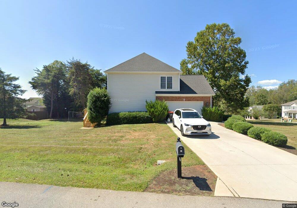
1029 Daltons Dr Forest, VA 24551
Estimated Value: $908,000 - $1,358,000
About This Home
This home is located at 1029 Daltons Dr, Forest, VA 24551 and is currently estimated at $1,058,093, approximately $635 per square foot. 1029 Daltons Dr is a home located in Bedford County with nearby schools including Forest Elementary School, Forest Middle School, and Jefferson Forest High School.
Ownership History
We collect this data history from publicly available records. To have your information removed, we recommend requesting removal directly through your county’s website.
Purchase Details
Purchase Details
Home Financials for this Owner
Home Financials are based on the most recent Mortgage that was taken out on this home.Purchase History
We collect this data history from publicly available records. To have your information removed, we recommend requesting removal directly through your county’s website.
| Date | Buyer | Sale Price | Title Company |
|---|---|---|---|
| -- | None Listed On Document | ||
| $300,000 | Old Republic National Title |
Mortgage History
We collect this data history from publicly available records. To have your information removed, we recommend requesting removal directly through your county’s website.
| Date | Status | Borrower | Loan Amount |
|---|---|---|---|
| Previous Owner | $538,000 |
Tax History
We collect this data history from publicly available records. To have your information removed, we recommend requesting removal directly through your county’s website.
| Year | Tax Paid | Tax Assessment Tax Assessment Total Assessment is a certain percentage of the fair market value that is determined by local assessors to be the total taxable value of land and additions on the property. | Land | Improvement |
|---|---|---|---|---|
| 2025 | $3,328 | $811,800 | $500,000 | $311,800 |
| 2024 | $3,328 | $811,800 | $500,000 | $311,800 |
| 2023 | $3,328 | $405,900 | $0 | $0 |
| 2022 | $2,836 | $283,600 | $0 | $0 |
| 2021 | $2,836 | $567,200 | $270,000 | $297,200 |
| 2020 | $2,836 | $567,200 | $270,000 | $297,200 |
| 2019 | $2,836 | $567,200 | $270,000 | $297,200 |
| 2018 | $2,972 | $571,600 | $280,000 | $291,600 |
| 2017 | $2,972 | $571,600 | $280,000 | $291,600 |
| 2016 | $2,972 | $571,600 | $280,000 | $291,600 |
| 2015 | $2,972 | $571,600 | $280,000 | $291,600 |
| 2014 | $2,984 | $573,900 | $292,500 | $281,400 |
Map
- 1185 Hooper Woods Dr
- 1075 Hooper Woods Dr
- 1017 Hooper Woods Dr
- 1305 Daltons Dr
- 1044 Grand Oaks Dr
- 1210 Toni Ln
- 1248 Destiny Ln
- 1305 Autumn Run Dr
- 1254 Ivy Creek Dr
- 29-LOT High Oaks Dr
- 28-LOT High Oaks Dr
- 1510 Autumn Run Dr
- 1079 High Oaks Dr
- 1262 Silver Creek Dr
- 1110 Adam Hill Ct
- 2050 Hawkins Mill Rd
- 1059 Gilliam Ct
- 1151 Lake Shore Dr
- 0 Lejack Cir
- 0 Lejack Cir Unit 333233
- 1029 Daltons Dr
- 1029 Daltons Dr
- 1029 Daltons Dr
- 1029 Daltons Dr
- 1170 Hooper Woods Dr
- 1061 Daltons Dr
- 1202 Hooper Woods Dr
- 1014 Daltons Dr
- 1050 Daltons Dr
- 1037 Cossman Ct
- 1062 Daltons Dr
- 1208 Hooper Woods Dr
- 1157 Hooper Woods Dr
- 1049 Cossman Ct
- 1049 W Crossing Dr
- 1129 Hooper Woods Dr
- 1086 Daltons Dr
- 1232 Hooper Woods Dr
- 1193 Hooper Woods Dr
- 1065 Cossman Ct
Ask me questions while you tour the home.