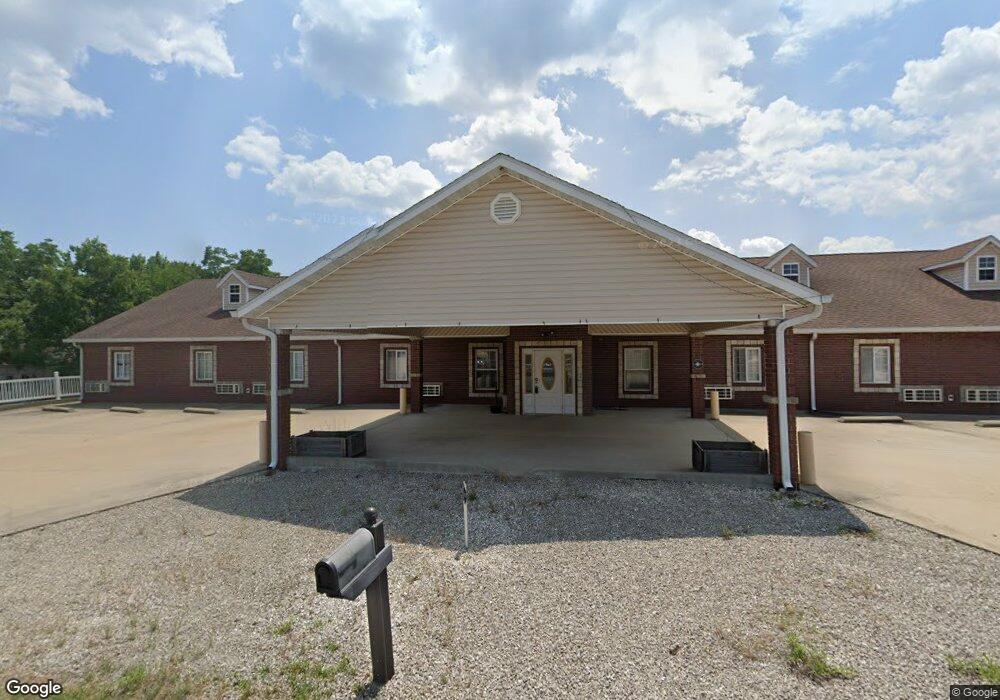
103 E Pulaski Ave Richland, MO 65556
Estimated Value: $539,000
About This Home
This home is located at 103 E Pulaski Ave, Richland, MO 65556 and is currently priced at $539,000, approximately $85 per square foot. 103 E Pulaski Ave is a home located in Pulaski County with nearby schools including Richland Elementary School, Richland Jr. High School, and Richland High School.
Ownership History
We collect this data history from publicly available records. To have your information removed, we recommend requesting removal directly through your county’s website.
Purchase Details
Home Financials for this Owner
Home Financials are based on the most recent Mortgage that was taken out on this home.Purchase Details
Home Financials for this Owner
Home Financials are based on the most recent Mortgage that was taken out on this home.Purchase Details
Purchase Details
Purchase Details
Home Financials for this Owner
Home Financials are based on the most recent Mortgage that was taken out on this home.Purchase History
We collect this data history from publicly available records. To have your information removed, we recommend requesting removal directly through your county’s website.
| Date | Buyer | Sale Price | Title Company |
|---|---|---|---|
| $28,000 | -- | ||
| $594,574 | -- | ||
| -- | -- | ||
| $24,000 | None Available | ||
| -- | None Available |
Mortgage History
We collect this data history from publicly available records. To have your information removed, we recommend requesting removal directly through your county’s website.
| Date | Status | Borrower | Loan Amount |
|---|---|---|---|
| Open | $22,400 | ||
| Previous Owner | $475,659 | ||
| Previous Owner | $61,072 |
Tax History
We collect this data history from publicly available records. To have your information removed, we recommend requesting removal directly through your county’s website.
| Year | Tax Paid | Tax Assessment Tax Assessment Total Assessment is a certain percentage of the fair market value that is determined by local assessors to be the total taxable value of land and additions on the property. | Land | Improvement |
|---|---|---|---|---|
| 2025 | $8,074 | $716,450 | $17,640 | $698,810 |
| 2024 | $81 | $168,003 | $5,645 | $162,358 |
| 2023 | $8,042 | $168,003 | $5,645 | $162,358 |
| 2022 | $7,885 | $168,003 | $5,645 | $162,358 |
| 2021 | $9,631 | $203,552 | $4,992 | $198,560 |
| 2020 | $9,689 | $186,045 | $0 | $0 |
| 2019 | $9,670 | $203,552 | $0 | $0 |
| 2018 | $9,665 | $203,552 | $0 | $0 |
| 2017 | $9,659 | $186,045 | $0 | $0 |
| 2016 | $9,659 | $203,550 | $0 | $0 |
| 2015 | -- | $203,550 | $0 | $0 |
| 2014 | $97 | $203,550 | $0 | $0 |
Map
- 204 E Mcclurg St
- 23013 Rock Bluff Dr
- TBD Route 7
- 220 Warren St
- 810 Mildred St
- 11 Flora Dr
- 514 O Dell Ave
- 337 Cottonwood Branch
- 24939 Storm Break Dr
- 34555 Highway Ff
- 26287 Radcliff Dr
- 20955 Rye Ln
- 23400 Range Ln
- 271 Pleasant Knoll Rd
- 27 Pleasant Knoll Rd
- TBD Ranch Ln
- TBD Range Ln Tract 5
- TBD Range Ln Tract 7
- 6203 Shepherd Rd
- TBD Range Ln Tract 8
- 101 E Pulaski Ave
- 113 E Pulaski Ave
- 410 S Pine St
- 0 Pulaski Unit 14061961
- 0 Pulaski Unit 15017639
- 203 E Pulaski Ave
- 514 S Pine St
- 207 E Pulaski Ave
- 112 W Pulaski St
- 109 Texas Ave
- 619 S Pine
- 115 W Pulaski St
- 203 E Main St
- 312 S Chestnut St
- 207 E Main St
- 307 W Main St
- 307 W Main St
- 315 W Main St
- 307 W Main St
- 305 W Main St
Ask me questions while you tour the home.