103 N Pershing Ave Unit 105 Akron, OH 44313
Northwest Akron NeighborhoodEstimated Value: $172,549 - $208,000
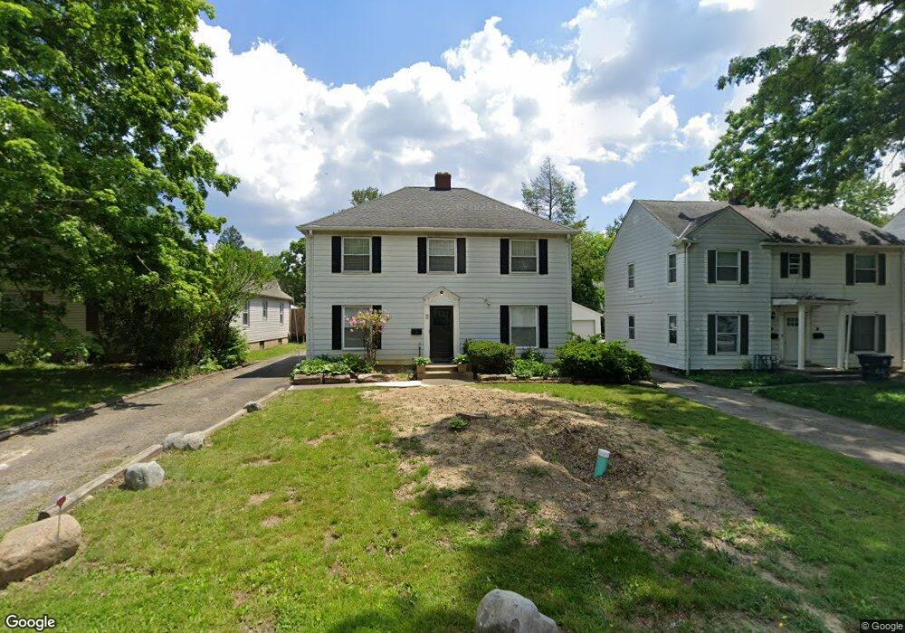
About This Home
This home is located at 103 N Pershing Ave Unit 105, Akron, OH 44313 and is currently estimated at $193,850, approximately $228 per square foot. 103 N Pershing Ave Unit 105 is a home located in Summit County with nearby schools including Summit Academy School, Our Lady Of The Elms Elementary School, and St. Sebastian Parish School.
Ownership History
We collect this data history from publicly available records. To have your information removed, we recommend requesting removal directly through your county’s website.
Purchase Details
Purchase Details
Home Values in the Area
Average Home Value in this Area
Purchase History
We collect this data history from publicly available records. To have your information removed, we recommend requesting removal directly through your county’s website.
| Date | Buyer | Sale Price | Title Company |
|---|---|---|---|
| -- | None Listed On Document | ||
| $75,000 | Chicago Title Insurance Co |
Mortgage History
We collect this data history from publicly available records. To have your information removed, we recommend requesting removal directly through your county’s website.
| Date | Status | Borrower | Loan Amount |
|---|---|---|---|
| Open | $135,944 |
Tax History
We collect this data history from publicly available records. To have your information removed, we recommend requesting removal directly through your county’s website.
| Year | Tax Paid | Tax Assessment Tax Assessment Total Assessment is a certain percentage of the fair market value that is determined by local assessors to be the total taxable value of land and additions on the property. | Land | Improvement |
|---|---|---|---|---|
| 2026 | $4,926 | $54,720 | $13,563 | $41,157 |
| 2025 | $2,378 | $42,088 | $8,992 | $33,096 |
| 2024 | $2,265 | $42,088 | $8,992 | $33,096 |
| 2023 | $2,378 | $42,088 | $8,992 | $33,096 |
| 2022 | $2,132 | $31,098 | $6,563 | $24,535 |
| 2021 | $2,134 | $31,098 | $6,563 | $24,535 |
| 2020 | $2,102 | $31,100 | $6,560 | $24,540 |
| 2019 | $2,644 | $35,730 | $8,610 | $27,120 |
| 2018 | $2,709 | $35,730 | $8,610 | $27,120 |
| 2017 | $2,603 | $35,730 | $8,610 | $27,120 |
| 2016 | $2,605 | $34,370 | $8,610 | $25,760 |
| 2015 | $2,603 | $34,370 | $8,610 | $25,760 |
| 2014 | $2,582 | $34,370 | $8,610 | $25,760 |
| 2013 | $2,757 | $37,600 | $8,610 | $28,990 |
Map
- 1727-1729 Shatto Ave
- 1766 Tanglewood Dr
- 1724 Wiltshire Rd
- 1695 Wiltshire Rd
- 1660 Wiltshire Rd
- 2070 White Pond Dr
- 330 N Hawkins Ave
- 0 White Pond Dr Unit 5156539
- 71 N Hawkins Ave
- 1593 Kingsley Ave
- 21 Hampshire Rd
- 361 Village Pointe Dr Unit 2
- 262 Lownsdale Ave
- 508 & 510 N Hawkins Ave
- 1933 Brookshire Rd
- 1559 Fairfax Rd
- 350 Village Pointe Dr
- 2120 Ridgewood Rd
- 173 Wichita Place
- 1920 Stockbridge Rd
- 92 Greencrest Terrace Unit 94
- 96 Greencrest Terrace Unit 98
- 86 Greencrest Terrace Unit 88
- 104 Greencrest Terrace Unit 106
- 80 Greencrest Terrace Unit 82
- 80 82 Greencrest Terrace
- 106 Greencrest Terrace
- 83 85 N Pershing Ave
- 77 N Pershing Ave Unit 79
- 95 Greencrest Terrace
- 83 N Pershing Ave Unit 85
- 71 N Pershing Ave Unit 73
- 89 Greencrest Terrace
- 108 Greencrest Terrace Unit 110
- 72 Greencrest Terrace Unit 74
- 93 Greencrest Terrace Unit 95
- 87 89 Greencrest
- 87 Greencrest Terrace Unit 89
- 81 83 Greencrest Terrace
- 83 Greencrest Terrace
Ask me questions while you tour the home.