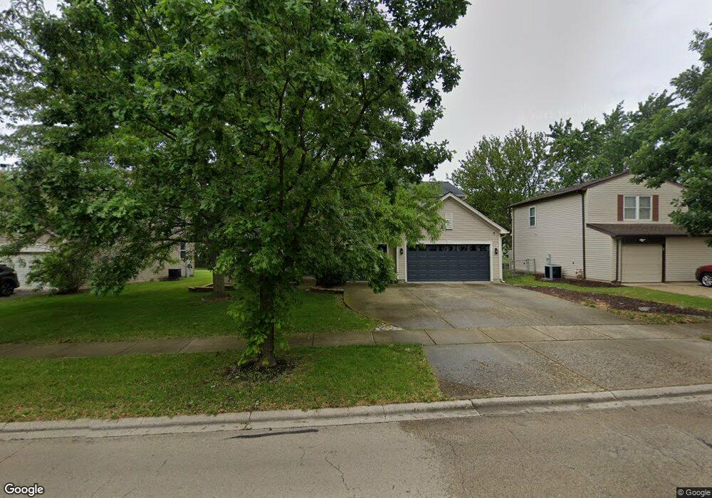
103 S Commonwealth Dr Bolingbrook, IL 60440
Balstrode Park NeighborhoodEstimated Value: $513,000 - $563,000
About This Home
This home is located at 103 S Commonwealth Dr, Bolingbrook, IL 60440 and is currently estimated at $535,168, approximately $169 per square foot. 103 S Commonwealth Dr is a home located in Will County with nearby schools including Jamie Mcgee Elementary School, Jane Addams Middle School, and Brooks Middle School.
Ownership History
We collect this data history from publicly available records. To have your information removed, we recommend requesting removal directly through your county’s website.
Purchase Details
Home Financials for this Owner
Home Financials are based on the most recent Mortgage that was taken out on this home.Home Values in the Area
Average Home Value in this Area
Purchase History
We collect this data history from publicly available records. To have your information removed, we recommend requesting removal directly through your county’s website.
| Date | Buyer | Sale Price | Title Company |
|---|---|---|---|
| $380,500 | Ryland Title Company |
Mortgage History
We collect this data history from publicly available records. To have your information removed, we recommend requesting removal directly through your county’s website.
| Date | Status | Borrower | Loan Amount |
|---|---|---|---|
| Open | $64,350 | ||
| Open | $343,200 | ||
| Closed | $399,000 | ||
| Closed | $361,464 |
Tax History
We collect this data history from publicly available records. To have your information removed, we recommend requesting removal directly through your county’s website.
| Year | Tax Paid | Tax Assessment Tax Assessment Total Assessment is a certain percentage of the fair market value that is determined by local assessors to be the total taxable value of land and additions on the property. | Land | Improvement |
|---|---|---|---|---|
| 2024 | $15,110 | $163,219 | $41,435 | $121,784 |
| 2023 | $14,335 | $146,859 | $37,282 | $109,577 |
| 2022 | $12,484 | $132,301 | $33,612 | $98,689 |
| 2021 | $11,850 | $123,704 | $31,428 | $92,276 |
| 2020 | $11,494 | $119,637 | $30,395 | $89,242 |
| 2019 | $11,137 | $113,940 | $28,948 | $84,992 |
| 2018 | $10,704 | $109,055 | $27,707 | $81,348 |
| 2017 | $10,205 | $103,370 | $26,263 | $77,107 |
| 2016 | $9,923 | $98,400 | $25,000 | $73,400 |
| 2015 | $8,594 | $94,400 | $24,000 | $70,400 |
| 2014 | $8,594 | $85,800 | $21,800 | $64,000 |
| 2013 | $8,594 | $85,800 | $21,800 | $64,000 |
Map
- 167 Glen Lake Dr
- 3 Claridge Ct
- 4 Claridge Ct
- 1133 Jennifer Ln
- 213 Campbell Dr
- 990 Pennwood Ln Unit 1
- 122 Grady Dr
- 19 Lily Ct
- 321 Claridge Cir
- 169 Sandalwood Ln
- 165 Park Meadow Ln
- 128 Farm Gate Ln
- 215 Brookwood Ln E
- 828 Tamms Ln
- 909 Brompton Cir
- 169 N Orchard Dr Unit 2
- 286 Plainview Dr
- 1133 Four Seasons Ln
- 346 Thistle Dr
- 184 Fox Bend Cir
- 107 S Commonwealth Dr
- 101 Commonwealth Dr
- 105 Commonwealth Dr
- 111 S Commonwealth Dr
- 1052 Ridgewood Dr
- 1020 Ashbrook Cir
- 1054 Ridgewood Dr
- 1021 W Briarcliff Rd
- 1050 Ridgewood Dr
- 1047 Towner Dr
- 115 S Commonwealth Dr
- 1059 Towner Dr
- 113 Commonwealth Dr
- 1017 W Briarcliff Rd
- 114 S Commonwealth Dr
- 1016 Ashbrook Cir
- 1048 Ridgewood Dr
- 1043 Towner Dr
- 1056 Ridgewood Dr Unit 2
- 1063 Towner Dr
Ask me questions while you tour the home.