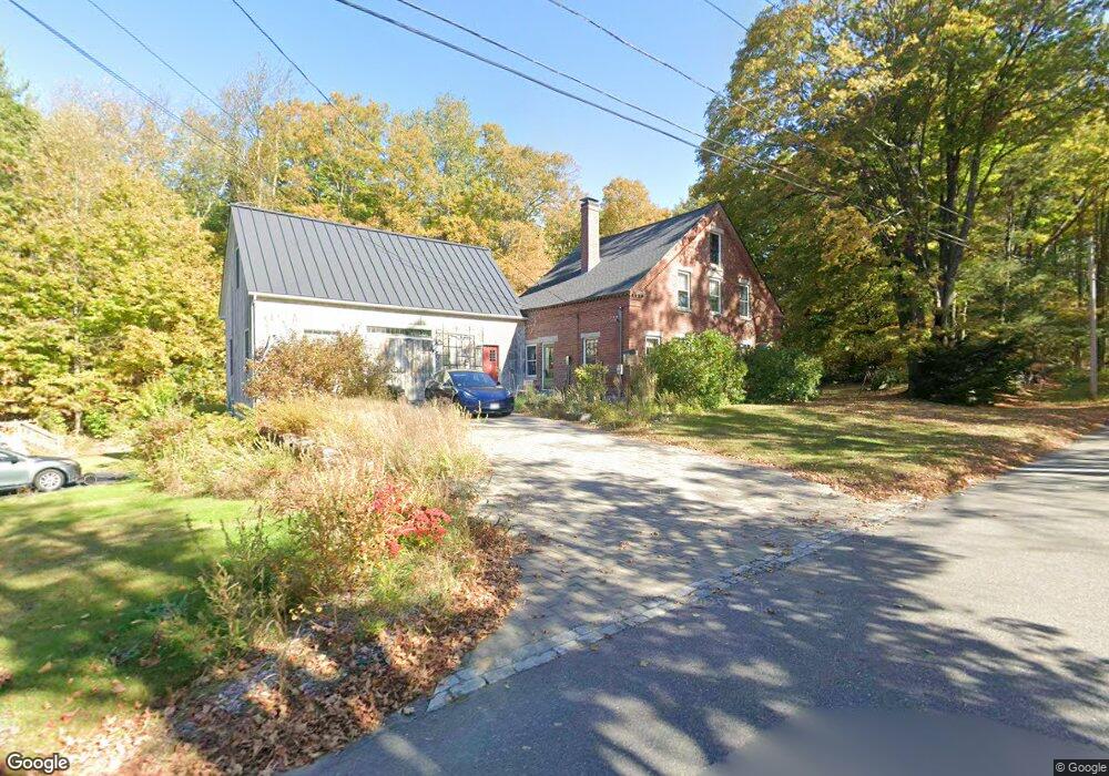
103 Turnpike Rd Westminster, MA 01473
Estimated Value: $522,274 - $685,000
4
Beds
2
Baths
2,573
Sq Ft
$236/Sq Ft
Est. Value
About This Home
This home is located at 103 Turnpike Rd, Westminster, MA 01473 and is currently estimated at $607,819, approximately $236 per square foot. 103 Turnpike Rd is a home located in Worcester County with nearby schools including Oakmont Regional High School.
Ownership History
Date
Name
Owned For
Owner Type
Purchase Details
Closed on
Dec 16, 2021
Sold by
Trei Peter G and Trei Roberta L
Bought by
Treu Ft
Current Estimated Value
Purchase Details
Closed on
Jan 26, 1999
Sold by
Sheldon Gregory W and Sheldon Pamela M
Bought by
Trei Peter G and Trei Roberta L
Purchase Details
Closed on
Jul 31, 1991
Sold by
Hines Theda Evelyn and Hines Everett Earl
Bought by
Sheldon Gregory W and Sheldon Pamela
Create a Home Valuation Report for This Property
The Home Valuation Report is an in-depth analysis detailing your home's value as well as a comparison with similar homes in the area
Home Values in the Area
Average Home Value in this Area
Purchase History
| Date | Buyer | Sale Price | Title Company |
|---|---|---|---|
| Treu Ft | -- | None Available | |
| Trei Peter G | $245,000 | -- | |
| Sheldon Gregory W | $115,000 | -- |
Source: Public Records
Mortgage History
| Date | Status | Borrower | Loan Amount |
|---|---|---|---|
| Previous Owner | Sheldon Gregory W | $170,000 | |
| Previous Owner | Sheldon Gregory W | $150,000 |
Source: Public Records
Tax History
| Year | Tax Paid | Tax Assessment Tax Assessment Total Assessment is a certain percentage of the fair market value that is determined by local assessors to be the total taxable value of land and additions on the property. | Land | Improvement |
|---|---|---|---|---|
| 2025 | $5,304 | $431,200 | $121,600 | $309,600 |
| 2024 | $5,061 | $412,800 | $121,600 | $291,200 |
| 2023 | $4,989 | $382,000 | $112,300 | $269,700 |
| 2022 | $4,939 | $312,600 | $97,700 | $214,900 |
| 2021 | $4,886 | $291,500 | $86,400 | $205,100 |
| 2020 | $4,770 | $271,800 | $78,400 | $193,400 |
| 2019 | $4,712 | $258,200 | $64,800 | $193,400 |
| 2018 | $4,673 | $251,900 | $64,800 | $187,100 |
| 2017 | $4,507 | $247,800 | $64,800 | $183,000 |
| 2016 | $4,449 | $236,900 | $53,900 | $183,000 |
| 2015 | $4,334 | $228,700 | $53,900 | $174,800 |
| 2014 | $4,341 | $228,700 | $53,900 | $174,800 |
Source: Public Records
Map
Nearby Homes
- 169 Narrows Rd
- 76 Saw Mill Pond Rd
- 5 Notown Rd
- 1199 Franklin Rd
- Lot 0 Narrows Rd
- 20 Battles Rd
- 2 Taymax Rd
- 147 Constitution Dr Unit 147
- 72 Green Briar Rd
- 3 Linda Dr
- 7 Green Briar Rd Unit 7
- 2 Roberts Way
- 34 Mountain Laurel Ln
- 204 Roosevelt St
- 18 Downy Cir
- 64 Loiselle Ave
- 122 Sanborn St
- 0 Syd Smith Rd (Rear)
- 0 Syd Smith Rd Map 71 Lot 4-2
- 0
Your Personal Tour Guide
Ask me questions while you tour the home.