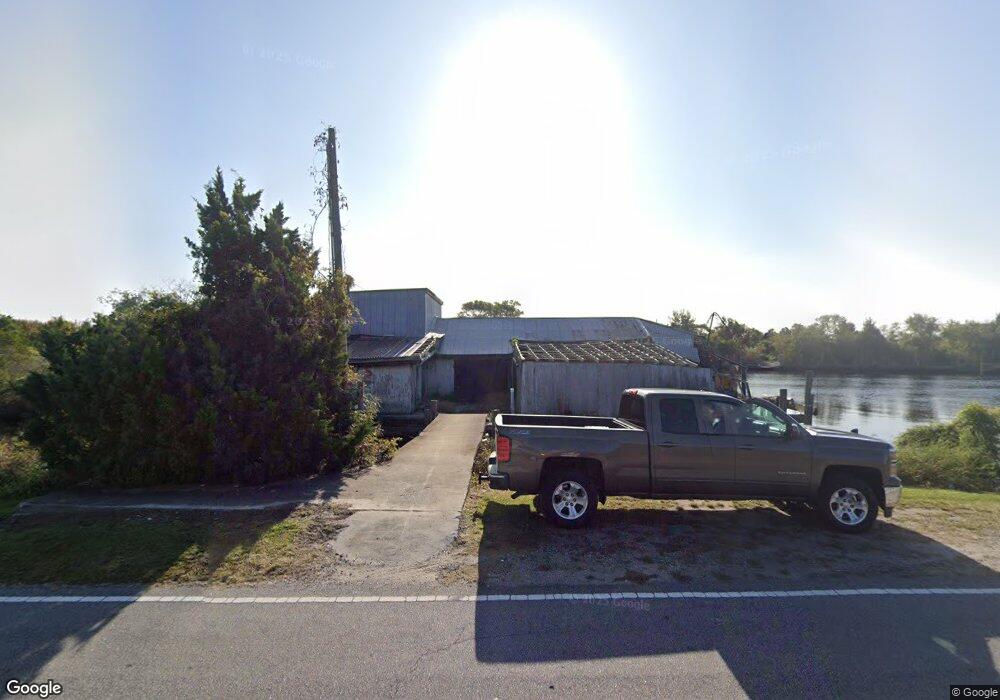
103 Us Highway 264 Stumpy Point, NC 27978
Estimated Value: $111,172
Studio
2
Baths
4,550
Sq Ft
$24/Sq Ft
Est. Value
About This Home
This home is located at 103 Us Highway 264, Stumpy Point, NC 27978 and is currently estimated at $111,172, approximately $24 per square foot. 103 Us Highway 264 is a home located in Dare County with nearby schools including Manteo Elementary School, Manteo Middle School, and Manteo High School.
Ownership History
Date
Name
Owned For
Owner Type
Purchase Details
Closed on
Apr 2, 2020
Sold by
Nicholas James D and Nicholas June C
Bought by
Midgett Luke and Seafood Nseine
Current Estimated Value
Purchase Details
Closed on
Mar 14, 2014
Sold by
Lake Worth Development Llc
Bought by
Nicholas James D and Nicholas June C
Purchase Details
Closed on
Oct 5, 2005
Sold by
Twiford William B and Twiford Sandra K
Bought by
Lake Worth Development Llc
Purchase Details
Closed on
Mar 9, 2005
Sold by
Rippons Benny H and Rippons Diana L
Bought by
Twiford W Brantley and Twiford Sandra K
Home Financials for this Owner
Home Financials are based on the most recent Mortgage that was taken out on this home.
Original Mortgage
$160,000
Interest Rate
5.57%
Mortgage Type
Commercial
Create a Home Valuation Report for This Property
The Home Valuation Report is an in-depth analysis detailing your home's value as well as a comparison with similar homes in the area
Purchase History
| Date | Buyer | Sale Price | Title Company |
|---|---|---|---|
| Midgett Luke | $62,000 | None Available | |
| Nicholas James D | $40,000 | None Available | |
| Lake Worth Development Llc | $165,000 | None Available | |
| Twiford W Brantley | $50,000 | None Available |
Source: Public Records
Mortgage History
| Date | Status | Borrower | Loan Amount |
|---|---|---|---|
| Previous Owner | Twiford W Brantley | $160,000 |
Source: Public Records
Tax History
| Year | Tax Paid | Tax Assessment Tax Assessment Total Assessment is a certain percentage of the fair market value that is determined by local assessors to be the total taxable value of land and additions on the property. | Land | Improvement |
|---|---|---|---|---|
| 2025 | $585 | $84,200 | $70,400 | $13,800 |
| 2024 | $608 | $43,800 | $36,300 | $7,500 |
| 2023 | $577 | $93,800 | $36,300 | $57,500 |
| 2022 | $567 | $93,800 | $36,300 | $57,500 |
| 2021 | $558 | $93,800 | $36,300 | $57,500 |
| 2020 | $260 | $43,800 | $36,300 | $7,500 |
| 2019 | $274 | $39,100 | $31,400 | $7,700 |
| 2018 | $274 | $39,100 | $31,400 | $7,700 |
| 2017 | $274 | $39,100 | $31,400 | $7,700 |
| 2016 | $258 | $39,100 | $31,400 | $7,700 |
| 2014 | $301 | $45,600 | $37,900 | $7,700 |
Source: Public Records
Map
Nearby Homes
- 0 Bayview Dr Unit 131251
- 123 Bayview Dr
- 137 Bayview Dr Unit Lot N/A
- 170 Bayview Dr
- 172 Bayview Dr
- 278 Bayview Dr
- 288 Bayview Dr
- 92 Mosley Ln
- 72 Hickman Ln
- 1146 E R Daniels Rd
- 7552 Shipyard Rd
- 7636 Shipyard Rd
- 168 Burrus Rd
- 4013 Mill Landing Rd
- 4683 Mill Landing Rd
- 109 Toler Rd
- 5689 Old Ferry Dock Rd
- 0 Docks Unit Lot 15 125645
- 0 Docks Unit 4
- 807 Back Bay Rd Unit Lot30
- 100 Us Highway 264
- 106 Us Highway 264
- 108 Us Highway 264
- 0 Bayview Dr Unit 100850
- 0 Bayview Dr Unit 97207
- 0 Bayview Dr Unit 97206
- 0 Bayview Dr Unit Parcel 1 64174
- 0 Bayview Dr Unit 84006
- 0 Bayview Dr Unit 90021
- 0 Bayview Dr Unit 95560
- 0 Bayview Dr Unit 95559
- 0 Bayview Dr Unit Lot Parcel 2 128663
- 0 Bayview Dr Unit 123537
- 0 Bayview Dr Unit 122902
- 0 Bayview Dr Unit 113809
- 0 Bayview Dr Unit 113805
- 0 Bayview Dr Unit 64906
- 0 Bayview Dr Unit 80931
- 114A Bayview Dr
- 114B Bayview Dr
Your Personal Tour Guide
Ask me questions while you tour the home.