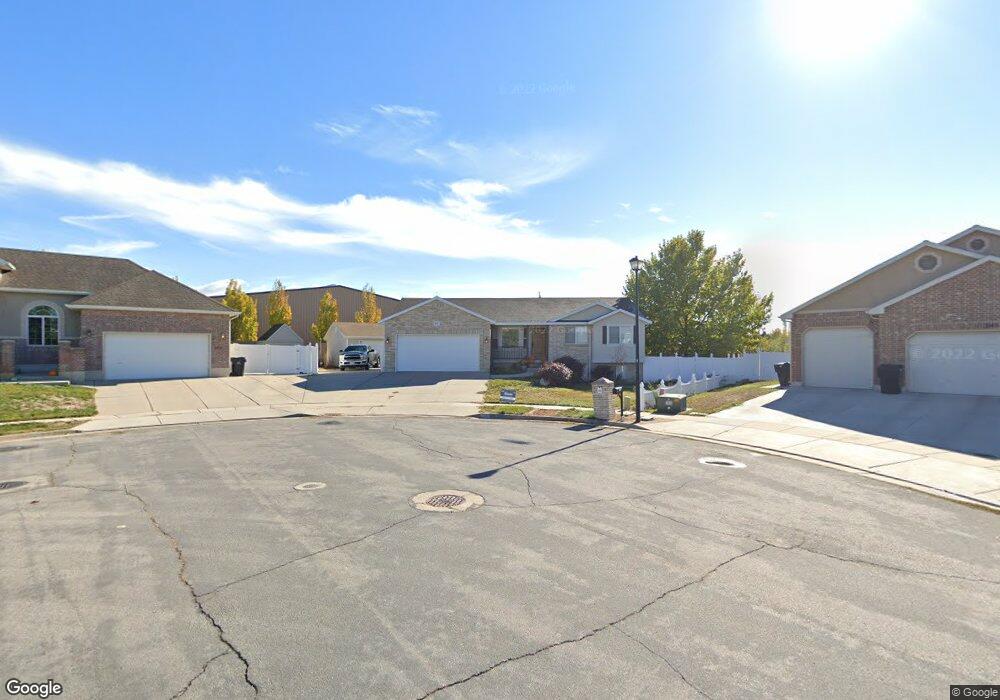
1031 S 2125 W Syracuse, UT 84075
Estimated Value: $582,000 - $618,671
5
Beds
3
Baths
2,874
Sq Ft
$208/Sq Ft
Est. Value
About This Home
This home is located at 1031 S 2125 W, Syracuse, UT 84075 and is currently estimated at $598,668, approximately $208 per square foot. 1031 S 2125 W is a home located in Davis County with nearby schools including Syracuse Elementary School, Syracuse Junior High School, and Syracuse High School.
Ownership History
Date
Name
Owned For
Owner Type
Purchase Details
Closed on
Dec 7, 2021
Sold by
Burgoyne Orion and Burgoyne Christy Makell
Bought by
Pollard Abraham Doulas and Pollard Kristine
Current Estimated Value
Home Financials for this Owner
Home Financials are based on the most recent Mortgage that was taken out on this home.
Original Mortgage
$420,000
Outstanding Balance
$383,267
Interest Rate
3.14%
Mortgage Type
New Conventional
Estimated Equity
$215,401
Purchase Details
Closed on
Mar 27, 2018
Sold by
Flurer Joe W and Flurer Deanne F
Bought by
Burgoyne Orion and Burgoyne Christy Makell
Home Financials for this Owner
Home Financials are based on the most recent Mortgage that was taken out on this home.
Original Mortgage
$324,950
Interest Rate
4.43%
Mortgage Type
New Conventional
Purchase Details
Closed on
Oct 25, 2011
Sold by
Flurer Josef and Flurer Deanne
Bought by
Flurer Joe W and Flurer Deanne F
Home Financials for this Owner
Home Financials are based on the most recent Mortgage that was taken out on this home.
Original Mortgage
$194,000
Interest Rate
4.01%
Mortgage Type
New Conventional
Purchase Details
Closed on
Jul 14, 2009
Sold by
Rokus John
Bought by
Flurer Josef and Flurer Deanne
Home Financials for this Owner
Home Financials are based on the most recent Mortgage that was taken out on this home.
Original Mortgage
$194,000
Interest Rate
5.25%
Mortgage Type
Purchase Money Mortgage
Purchase Details
Closed on
Oct 14, 2003
Sold by
Rokus John and Rokus John J
Bought by
Rokus John
Purchase Details
Closed on
Mar 26, 2003
Sold by
Rokus John J and Rokus John
Bought by
Rokus John J
Home Financials for this Owner
Home Financials are based on the most recent Mortgage that was taken out on this home.
Original Mortgage
$235,000
Interest Rate
5.79%
Purchase Details
Closed on
Jul 8, 2002
Sold by
Johnson Kevin R
Bought by
Rokus John
Home Financials for this Owner
Home Financials are based on the most recent Mortgage that was taken out on this home.
Original Mortgage
$171,700
Interest Rate
9.37%
Purchase Details
Closed on
Feb 14, 2002
Sold by
Thompson Shane W and Thompson Jennifer H
Bought by
Johnson Kevin R
Purchase Details
Closed on
Apr 10, 2001
Sold by
Benchmark Real Estate Company
Bought by
Thompson Shane W and Thompson Jennifer H
Create a Home Valuation Report for This Property
The Home Valuation Report is an in-depth analysis detailing your home's value as well as a comparison with similar homes in the area
Home Values in the Area
Average Home Value in this Area
Purchase History
| Date | Buyer | Sale Price | Title Company |
|---|---|---|---|
| Pollard Abraham Doulas | -- | First American Title | |
| Burgoyne Orion | -- | Us Title | |
| Flurer Joe W | -- | Backman Title Servic | |
| Flurer Josef | -- | Cottonwood Title Ins Agen | |
| Rokus John | -- | Nations Title Agency Inc | |
| Rokus John J | -- | Superior Title Company Inc | |
| Rokus John | -- | Crocker Companies Inc | |
| Johnson Kevin R | $155,000 | Bonneville Title Company Inc | |
| Thompson Shane W | -- | Founders Title Co |
Source: Public Records
Mortgage History
| Date | Status | Borrower | Loan Amount |
|---|---|---|---|
| Open | Pollard Abraham Doulas | $420,000 | |
| Previous Owner | Burgoyne Orion | $324,950 | |
| Previous Owner | Flurer Joe W | $194,000 | |
| Previous Owner | Flurer Josef | $194,000 | |
| Previous Owner | Rokus John J | $235,000 | |
| Previous Owner | Rokus John | $171,700 |
Source: Public Records
Tax History
| Year | Tax Paid | Tax Assessment Tax Assessment Total Assessment is a certain percentage of the fair market value that is determined by local assessors to be the total taxable value of land and additions on the property. | Land | Improvement |
|---|---|---|---|---|
| 2025 | $3,358 | $323,950 | $128,486 | $195,464 |
| 2024 | -- | $297,550 | $109,715 | $187,835 |
| 2023 | $2,955 | $523,000 | $152,674 | $370,326 |
| 2022 | $3,186 | $309,100 | $87,406 | $221,694 |
| 2021 | $2,796 | $420,000 | $129,562 | $290,438 |
| 2020 | $2,510 | $365,000 | $111,124 | $253,876 |
| 2019 | $2,382 | $342,000 | $110,748 | $231,252 |
| 2018 | $2,232 | $318,000 | $105,810 | $212,190 |
| 2016 | $2,077 | $155,210 | $40,534 | $114,676 |
| 2015 | $2,221 | $158,070 | $40,534 | $117,536 |
| 2014 | $1,830 | $132,732 | $40,534 | $92,198 |
| 2013 | -- | $161,797 | $33,689 | $128,108 |
Source: Public Records
Map
Nearby Homes
- 2098 W 700 S
- 1079 S 1875 W
- 2584 S 2430 St W Unit 502
- 2613 S 2430 W Unit 111
- 2614 S 2430 W Unit 106
- 2665 S 2430 W Unit 118
- 2663 S 2430 W
- 1728 Dallas St
- 634 S 1550 W
- 1240 S 1575 W
- 552 S 1525 W
- 1720 W 1400 S
- 1115 S 1425 W
- 1437 W 1200 S
- 2885 W 700 S
- 1443 W 550 S
- 1932 W 200 S
- 615 S 1400 W
- 2329 W 1700 S
- 1413 S David St
Your Personal Tour Guide
Ask me questions while you tour the home.