M
Seller's Agent in 2025
Mike Bowler
Keller Williams Realty Lansing
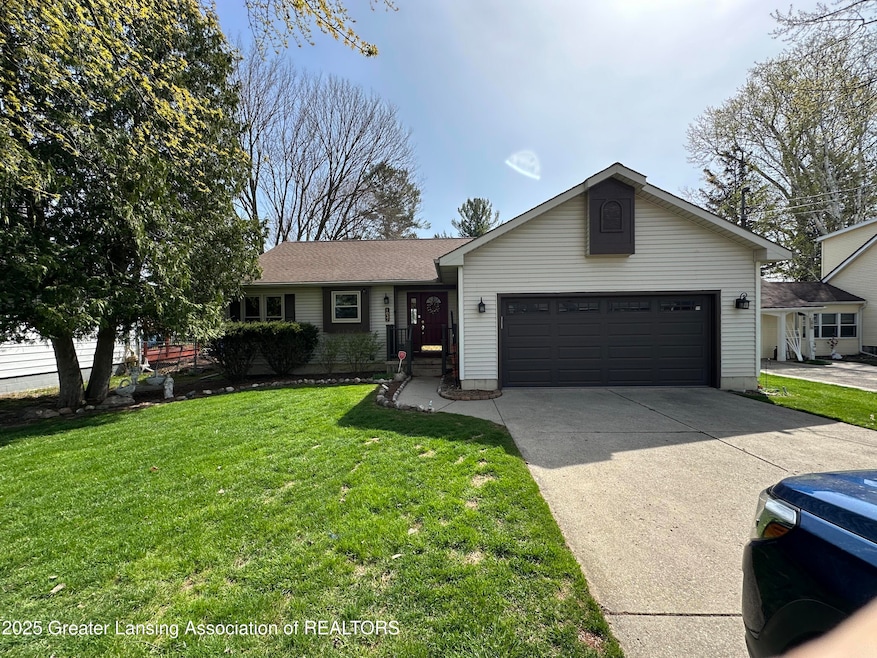
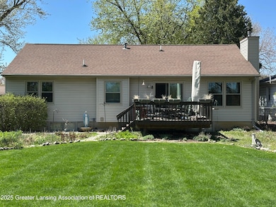
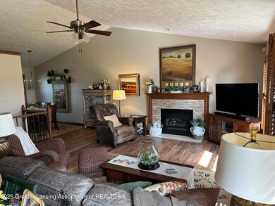
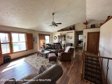
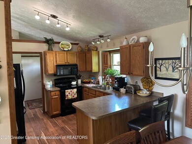
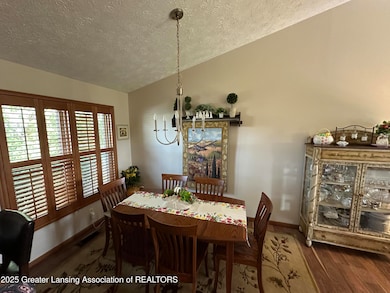
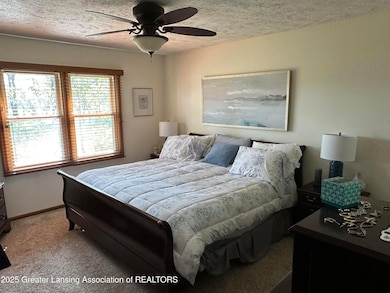
Offering 1,297 square feet of comfortable living space, this residence boasts 2+ spacious bedrooms, 2.5 bathrooms, first floor laundry and the perfect blend of functionality and charm. Step inside to find a bright and inviting layout with a convenient a partially finished lower level that provides 3rd bedroom and 3-piece bath. 3 Daylight windows in lower level.
Last Agent to Sell the Property
Mike Bowler
Keller Williams Realty Lansing License #6506029407 Listed on: 06/09/2025
| Date | Type | Sale Price | Title Company |
|---|---|---|---|
| Warranty Deed | $250,000 | Ata National Title Group | |
| Warranty Deed | $250,000 | Ata National Title Group | |
| Warranty Deed | $140,000 | Bell Title Company | |
| Land Contract | -- | First American Title Ins Co |
| Date | Status | Loan Amount | Loan Type |
|---|---|---|---|
| Open | $237,500 | New Conventional | |
| Previous Owner | $109,890 | FHA |
| Date | Event | Price | List to Sale | Price per Sq Ft |
|---|---|---|---|---|
| 07/11/2025 07/11/25 | Sold | $250,000 | +8.7% | $167 / Sq Ft |
| 06/10/2025 06/10/25 | Pending | -- | -- | -- |
| 06/09/2025 06/09/25 | For Sale | $229,900 | -- | $154 / Sq Ft |
| Year | Tax Paid | Tax Assessment Tax Assessment Total Assessment is a certain percentage of the fair market value that is determined by local assessors to be the total taxable value of land and additions on the property. | Land | Improvement |
|---|---|---|---|---|
| 2025 | $3,484 | $109,800 | $0 | $0 |
| 2024 | $2,038 | $102,900 | $0 | $0 |
| 2023 | $1,960 | $92,600 | $0 | $0 |
| 2022 | $3,068 | $87,200 | $0 | $0 |
| 2021 | $2,968 | $79,000 | $0 | $0 |
| 2020 | $3,056 | $74,500 | $0 | $0 |
| 2019 | $2,998 | $71,112 | $0 | $0 |
| 2018 | $2,983 | $67,300 | $0 | $0 |
| 2017 | $2,878 | $66,900 | $0 | $0 |
| 2016 | -- | $65,300 | $0 | $0 |
| 2015 | -- | $64,800 | $0 | $0 |
| 2014 | -- | $61,900 | $0 | $0 |
| 2013 | -- | $62,300 | $0 | $0 |
M
Seller's Agent in 2025
Mike Bowler
Keller Williams Realty Lansing

Buyer's Agent in 2025
Gary Newton
RE/MAX Michigan
(517) 410-8307
41 in this area
675 Total Sales
Source: Greater Lansing Association of Realtors®
MLS Number: 288651
APN: 040-042-500-260-00
Disclaimer: Certain information contained herein is derived from information provided by parties other than Homes.com. All information provided is deemed reliable, but is not guaranteed to be accurate and should be independently verified.
![]() IDX information is provided exclusively for Consumers'
IDX information is provided exclusively for Consumers'
personal, non-commercial use, that it may not be used for any purpose other than to identify prospective properties Consumers may be interested in purchasing. Data is deemed reliable but is not guaranteed accurate by the MLS.
Copyright © 2026 Greater Lansing Association of REALTORS®
Ask me questions while you tour the home.