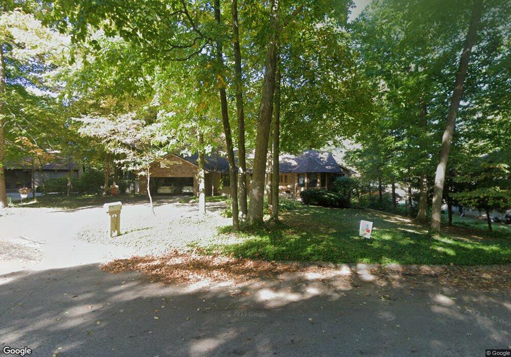
1032 Woodhaven Ct Springfield, OH 45503
Estimated Value: $372,000 - $430,000
3
Beds
2
Baths
1,895
Sq Ft
$209/Sq Ft
Est. Value
About This Home
This home is located at 1032 Woodhaven Ct, Springfield, OH 45503 and is currently estimated at $396,482, approximately $209 per square foot. 1032 Woodhaven Ct is a home located in Clark County with nearby schools including Northridge Elementary School, Kenton Ridge Middle & High School, and Emmanuel Christian Academy.
Ownership History
Date
Name
Owned For
Owner Type
Purchase Details
Closed on
Jan 15, 2001
Sold by
Robert Jackson Lois L and Robert J
Bought by
Young Robert C and Young Lori A
Current Estimated Value
Home Financials for this Owner
Home Financials are based on the most recent Mortgage that was taken out on this home.
Original Mortgage
$140,000
Outstanding Balance
$50,216
Interest Rate
7.69%
Estimated Equity
$346,266
Create a Home Valuation Report for This Property
The Home Valuation Report is an in-depth analysis detailing your home's value as well as a comparison with similar homes in the area
Home Values in the Area
Average Home Value in this Area
Purchase History
| Date | Buyer | Sale Price | Title Company |
|---|---|---|---|
| Young Robert C | $240,000 | -- |
Source: Public Records
Mortgage History
| Date | Status | Borrower | Loan Amount |
|---|---|---|---|
| Open | Young Robert C | $140,000 |
Source: Public Records
Tax History
| Year | Tax Paid | Tax Assessment Tax Assessment Total Assessment is a certain percentage of the fair market value that is determined by local assessors to be the total taxable value of land and additions on the property. | Land | Improvement |
|---|---|---|---|---|
| 2025 | $4,968 | $126,710 | $26,330 | $100,380 |
| 2024 | $4,804 | $113,590 | $22,970 | $90,620 |
| 2023 | $4,804 | $113,590 | $22,970 | $90,620 |
| 2022 | $4,822 | $113,590 | $22,970 | $90,620 |
| 2021 | $4,164 | $83,140 | $18,080 | $65,060 |
| 2020 | $4,167 | $83,140 | $18,080 | $65,060 |
| 2019 | $4,246 | $83,140 | $18,080 | $65,060 |
| 2018 | $3,944 | $74,110 | $14,360 | $59,750 |
| 2017 | $3,380 | $76,563 | $14,361 | $62,202 |
| 2016 | $3,356 | $76,563 | $14,361 | $62,202 |
| 2015 | $3,152 | $70,364 | $13,300 | $57,064 |
| 2014 | $3,151 | $70,364 | $13,300 | $57,064 |
| 2013 | $3,078 | $70,364 | $13,300 | $57,064 |
Source: Public Records
Map
Nearby Homes
- 1415 Montego Dr
- 1052 Cheyenne Ave Unit 1052
- 1341 Student Ave
- 954 Forest Edge Ave
- 4528 W Ridgewood Rd
- 4250 Midfield St
- 1201 Kingsgate Rd
- 4480 Tacoma St
- 1644 Delmar Dr
- 4802 Willowbrook Dr
- 4385 Helena Ct
- 1141 Brixton Dr W
- 3113 Brixton Dr E
- 1500 Kingsgate Rd Unit 19430
- 1502 Kingsgate Rd Unit 19432
- 1500 Kingsgate Rd
- 1502 Kingsgate Rd
- 3631 Kingsgate Ln
- 1503 Kingsgate Rd
- 1505 Kingsgate Rd
- 1040 Woodhaven Ct
- 1018 Woodhaven Ct
- 1053 Montego Dr
- 1065 Montego Dr
- 1041 Montego Dr
- 4241 Tritle Trail
- 1023 Montego Dr
- 1012 Woodhaven Ct
- 1035 Woodhaven Ct
- 1041 Woodhaven Ct
- 1102 Woodhaven Ct
- 4242 Derr Rd
- 1011 Woodhaven Ct
- 4242 Tritle Trail
- 1023 Woodhaven Ct
- 1060 Montego Dr
- 1103 Woodhaven Ct
- 1078 Montego Dr
- 1127 Montego Dr
- 1020 Montego Dr
Your Personal Tour Guide
Ask me questions while you tour the home.