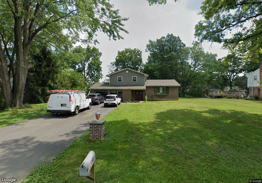
1035 Yorkshire Rd Bethlehem, PA 18017
Estimated Value: $378,157 - $471,000
3
Beds
2
Baths
1,607
Sq Ft
$261/Sq Ft
Est. Value
About This Home
This home is located at 1035 Yorkshire Rd, Bethlehem, PA 18017 and is currently estimated at $418,789, approximately $260 per square foot. 1035 Yorkshire Rd is a home located in Northampton County with nearby schools including Asa Packer Elementary School, Nitschmann Middle School, and Liberty High School.
Ownership History
Date
Name
Owned For
Owner Type
Purchase Details
Closed on
Dec 23, 2020
Sold by
Branigan Charles B and Branigan Sharon M
Bought by
Koxha Qamil
Current Estimated Value
Home Financials for this Owner
Home Financials are based on the most recent Mortgage that was taken out on this home.
Original Mortgage
$225,150
Outstanding Balance
$198,129
Interest Rate
2.7%
Mortgage Type
New Conventional
Estimated Equity
$220,660
Create a Home Valuation Report for This Property
The Home Valuation Report is an in-depth analysis detailing your home's value as well as a comparison with similar homes in the area
Home Values in the Area
Average Home Value in this Area
Purchase History
| Date | Buyer | Sale Price | Title Company |
|---|---|---|---|
| Koxha Qamil | $237,000 | Lighthouse Abstract Ltd |
Source: Public Records
Mortgage History
| Date | Status | Borrower | Loan Amount |
|---|---|---|---|
| Open | Koxha Qamil | $225,150 |
Source: Public Records
Tax History
| Year | Tax Paid | Tax Assessment Tax Assessment Total Assessment is a certain percentage of the fair market value that is determined by local assessors to be the total taxable value of land and additions on the property. | Land | Improvement |
|---|---|---|---|---|
| 2026 | $780 | $72,200 | $31,400 | $40,800 |
| 2025 | $780 | $72,200 | $31,400 | $40,800 |
| 2024 | $5,263 | $72,200 | $31,400 | $40,800 |
| 2023 | $5,281 | $72,200 | $31,400 | $40,800 |
| 2022 | $5,232 | $72,200 | $31,400 | $40,800 |
| 2021 | $5,189 | $72,200 | $31,400 | $40,800 |
| 2020 | $5,196 | $72,200 | $31,400 | $40,800 |
| 2019 | $5,175 | $72,200 | $31,400 | $40,800 |
| 2018 | $5,072 | $72,200 | $31,400 | $40,800 |
| 2017 | $5,036 | $72,200 | $31,400 | $40,800 |
| 2016 | -- | $72,200 | $31,400 | $40,800 |
| 2015 | -- | $72,200 | $31,400 | $40,800 |
| 2014 | -- | $72,200 | $31,400 | $40,800 |
Source: Public Records
Map
Nearby Homes
- 801 Yorkshire Rd
- 1385 W MacAda Rd
- 2610 Jacksonville Rd
- 1425 Roselawn Dr
- 2740 Stonewood Dr
- 0 Rosewood Dr Unit 766427
- 1305 Statten Ave
- 2465 Jacksonville Rd
- 3225 Harmor Ln
- 2821 Center St
- 2713 Center St
- 1645 Mark Twain Cir
- 1655 Mark Twain Cir
- 7 Moreland Ave
- 1655 Chippendale Cir
- 2246 Barrington Rd
- 1339 Richard Ave
- 3424 Park Place
- 1224 Eaton Ave
- 1569 Kelchner Rd
- 1065 Yorkshire Rd
- 1011 Yorkshire Rd
- 1030 Sunset View Cir
- 1125 Sunset Place
- 1040 Sunset View Cir
- 985 Yorkshire Rd
- 1040 Yorkshire Rd
- 1020 Sunset View Cir
- 1070 Yorkshire Rd
- 1020 Yorkshire Rd
- 1115 Yorkshire Rd
- 1130 Sunset View Dr
- 1135 Sunset Place
- 1090 Yorkshire Rd
- 1050 Sunset View Cir
- 990 Yorkshire Rd
- 1021 Sunset View Cir
- 965 Yorkshire Rd
- 1135 Yorkshire Rd
- 1120 Yorkshire Rd
Your Personal Tour Guide
Ask me questions while you tour the home.