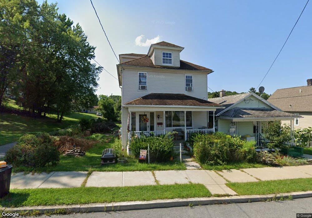
1036 E Locust St Scranton, PA 18505
South Side NeighborhoodEstimated Value: $204,000 - $234,000
About This Home
This home is located at 1036 E Locust St, Scranton, PA 18505 and is currently estimated at $221,938, approximately $115 per square foot. 1036 E Locust St is a home located in Lackawanna County with nearby schools including McNichols Plaza Elementary School, South Scranton Intermediate, and West Scranton High School.
Ownership History
We collect this data history from publicly available records. To have your information removed, we recommend requesting removal directly through your county’s website.
Purchase Details
Home Financials for this Owner
Home Financials are based on the most recent Mortgage that was taken out on this home.Home Values in the Area
Average Home Value in this Area
Purchase History
We collect this data history from publicly available records. To have your information removed, we recommend requesting removal directly through your county’s website.
| Date | Buyer | Sale Price | Title Company |
|---|---|---|---|
| $68,556 | None Available |
Mortgage History
We collect this data history from publicly available records. To have your information removed, we recommend requesting removal directly through your county’s website.
| Date | Status | Borrower | Loan Amount |
|---|---|---|---|
| Open | $65,128 |
Tax History
We collect this data history from publicly available records. To have your information removed, we recommend requesting removal directly through your county’s website.
| Year | Tax Paid | Tax Assessment Tax Assessment Total Assessment is a certain percentage of the fair market value that is determined by local assessors to be the total taxable value of land and additions on the property. | Land | Improvement |
|---|---|---|---|---|
| 2026 | $31,184 | $194,910 | $32,510 | $162,400 |
| 2025 | $3,062 | $10,000 | $800 | $9,200 |
| 2024 | $2,788 | $10,000 | $800 | $9,200 |
| 2023 | $2,788 | $10,000 | $800 | $9,200 |
| 2022 | $2,726 | $10,000 | $800 | $9,200 |
| 2021 | $2,726 | $10,000 | $800 | $9,200 |
| 2020 | $2,672 | $10,000 | $800 | $9,200 |
| 2019 | $2,510 | $10,000 | $800 | $9,200 |
| 2018 | $2,510 | $10,000 | $800 | $9,200 |
| 2017 | $2,463 | $10,000 | $800 | $9,200 |
| 2016 | $651 | $10,000 | $800 | $9,200 |
| 2015 | $1,492 | $10,000 | $800 | $9,200 |
| 2014 | -- | $10,000 | $800 | $9,200 |
Map
- 1109 Stafford Ave Unit rear
- 955 E Elm St
- 1207 Moltke Ave
- 16 Cherry St
- 937 Birch St
- 1223 Beech St
- 833 Palm St
- 623 Crown Ave
- 1601 S Irving Ave
- 812 Willow St
- 618 Rear Alder
- 635 E Elm St Unit Rear
- 840 Alder St
- 518 Meadow Ave
- 613 E Locust St
- 1401 Prospect Ave
- 616 Birch St
- 638 Willow St
- 736 Hickory St
- 826 Prospect Ave
- 1023 E Locust St
- 1021 E Locust St
- 1025 E Locust St
- 1019 E Locust St
- 1015 E Locust St Unit 9
- 1112 Meadow Ave
- 1036 E Elm St
- 1018 E Elm St
- 1038 E Elm St
- 1121 Stafford Ave
- 1121 Stafford Ave
- 1126 Meadow Ave
- 1124 Meadow Ave
- 1040 E Elm St
- 1130 Meadow Ave
- 1122 Meadow Ave
- 1016 E Elm St
- 1030 E Locust St
- 1026 E Locust St
- 1034 E Locust St
Ask me questions while you tour the home.