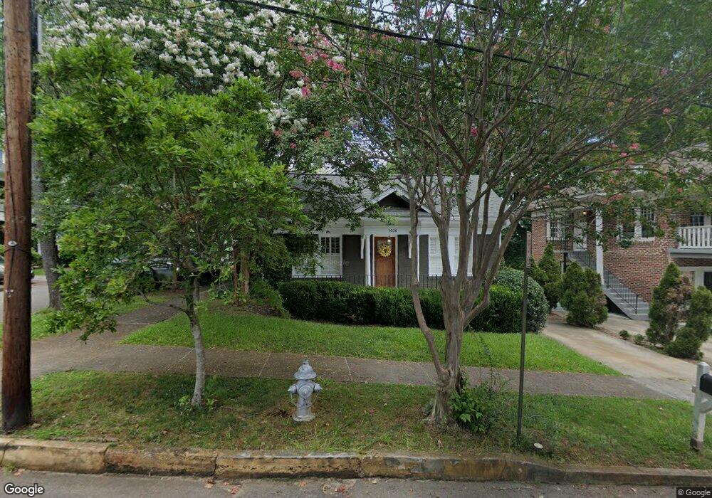
1036 High Point Dr NE Atlanta, GA 30306
Morningside NeighborhoodEstimated Value: $1,016,026 - $1,340,000
3
Beds
2
Baths
2,005
Sq Ft
$566/Sq Ft
Est. Value
About This Home
This home is located at 1036 High Point Dr NE, Atlanta, GA 30306 and is currently estimated at $1,135,507, approximately $566 per square foot. 1036 High Point Dr NE is a home located in Fulton County with nearby schools including Morningside Elementary School, Midtown High School, and Atlanta Montessori International School - Druid Hills.
Ownership History
Date
Name
Owned For
Owner Type
Purchase Details
Closed on
Sep 16, 2011
Sold by
Ryburn Margaret Anne
Bought by
Ryburn Margaret Anne and C/O Commercial Bank
Current Estimated Value
Purchase Details
Closed on
Sep 16, 2003
Sold by
Bickerton Jane E
Bought by
Hoch Jason G and Hoch Shannon
Home Financials for this Owner
Home Financials are based on the most recent Mortgage that was taken out on this home.
Original Mortgage
$230,250
Interest Rate
6.45%
Mortgage Type
New Conventional
Purchase Details
Closed on
Jul 15, 1998
Sold by
Hudgins Anthony A
Bought by
Bickerton Jane E
Purchase Details
Closed on
Nov 17, 1994
Sold by
Gould Patrick A
Bought by
Hudgins Anthony A
Create a Home Valuation Report for This Property
The Home Valuation Report is an in-depth analysis detailing your home's value as well as a comparison with similar homes in the area
Home Values in the Area
Average Home Value in this Area
Purchase History
| Date | Buyer | Sale Price | Title Company |
|---|---|---|---|
| Ryburn Margaret Anne | -- | -- | |
| Ryburn Margaret Anne | $475,550 | -- | |
| Hoch Jason G | $295,000 | -- | |
| Bickerton Jane E | -- | -- | |
| Hudgins Anthony A | $15,000 | -- |
Source: Public Records
Mortgage History
| Date | Status | Borrower | Loan Amount |
|---|---|---|---|
| Previous Owner | Hoch Jason G | $230,250 | |
| Closed | Hudgins Anthony A | -- |
Source: Public Records
Tax History
| Year | Tax Paid | Tax Assessment Tax Assessment Total Assessment is a certain percentage of the fair market value that is determined by local assessors to be the total taxable value of land and additions on the property. | Land | Improvement |
|---|---|---|---|---|
| 2025 | $9,289 | $368,000 | $229,400 | $138,600 |
| 2023 | $16,355 | $395,040 | $229,400 | $165,640 |
| 2022 | $8,941 | $289,800 | $112,840 | $176,960 |
| 2021 | $9,134 | $281,360 | $109,560 | $171,800 |
| 2020 | $8,653 | $281,360 | $109,560 | $171,800 |
| 2019 | $484 | $246,000 | $67,720 | $178,280 |
| 2018 | $7,986 | $231,640 | $58,640 | $173,000 |
| 2017 | $7,563 | $209,560 | $65,080 | $144,480 |
| 2016 | $7,557 | $209,560 | $65,080 | $144,480 |
| 2015 | $8,043 | $209,560 | $65,080 | $144,480 |
| 2014 | $6,750 | $177,760 | $55,200 | $122,560 |
Source: Public Records
Map
Nearby Homes
- 1417 Lanier Place NE
- 1528 N Highland Ave NE
- 1165 Reeder Cir NE
- 1180 Cumberland Rd NE
- 1350 N Morningside Dr NE Unit 13
- 1323 N Highland Ave NE
- 1298 Lanier Blvd NE
- 991 Courtenay Dr NE
- 1216 E Rock Springs Rd NE
- 1329 Berwick Ave NE
- 843 Yorkshire Rd NE
- 1248 Zimmer Dr NE
- 1386 Wayne Ave NE
- 997 McLynn Ave NE
- 1380 Wayne Ave NE
- 1264 Spring Valley Ln NE
- 1348 Berwick Ave NE
- 1265 E Rock Springs Rd NE
- 864 Courtenay Dr NE
- 1566 N Morningside Dr NE
- 1042 High Point Dr NE
- 1046 High Point Dr NE
- 1450 High Point Place NE
- 1437 High Point Place NE
- 1039 Reeder Cir NE
- 1045 Reeder Cir NE
- 1440 High Point Place NE
- 1050 High Point Dr NE
- 1033 Reeder Cir NE
- 1431 High Point Place NE
- 1436 High Point Place NE
- 1049 Reeder Cir NE
- 1056 High Point Dr NE
- 1047 High Point Dr NE
- 1427 High Point Place NE
- 1426 High Point Place NE
- 1053 High Point Dr NE
- 1062 High Point Dr NE
- 1055 Reeder Cir NE
- 1423 High Point Place NE
Your Personal Tour Guide
Ask me questions while you tour the home.