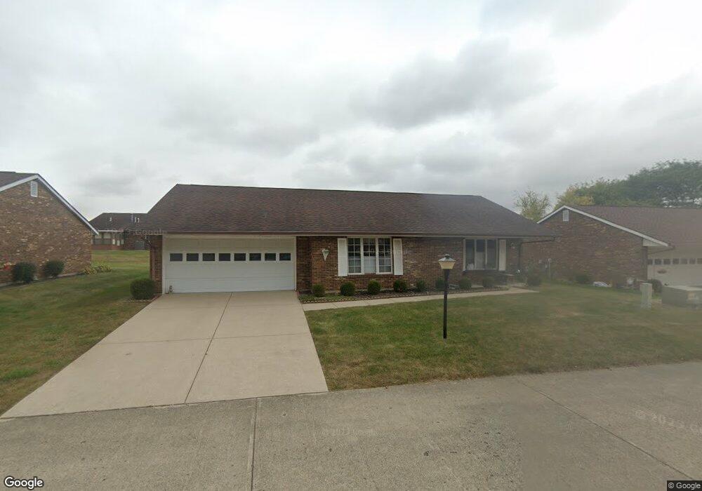
1038 Armsgate Rd Unit 33 Springfield, OH 45503
Estimated Value: $195,000 - $199,000
2
Beds
2
Baths
1,300
Sq Ft
$152/Sq Ft
Est. Value
About This Home
This home is located at 1038 Armsgate Rd Unit 33, Springfield, OH 45503 and is currently estimated at $197,226, approximately $151 per square foot. 1038 Armsgate Rd Unit 33 is a home located in Clark County with nearby schools including Northridge Elementary School, Kenton Ridge Middle & High School, and Emmanuel Christian Academy.
Ownership History
Date
Name
Owned For
Owner Type
Purchase Details
Closed on
Jun 1, 2017
Sold by
Rohrer Derek P and Rohrer Daniel E
Bought by
Eagleton Ii Michael L and Eagleton Teri L
Current Estimated Value
Home Financials for this Owner
Home Financials are based on the most recent Mortgage that was taken out on this home.
Original Mortgage
$58,000
Outstanding Balance
$47,935
Interest Rate
4.05%
Mortgage Type
New Conventional
Estimated Equity
$149,291
Purchase Details
Closed on
Aug 16, 2011
Sold by
Rice Carol Jean
Bought by
Rohrer Donald E and Rohrer Ruth M
Purchase Details
Closed on
Jul 8, 2005
Sold by
Rice Carol J and Rice Carol Jean
Bought by
Rice Carol Jean and Donald F & Carol Jean Rice Declaration T
Purchase Details
Closed on
Nov 16, 2004
Sold by
Lake Kenneth E
Bought by
Rice Carol J
Create a Home Valuation Report for This Property
The Home Valuation Report is an in-depth analysis detailing your home's value as well as a comparison with similar homes in the area
Home Values in the Area
Average Home Value in this Area
Purchase History
| Date | Buyer | Sale Price | Title Company |
|---|---|---|---|
| Eagleton Ii Michael L | $90,000 | Ohio Real Estate Title | |
| Rohrer Donald E | $100,000 | Attorney | |
| Rice Carol Jean | -- | -- | |
| Rice Carol J | $106,000 | -- |
Source: Public Records
Mortgage History
| Date | Status | Borrower | Loan Amount |
|---|---|---|---|
| Open | Eagleton Ii Michael L | $58,000 |
Source: Public Records
Tax History
| Year | Tax Paid | Tax Assessment Tax Assessment Total Assessment is a certain percentage of the fair market value that is determined by local assessors to be the total taxable value of land and additions on the property. | Land | Improvement |
|---|---|---|---|---|
| 2025 | $1,693 | $53,050 | $7,350 | $45,700 |
| 2024 | $1,637 | $39,050 | $6,300 | $32,750 |
| 2023 | $1,637 | $39,050 | $6,300 | $32,750 |
| 2022 | $1,643 | $39,050 | $6,300 | $32,750 |
| 2021 | $1,873 | $38,190 | $5,250 | $32,940 |
| 2020 | $1,875 | $38,190 | $5,250 | $32,940 |
| 2019 | $1,913 | $38,190 | $5,250 | $32,940 |
| 2018 | $1,595 | $30,770 | $5,570 | $25,200 |
| 2017 | $948 | $30,104 | $5,565 | $24,539 |
| 2016 | $941 | $30,104 | $5,565 | $24,539 |
| 2015 | $420 | $29,789 | $5,250 | $24,539 |
| 2014 | $841 | $29,789 | $5,250 | $24,539 |
| 2013 | $839 | $29,789 | $5,250 | $24,539 |
Source: Public Records
Map
Nearby Homes
- 1039 Bradford Dr Unit 42
- 1139 Bradford Dr
- 3052 Brixton Dr E
- 1136 Foxboro Rd Unit 202
- 3211 Haverhill St
- 1525 Providence Ave
- 3124 El Camino Dr
- 1404 Attleboro Ave
- 2943 Tarryton Ln
- 3135 Imperial Blvd
- 2022 Westboro Ave
- 3214 Revels St
- 3631 Kingsgate Ln
- 1500 Kingsgate Rd Unit 19430
- 1502 Kingsgate Rd Unit 19432
- 1500 Kingsgate Rd
- 1502 Kingsgate Rd
- 1201 Kingsgate Rd
- 1507 Kingsgate Rd
- 1503 Kingsgate Rd
- 1036 Armsgate Rd
- 1040 Armsgate Rd Unit 34
- 1039 Armsgate Rd Unit 7
- 1037 Bradford Dr Unit 43
- 1041 Armsgate Rd Unit 6
- 1041 Armsgate Rd
- 1041 Armsgate Rd
- 1037 Armsgate Rd
- 1034 Armsgate Rd
- 1042 Armsgate Rd Unit 35
- 1041 Bradford Dr
- 1041 Bradford Dr
- 1043 Armsgate Rd
- 1035 Armsgate Rd Unit 9
- 1044 Armsgate Rd Unit 36
- 1043 Bradford Dr
- 1038 Bradford Dr Unit 54
- 1038 Bradford Dr
- 1045 Armsgate Rd
- 1045 Armsgate Rd Unit 4
Your Personal Tour Guide
Ask me questions while you tour the home.