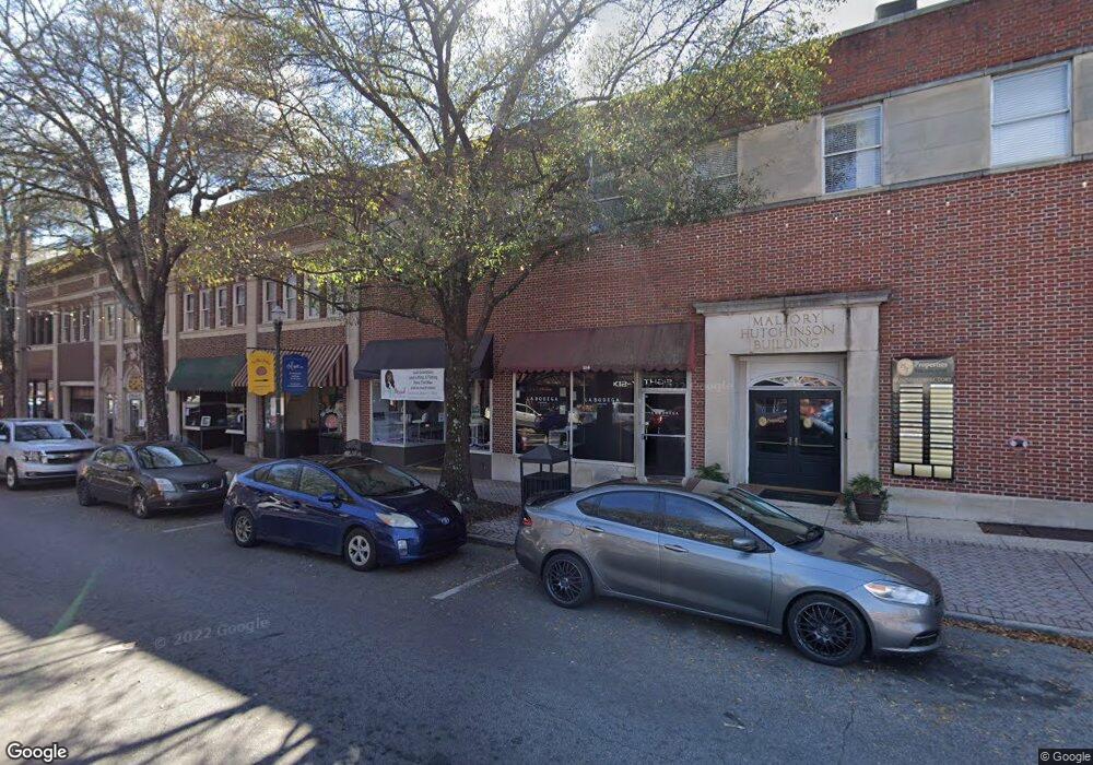
104 Main St Lagrange, GA 30240
Studio
1
Bath
24,843
Sq Ft
18,731
Sq Ft Lot
About This Home
This home is located at 104 Main St, Lagrange, GA 30240. 104 Main St is a home located in Troup County with nearby schools including Hollis Hand Elementary School, Franklin Forest Elementary School, and Ethel W. Kight Elementary School.
Ownership History
Date
Name
Owned For
Owner Type
Purchase Details
Closed on
Oct 12, 2018
Sold by
Hutchinson Traylor Properties Llc
Bought by
City Of Lagrange Ga
Purchase Details
Closed on
Dec 30, 2010
Sold by
Charterbank
Bought by
Hutchinson Traylor Properties
Purchase Details
Closed on
Jul 6, 2010
Sold by
Charterbank
Bought by
Charterbank
Purchase Details
Closed on
Dec 1, 2004
Sold by
Rachel M Jones
Bought by
Lagrange Development Co Llc
Purchase Details
Closed on
Dec 22, 1986
Sold by
Hunsy Inc
Bought by
Rachel M Jones
Purchase Details
Closed on
Feb 1, 1956
Sold by
Hutchinson J F
Bought by
Mallory A E
Create a Home Valuation Report for This Property
The Home Valuation Report is an in-depth analysis detailing your home's value as well as a comparison with similar homes in the area
Purchase History
| Date | Buyer | Sale Price | Title Company |
|---|---|---|---|
| City Of Lagrange Ga | $434,000 | -- | |
| Hutchinson Traylor Properties | $720,000 | -- | |
| Hutchinson Traylor Properties | $720,000 | -- | |
| Charterbank | $550,000 | -- | |
| Lagrange Development Co Llc | $955,000 | -- | |
| Lagrange Development Co Llc | $955,000 | -- | |
| Rachel M Jones | $735,000 | -- | |
| Mallory A E | -- | -- | |
| Hunsy Inc | -- | -- |
Source: Public Records
Tax History
| Year | Tax Paid | Tax Assessment Tax Assessment Total Assessment is a certain percentage of the fair market value that is determined by local assessors to be the total taxable value of land and additions on the property. | Land | Improvement |
|---|---|---|---|---|
| 2025 | $25,933 | $829,240 | $172,920 | $656,320 |
| 2024 | $25,623 | $819,320 | $172,920 | $646,400 |
| 2023 | $20,995 | $1,200 | $0 | $1,200 |
| 2022 | $18,531 | $580,720 | $172,920 | $407,800 |
| 2021 | $16,501 | $483,040 | $172,920 | $310,120 |
| 2020 | $16,501 | $483,040 | $172,920 | $310,120 |
| 2019 | $15,537 | $454,840 | $172,920 | $281,920 |
| 2018 | $15,611 | $457,000 | $199,280 | $257,720 |
| 2017 | $15,670 | $458,720 | $236,920 | $221,800 |
| 2016 | $17,876 | $523,294 | $222,000 | $301,294 |
| 2015 | $12,231 | $357,518 | $203,523 | $153,994 |
| 2014 | $12,249 | $357,518 | $203,523 | $153,994 |
| 2013 | -- | $357,518 | $203,523 | $153,994 |
Source: Public Records
Map
Nearby Homes
- 206 Broad St
- 405 W Broome St Unit 2
- 405 W Broome St Unit 3
- 405 W Broome St Unit 4
- 405 W Broome St Unit 1
- 405 W Broome St Unit 5
- TRACT 1 W Haralson St
- 509 S Lewis St
- 301 E Bacon St
- 208 Boulevard
- 203 Fannin St
- 609 Ridley Ave
- 707 Ridley Ave
- 611 Ridley Ave
- 615 Ridley Ave
- 709 Ridley Ave
- 0 Ridley Ave Unit 10550104
- 304 Boulevard
- 311 Park Ave
- 803 1/2 Hines St
- 106 Main St
- 102 Main St Unit 300
- 108 Main St
- 120 Main St
- 112 Main St
- 37 S Lafayette Square
- 36 S Lafayette Square
- 111 Bull St
- 0 Lafayette Pkwy Unit 8246801
- 0 Lafayette Pkwy Unit 2692057
- 0 Lafayette Pkwy Unit 2811128
- 0 Lafayette Pkwy Unit 3040597
- 0 Lafayette Pkwy Unit 3223739
- 0 Lafayette Pkwy Unit 3271376
- 0 Lafayette Pkwy Unit 7000267
- 0 Lafayette Pkwy Unit 7068596
- 0 Lafayette Pkwy Unit 7088147
- 0 Lafayette Pkwy Unit 7118989
- 0 Lafayette Pkwy Unit 7118981
- 0 Lafayette Pkwy Unit 7215277
Your Personal Tour Guide
Ask me questions while you tour the home.