

104 Pine Dr Hankinson, ND 58041
Estimated payment $16/month
About This Lot
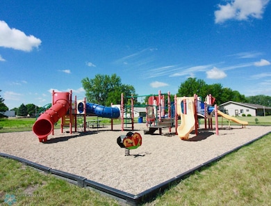
Price REDUCED! Newer development in beautiful Hankinson ND with its own park and country feel!
Property Details
Property Type
- Land
Lot Details
- Unpaved Streets
Community Details
- No Home Owners Association
- Prairie Pines Subdivision
Listing and Financial Details
- Assessor Parcel Number 48120504129070
Map
Tax History
| Year | Tax Paid | Tax Assessment Tax Assessment Total Assessment is a certain percentage of the fair market value that is determined by local assessors to be the total taxable value of land and additions on the property. | Land | Improvement |
|---|---|---|---|---|
| 2024 | $105 | $3,300 | $3,300 | $0 |
| 2023 | $104 | $3,300 | $3,300 | $0 |
| 2022 | $106 | $3,300 | $3,300 | $0 |
| 2021 | $1,168 | $3,300 | $3,300 | $0 |
| 2020 | $1,323 | $8,200 | $8,200 | $0 |
| 2019 | $1,066 | $150 | $150 | $0 |
| 2018 | $1,066 | $150 | $150 | $0 |
Property History
| Date | Event | Price | List to Sale | Price per Sq Ft |
|---|---|---|---|---|
| 12/16/2025 12/16/25 | Price Changed | $2,500 | -50.0% | -- |
| 08/21/2024 08/21/24 | For Sale | $5,000 | -- | -- |
Purchase History
We collect this data history from publicly available records. To have your information removed, we recommend requesting removal directly through your county’s website.
| Date | Type | Sale Price | Title Company |
|---|---|---|---|
| Warranty Deed | -- | None Available | |
| Warranty Deed | -- | None Available |
Source: NorthstarMLS
MLS Number: 6589575
APN: 48120504129070
Disclaimer: Certain information contained herein is derived from information provided by parties other than Homes.com. All information provided is deemed reliable, but is not guaranteed to be accurate and should be independently verified.
![]() All data is obtained from various sources and may not have been verified by broker or MLS GRID. Supplied Open House Information is subject to change without notice. All information should be independently reviewed and verified for accuracy. Properties may or may not be listed by the office/agent presenting the information. Some IDX listings have been excluded from this website.
All data is obtained from various sources and may not have been verified by broker or MLS GRID. Supplied Open House Information is subject to change without notice. All information should be independently reviewed and verified for accuracy. Properties may or may not be listed by the office/agent presenting the information. Some IDX listings have been excluded from this website.
Listings courtesy of NorthstarMLS as distributed by MLS GRID.
Based on information submitted to the MLS GRID
- 511 Main Ave N
- 211 1st Ave NW Unit 5
- 500 1st Ave S
- 909-911 Western Rd
- 902 1st St S
- 809-905 Center St S
- 97 7th Ave S
- 500 Dakota Ave
- 321 4th Ave N Unit 2
- 702 8th Ave N
- 1891 17th Ave N
- 418 8th St S
- 1606 8th St N Unit 59
- 1624 8th St N Unit 77
- 1612 8th St N Unit 70
- 1621 7th St N
- 1627 7th St N Unit 4
- 1627 7th St N Unit 2
- 429 14th St N

Ask me questions while you tour the home.