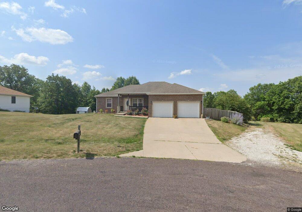
10443 Pinecrest St New Bloomfield, MO 65063
Estimated Value: $261,041 - $328,000
Studio
--
Bath
1,544
Sq Ft
$199/Sq Ft
Est. Value
About This Home
This home is located at 10443 Pinecrest St, New Bloomfield, MO 65063 and is currently estimated at $306,510, approximately $198 per square foot. 10443 Pinecrest St is a home located in Callaway County with nearby schools including New Bloomfield Elementary School and New Bloomfield High School.
Ownership History
Date
Name
Owned For
Owner Type
Purchase Details
Closed on
Jun 18, 2007
Sold by
Henson Bros Const Llc
Bought by
Rohman Michael and Rohman Nancy
Current Estimated Value
Purchase Details
Closed on
Mar 16, 2007
Sold by
Henson Robert W and Henson Sonya
Bought by
Hanson Broe Const Llc
Purchase Details
Closed on
May 15, 2006
Sold by
Rackers & Chinn Construction Llc
Bought by
Henson Robert M and Henson Sonya
Home Financials for this Owner
Home Financials are based on the most recent Mortgage that was taken out on this home.
Original Mortgage
$25,500
Interest Rate
6.36%
Mortgage Type
Purchase Money Mortgage
Create a Home Valuation Report for This Property
The Home Valuation Report is an in-depth analysis detailing your home's value as well as a comparison with similar homes in the area
Purchase History
We collect this data history from publicly available records. To have your information removed, we recommend requesting removal directly through your county’s website.
| Date | Buyer | Sale Price | Title Company |
|---|---|---|---|
| Rohman Michael | -- | -- | |
| Hanson Broe Const Llc | -- | -- | |
| Henson Robert M | -- | None Available |
Source: Public Records
Mortgage History
We collect this data history from publicly available records. To have your information removed, we recommend requesting removal directly through your county’s website.
| Date | Status | Borrower | Loan Amount |
|---|---|---|---|
| Previous Owner | Henson Robert M | $25,500 | |
| Closed | Hanson Broe Const Llc | $0 |
Source: Public Records
Tax History
| Year | Tax Paid | Tax Assessment Tax Assessment Total Assessment is a certain percentage of the fair market value that is determined by local assessors to be the total taxable value of land and additions on the property. | Land | Improvement |
|---|---|---|---|---|
| 2025 | $1,748 | $30,845 | $0 | $0 |
| 2024 | $1,748 | $30,845 | $0 | $0 |
| 2023 | $1,747 | $30,370 | $0 | $0 |
| 2022 | $1,716 | $30,370 | $3,420 | $26,950 |
| 2021 | $1,717 | $30,370 | $3,420 | $26,950 |
| 2020 | $1,718 | $30,370 | $3,420 | $26,950 |
| 2019 | $1,681 | $30,370 | $3,420 | $26,950 |
| 2018 | $1,688 | $30,370 | $3,420 | $26,950 |
| 2017 | $1,684 | $30,370 | $3,420 | $26,950 |
| 2016 | $1,538 | $27,670 | $0 | $0 |
| 2015 | $1,529 | $27,670 | $0 | $0 |
| 2014 | -- | $27,670 | $0 | $0 |
Source: Public Records
Map
Nearby Homes
- 72 S Larand Dr
- 94 S Larand Dr
- 2437 Kirk Dr
- 61 Kirk Dr
- 54 Kirk Dr
- 60 Kirk Dr
- 56 Kirk Dr
- 55 Kirk Dr
- 59 Kirk Dr
- 10867 Country Aire Meadows Ct
- 10867 Country Ln
- 10873 Country Ln
- 10872 Country Aire Meadows Ct
- 10872 Country Ln
- 10878 Country Aire Meadows Ct
- 787 Vine Dr
- 794 Vine Dr
- 779 Vine Dr
- 2650 Eagle View Spur
- 775 Vine Dr
- 2431 Stoney Creek Rd
- 10441 Pinecrest St
- 10447 Pinecrest St
- 2379 Sunset Ln
- 10444 Pinecrest St
- 2430 Stoney Creek Rd
- 10435 Pinecrest St
- 2435 Stoney Creek Rd
- 10442 Pinecrest St
- 0 Pinecrest St
- 2432 Stoney Creek Rd Unit LOT 28
- 2437 Stoney Creek Rd
- 2437 Stoney Creek Rd
- 2434 Stoney Creek Rd
- 10434 Pinecrest St
- 10429 Pinecrest St
- 2436 Stoney Creek Rd
- 10426 Pinecrest St
- 2441 Stoney Creek Rd
- 2438 Stoney Creek Rd
Your Personal Tour Guide
Ask me questions while you tour the home.