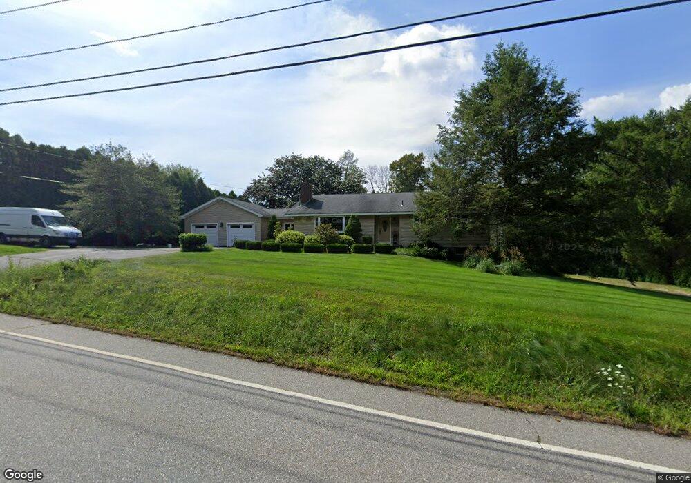
1045 Bread and Milk St Coventry, CT 06238
Estimated Value: $391,000 - $512,000
2
Beds
2
Baths
1,476
Sq Ft
$293/Sq Ft
Est. Value
About This Home
This home is located at 1045 Bread and Milk St, Coventry, CT 06238 and is currently estimated at $433,042, approximately $293 per square foot. 1045 Bread and Milk St is a home located in Tolland County with nearby schools including Coventry Grammar School, George Hersey Robertson School, and Capt. Nathan Hale School.
Ownership History
Date
Name
Owned For
Owner Type
Purchase Details
Closed on
Sep 15, 2000
Sold by
Lyman James
Bought by
Larson Darryl and Typrowicz Rhonda
Current Estimated Value
Home Financials for this Owner
Home Financials are based on the most recent Mortgage that was taken out on this home.
Original Mortgage
$134,700
Interest Rate
8.07%
Purchase Details
Closed on
Nov 12, 1993
Sold by
Allen Margaret
Bought by
Lyman James
Create a Home Valuation Report for This Property
The Home Valuation Report is an in-depth analysis detailing your home's value as well as a comparison with similar homes in the area
Home Values in the Area
Average Home Value in this Area
Purchase History
We collect this data history from publicly available records. To have your information removed, we recommend requesting removal directly through your county’s website.
| Date | Buyer | Sale Price | Title Company |
|---|---|---|---|
| Larson Darryl | $168,400 | -- | |
| Lyman James | $127,000 | -- | |
| Larson Darryl | $168,400 | -- | |
| Lyman James | $127,000 | -- |
Source: Public Records
Mortgage History
We collect this data history from publicly available records. To have your information removed, we recommend requesting removal directly through your county’s website.
| Date | Status | Borrower | Loan Amount |
|---|---|---|---|
| Open | Lyman James | $61,950 | |
| Closed | Lyman James | $657,700 | |
| Closed | Lyman James | $134,700 |
Source: Public Records
Tax History
| Year | Tax Paid | Tax Assessment Tax Assessment Total Assessment is a certain percentage of the fair market value that is determined by local assessors to be the total taxable value of land and additions on the property. | Land | Improvement |
|---|---|---|---|---|
| 2025 | $5,132 | $216,000 | $46,300 | $169,700 |
| 2024 | $4,497 | $135,000 | $40,200 | $94,800 |
| 2023 | $4,285 | $135,000 | $40,200 | $94,800 |
| 2022 | $4,205 | $135,000 | $40,200 | $94,800 |
| 2021 | $4,205 | $135,000 | $40,200 | $94,800 |
| 2020 | $4,208 | $135,000 | $40,200 | $94,800 |
| 2019 | $4,183 | $129,900 | $40,200 | $89,700 |
| 2018 | $3,864 | $120,000 | $40,200 | $79,800 |
| 2017 | $3,840 | $120,000 | $40,200 | $79,800 |
| 2016 | $3,744 | $120,000 | $40,200 | $79,800 |
| 2015 | $3,744 | $120,000 | $40,200 | $79,800 |
| 2014 | $3,900 | $137,000 | $49,800 | $87,200 |
Source: Public Records
Map
Nearby Homes
- 132 Skyview Dr
- 361 Dunn Rd
- 67 Pine Hill Rd
- 100 New Rd
- 0 Mile Hill Rd
- 312 Gehring Rd
- 44 Reed Rd
- 82 Bolton Branch Rd
- 54 Josephine Way
- 64 Tolland Farms Rd
- 39 Josephine Way
- 6 Miller Rd
- 38 Josephine Way
- 198 N Farms Rd
- 21 Josephine Way
- 32 Josephine Way
- 26 Josephine Way
- 37 Wolf Hill Rd Unit Lot 40
- 37 Wolf Hill Lot (#40) Rd
- 14 Joshua Ln
- 0 Dunn Rd
- 10 Dunn Rd
- Lot 1 Dunn Rd
- Lot 3 Dunn Rd
- LOT 5 Dunn Rd
- 1063 Bread and Milk St
- 48 Heather Ln
- 1028 Bread and Milk St Unit B
- 1028 Bread and Milk St
- 1028 Bread and Milk St Unit 2
- 1028 Bread and Milk St Unit 1
- 47 Heather Ln
- 31 Dunn Rd
- 52 Heather Ln
- 1404 Cedar Swamp Rd
- 28 Heather Ln
- 72 Skyview Dr
- 27 Heather Ln
- 60 Dunn Rd
- 65 Heather Ln
Your Personal Tour Guide
Ask me questions while you tour the home.