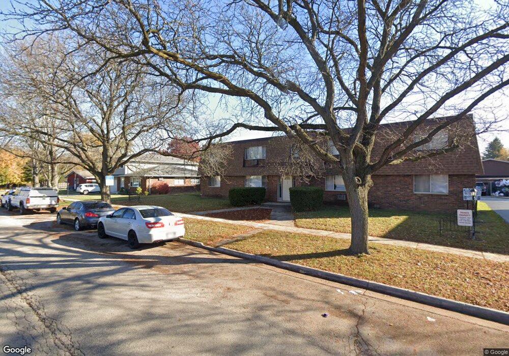
1045 Todd Farm Dr Unit 4 Elgin, IL 60123
Century Oaks NeighborhoodEstimated Value: $67,000 - $262,000
Studio
--
Bath
--
Sq Ft
--
Built
About This Home
This home is located at 1045 Todd Farm Dr Unit 4, Elgin, IL 60123 and is currently estimated at $137,333. 1045 Todd Farm Dr Unit 4 is a home located in Kane County with nearby schools including Century Oaks Elementary School, Kimball Middle School, and Larkin High School.
Ownership History
Date
Name
Owned For
Owner Type
Purchase Details
Closed on
Sep 21, 2012
Sold by
Beneficial Financial I Inc
Bought by
Scardamaglia Joseph
Current Estimated Value
Purchase Details
Closed on
Aug 16, 2011
Sold by
Pulkownik Christopher A and Pulkownik Sabrina L
Bought by
Beneficial Financial I Inc
Purchase Details
Closed on
Oct 28, 2005
Sold by
Mccarthy Daniel L and Mccarthy Aleta
Bought by
Pulkownik Christopher A and Pulkownik Sabrina L
Home Financials for this Owner
Home Financials are based on the most recent Mortgage that was taken out on this home.
Original Mortgage
$22,000
Interest Rate
6.04%
Mortgage Type
Purchase Money Mortgage
Purchase Details
Closed on
Jun 8, 2005
Sold by
Barg Properties Llc
Bought by
Mccarthy Daniel L
Create a Home Valuation Report for This Property
The Home Valuation Report is an in-depth analysis detailing your home's value as well as a comparison with similar homes in the area
Home Values in the Area
Average Home Value in this Area
Purchase History
| Date | Buyer | Sale Price | Title Company |
|---|---|---|---|
| Scardamaglia Joseph | $19,000 | Forum Title Insurance Compan | |
| Beneficial Financial I Inc | -- | None Available | |
| Pulkownik Christopher A | $110,000 | -- | |
| Mccarthy Daniel L | $97,000 | Republic Title |
Source: Public Records
Mortgage History
| Date | Status | Borrower | Loan Amount |
|---|---|---|---|
| Previous Owner | Pulkownik Christopher A | $22,000 |
Source: Public Records
Tax History
| Year | Tax Paid | Tax Assessment Tax Assessment Total Assessment is a certain percentage of the fair market value that is determined by local assessors to be the total taxable value of land and additions on the property. | Land | Improvement |
|---|---|---|---|---|
| 2024 | $64 | $796 | $796 | -- |
| 2023 | $61 | $719 | $719 | -- |
| 2022 | $57 | $656 | $656 | $0 |
| 2021 | $55 | $613 | $613 | $0 |
| 2020 | $53 | $585 | $585 | $0 |
| 2019 | $52 | $557 | $557 | $0 |
| 2018 | $82 | $525 | $525 | $0 |
| 2017 | $51 | $496 | $496 | $0 |
| 2016 | $49 | $460 | $460 | $0 |
| 2015 | -- | $422 | $422 | $0 |
| 2014 | -- | $417 | $417 | $0 |
| 2013 | -- | $428 | $428 | $0 |
Source: Public Records
Map
Nearby Homes
- 1009 Meadow Ln
- 1005 Meadow Ln
- 1212 Century Oaks Dr
- 1583 Sheffield Dr Unit 85
- 1560 Sheffield Dr
- 801 N Mclean Blvd Unit 320
- 801 N Mclean Blvd Unit 118
- 801 N Mclean Blvd Unit 124
- 801 N Mclean Blvd Unit 136
- 801 N Mclean Blvd Unit 222
- 801 N Mclean Blvd Unit 156
- 14 Devonshire Cir Unit 1
- 1104 Florimond Dr
- 1167 Florimond Dr
- 1865 Kevin Ave Unit 5
- 47 Lockman Cir
- 1932 Banks Dr
- 43 Creekside Cir Unit A
- 425 N Alfred Ave
- 2176 Jordan Ln
- 1045 Todd Farm Dr Unit 1
- 1045 Todd Farm Dr Unit 4
- 1045 Todd Farm Dr Unit 2
- 1045 Todd Farm Dr Unit 3
- 1051 Todd Farm Dr Unit 3
- 1051 Todd Farm Dr Unit 1
- 1051 Todd Farm Dr Unit 2
- 1071 Todd Farm Dr
- 1041 Todd Farm Dr Unit 1
- 1041 Todd Farm Dr
- 1041 Todd Farm Dr Unit 4
- 1041 Todd Farm Dr Unit 3
- 1041 Todd Farm Dr Unit 1
- 1041 Todd Farm Dr Unit 2
- 1257 Fairwood Ct
- 1259 Fairwood Ct
- 1253 Fairwood Ct
- 1267 Fairwood Dr Unit 69
- 1267 Fairwood Dr Unit 69
- 1267 Fairwood Dr
Your Personal Tour Guide
Ask me questions while you tour the home.