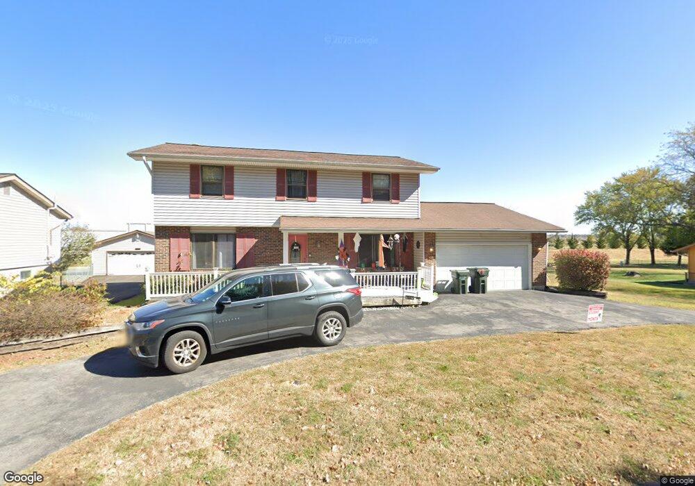
1047 Southcrest Dr Arnold, MO 63010
Estimated Value: $246,219 - $306,000
Studio
1
Bath
1,066
Sq Ft
$260/Sq Ft
Est. Value
About This Home
This home is located at 1047 Southcrest Dr, Arnold, MO 63010 and is currently estimated at $277,305, approximately $260 per square foot. 1047 Southcrest Dr is a home located in Jefferson County with nearby schools including Rockport Heights Elementary School, Fox Middle School, and Fox Senior High School.
Ownership History
Date
Name
Owned For
Owner Type
Purchase Details
Closed on
Sep 25, 2020
Sold by
Abbott Sandra J
Bought by
Sellers Codys and Sellers Felicia
Current Estimated Value
Home Financials for this Owner
Home Financials are based on the most recent Mortgage that was taken out on this home.
Original Mortgage
$180,500
Outstanding Balance
$158,720
Interest Rate
2.9%
Mortgage Type
New Conventional
Estimated Equity
$118,585
Create a Home Valuation Report for This Property
The Home Valuation Report is an in-depth analysis detailing your home's value as well as a comparison with similar homes in the area
Home Values in the Area
Average Home Value in this Area
Purchase History
| Date | Buyer | Sale Price | Title Company |
|---|---|---|---|
| Sellers Codys | -- | Freedom Title |
Source: Public Records
Mortgage History
| Date | Status | Borrower | Loan Amount |
|---|---|---|---|
| Open | Sellers Codys | $180,500 |
Source: Public Records
Tax History
| Year | Tax Paid | Tax Assessment Tax Assessment Total Assessment is a certain percentage of the fair market value that is determined by local assessors to be the total taxable value of land and additions on the property. | Land | Improvement |
|---|---|---|---|---|
| 2025 | $2,022 | $31,200 | $2,900 | $28,300 |
| 2024 | $2,022 | $28,900 | $2,900 | $26,000 |
| 2023 | $2,022 | $28,900 | $2,900 | $26,000 |
| 2022 | $2,060 | $28,900 | $2,900 | $26,000 |
| 2021 | $2,062 | $28,900 | $2,900 | $26,000 |
| 2020 | $1,977 | $26,300 | $2,500 | $23,800 |
| 2019 | $1,983 | $26,300 | $2,500 | $23,800 |
| 2018 | $1,971 | $26,300 | $2,500 | $23,800 |
| 2017 | $2,000 | $26,300 | $2,500 | $23,800 |
| 2016 | $1,674 | $23,600 | $2,500 | $21,100 |
| 2015 | $1,679 | $23,600 | $2,500 | $21,100 |
| 2013 | -- | $23,100 | $2,500 | $20,600 |
Source: Public Records
Map
Nearby Homes
- 2929 Tenbrook Rd
- 0 Unknown Unit 22001740
- 0 Unknown Unit 22071117
- 0 Unknown Unit 22001730
- 0 Unknown Unit 21017758
- 1258 Arnold Tenbrook Rd
- 2721 Rose Dr
- 2631 Georgia Dr
- 672 Berrywine Ln
- 2846 Fannie Dr
- 866 Sunset Dr
- 747 Esther Dr
- 1951 Fox Pointe Dr
- 1294 Windcrest Cir
- 324 Bramtonn Place
- 721 Leolia Dr
- 447 June Dr
- 170 Bogey Blvd
- 0000 Botanical Dr
- 2558 Frederitzi Ln
- 1055 Southcrest Dr
- 1048 Southcrest Dr
- 1039 Southcrest Dr
- 1065 Southcrest Dr
- 1040 Southcrest Dr
- 2922 Tenbrook Rd
- 2926 Tenbrook Rd
- 1031 Southcrest Dr
- 1032 Southcrest Dr
- 2932 Tenbrook Rd
- 2890 Tenbrook Rd
- 2925 Tenbrook Rd
- 1024 Southcrest Dr
- 1023 Southcrest Dr
- 2938 Tenbrook Rd
- 2917 Tenbrook Rd
- 2915 Tenbrook Rd
- 2915 Tenbrook Rd
- 1015 Southcrest Dr
- 1029 Southgate Dr
Your Personal Tour Guide
Ask me questions while you tour the home.