Estimated Value: $654,000 - $1,107,000
2
Beds
2
Baths
1,604
Sq Ft
$584/Sq Ft
Est. Value
About This Home
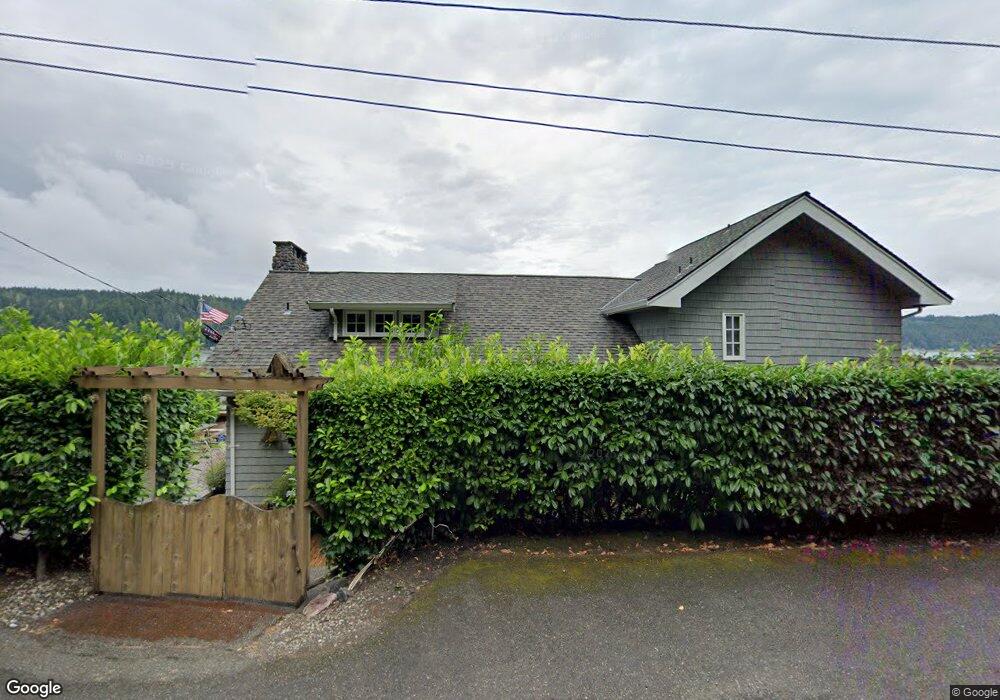
This home is located at 10471 E State Route 106, Union, WA 98592 and is currently estimated at $937,402, approximately $584 per square foot. 10471 E State Route 106 is a home with nearby schools including Hood Canal Elementary/Junior High School.
Ownership History
Date
Name
Owned For
Owner Type
Purchase Details
Closed on
Nov 5, 2014
Sold by
Corwin Kathryn Ann
Bought by
Randolph William and Randolph Shelley
Current Estimated Value
Purchase Details
Closed on
Jun 18, 2009
Sold by
Corwin Kathryn A
Bought by
Corwin Kathryn Ann and Kathryn Ann Corwin Trust
Purchase Details
Closed on
Jun 18, 2008
Sold by
Corwin Kathryn A
Bought by
Corwin Kathryn A
Create a Home Valuation Report for This Property
The Home Valuation Report is an in-depth analysis detailing your home's value as well as a comparison with similar homes in the area
Purchase History
| Date | Buyer | Sale Price | Title Company |
|---|---|---|---|
| Randolph William | $749,600 | Land Title Co | |
| Corwin Kathryn Ann | -- | None Available | |
| Corwin Kathryn A | -- | None Available |
Source: Public Records
Tax History
| Year | Tax Paid | Tax Assessment Tax Assessment Total Assessment is a certain percentage of the fair market value that is determined by local assessors to be the total taxable value of land and additions on the property. | Land | Improvement |
|---|---|---|---|---|
| 2025 | $8,659 | $1,057,605 | $214,830 | $842,775 |
| 2023 | $6,911 | $890,335 | $383,625 | $506,710 |
| 2022 | $6,398 | $696,170 | $385,170 | $311,000 |
| 2021 | $7,065 | $696,170 | $385,170 | $311,000 |
| 2020 | $7,817 | $687,330 | $389,615 | $297,715 |
| 2018 | $6,401 | $602,355 | $359,835 | $242,520 |
| 2017 | $5,447 | $607,225 | $364,705 | $242,520 |
| 2016 | $5,430 | $541,505 | $330,620 | $210,885 |
| 2015 | $5,482 | $553,585 | $340,845 | $212,740 |
| 2014 | -- | $551,730 | $340,845 | $210,885 |
| 2013 | -- | $579,905 | $395,000 | $184,905 |
Source: Public Records
Map
Nearby Homes
- 551 E Timber Tides Dr
- 1133 E Timber Tides Dr
- 11031 NE North Shore Rd
- 11571 E State Route 106
- 0 E Windstar Rd Unit NWM2436680
- 10731 NE North Shore Rd
- 361 Southridge Dr
- 1123 E Timber Tides Dr
- 1121 E Timber Tides Dr
- 100 NE Alta Vista Dr
- 62 Southridge Dr
- 30 NE Brook Dr
- 50 NE Alta Vista Dr
- 93 NE Marine View Dr
- 10212 NE North Shore Rd
- 9661 NE North Shore Rd
- 13300 NE North Shore Rd
- 8331 E State Route 106 Unit A
- 80 NE Brook Place
- 151 NE Myrlis Joy Dr
- 10451 Washington 106
- 10451 E State Route 106
- 10541 E State Route 106
- 10490 E State Route 106
- 10411 E State Route 106
- 10551 E State Route 106
- 10431 E State Route 106
- 10381 E State Route 106
- 10561 Washington 106
- 10581 E State Route 106
- 10351 E State Route 106
- 10591 E State Route 106
- 10332 E State Route 106
- 10330 E State Route 106
- 10332 Highway 106
- 10312 E State Route 106
- 10312 Washington 106
- 10290 E State Route 106
- 10281 E State Route 106
- 10670 E State Route 106
Your Personal Tour Guide
Ask me questions while you tour the home.