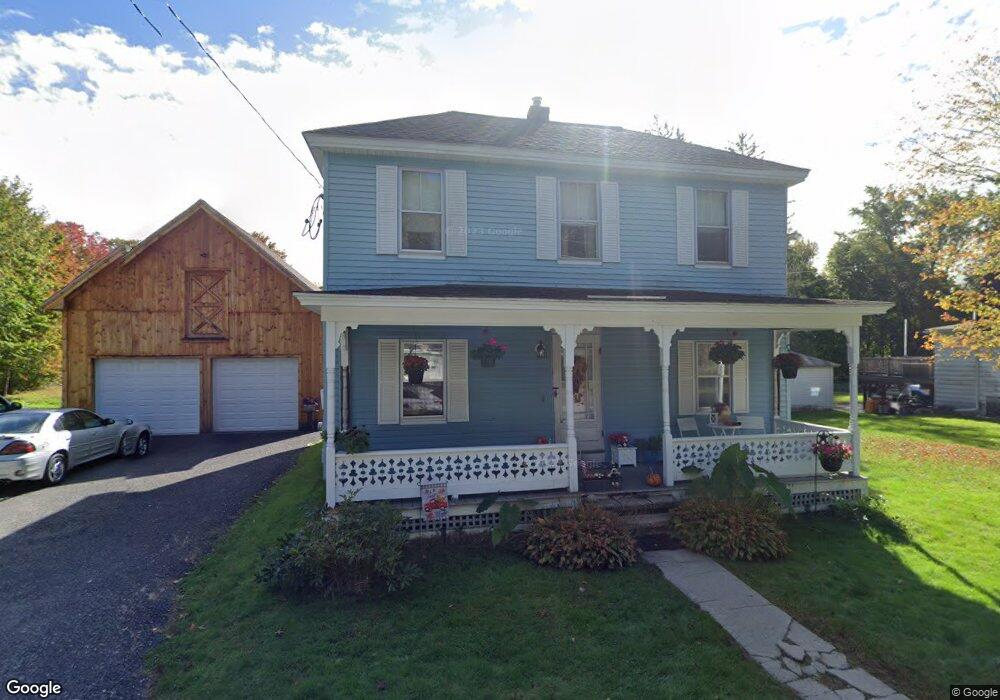
105 Harvard Rd Lancaster, MA 01523
Estimated Value: $409,000 - $496,000
3
Beds
1
Bath
1,316
Sq Ft
$333/Sq Ft
Est. Value
About This Home
This home is located at 105 Harvard Rd, Lancaster, MA 01523 and is currently estimated at $438,329, approximately $333 per square foot. 105 Harvard Rd is a home located in Worcester County with nearby schools including Mary Rowlandson Elementary School, Luther Burbank Middle School, and Nashoba Regional High School.
Ownership History
Date
Name
Owned For
Owner Type
Purchase Details
Closed on
Feb 9, 2007
Sold by
Shields Deborah R
Bought by
Schmidt Eric M
Current Estimated Value
Home Financials for this Owner
Home Financials are based on the most recent Mortgage that was taken out on this home.
Original Mortgage
$209,000
Outstanding Balance
$125,599
Interest Rate
6.22%
Mortgage Type
Purchase Money Mortgage
Estimated Equity
$312,730
Purchase Details
Closed on
Aug 1, 2002
Sold by
Schmidt David P
Bought by
Shields Deborah R
Home Financials for this Owner
Home Financials are based on the most recent Mortgage that was taken out on this home.
Original Mortgage
$145,000
Interest Rate
6.64%
Mortgage Type
Purchase Money Mortgage
Create a Home Valuation Report for This Property
The Home Valuation Report is an in-depth analysis detailing your home's value as well as a comparison with similar homes in the area
Home Values in the Area
Average Home Value in this Area
Purchase History
| Date | Buyer | Sale Price | Title Company |
|---|---|---|---|
| Schmidt Eric M | $209,000 | -- | |
| Shields Deborah R | $190,000 | -- |
Source: Public Records
Mortgage History
| Date | Status | Borrower | Loan Amount |
|---|---|---|---|
| Open | Schmidt Eric M | $209,000 | |
| Previous Owner | Shields Deborah R | $145,000 | |
| Previous Owner | Shields Deborah R | $120,000 |
Source: Public Records
Tax History
| Year | Tax Paid | Tax Assessment Tax Assessment Total Assessment is a certain percentage of the fair market value that is determined by local assessors to be the total taxable value of land and additions on the property. | Land | Improvement |
|---|---|---|---|---|
| 2025 | $5,027 | $311,100 | $118,900 | $192,200 |
| 2024 | $5,308 | $304,000 | $110,700 | $193,300 |
| 2023 | $4,753 | $276,500 | $100,600 | $175,900 |
| 2022 | $4,933 | $253,600 | $103,300 | $150,300 |
| 2021 | $4,801 | $240,300 | $103,300 | $137,000 |
| 2020 | $4,573 | $230,400 | $103,300 | $127,100 |
| 2019 | $4,023 | $203,700 | $103,300 | $100,400 |
| 2018 | $3,934 | $196,900 | $103,300 | $93,600 |
| 2016 | $3,691 | $188,800 | $102,300 | $86,500 |
| 2015 | $3,555 | $189,500 | $102,300 | $87,200 |
| 2014 | $3,510 | $185,600 | $102,300 | $83,300 |
Source: Public Records
Map
Nearby Homes
- 144 Seven Bridge Rd
- 0 Main St
- 565 Langen Rd
- 600 Red Tail Way
- 132 Kilbourn Rd
- 29 Bennett Ln
- 111 Goss Ln
- 303 Ponakin Rd
- 0 Parker Rd
- 19 Brendan Rd
- 110 Ridgefield Cir Unit D
- 303 Ridgefield Cir Unit A
- 7-9 Boynton St
- 9 Hamilton St
- 100 Nashaway Rd
- 503 Hilltop Rd
- 508 High St
- 48 Vaughn Hill Rd
- 861 Main St
- 114 Oak Trail
Your Personal Tour Guide
Ask me questions while you tour the home.