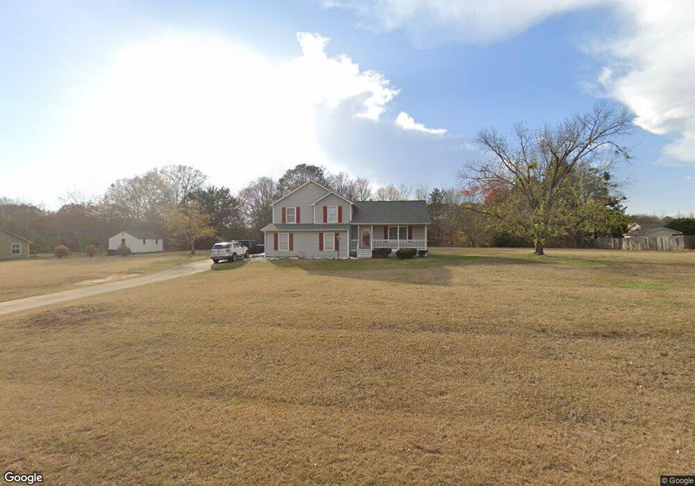
105 Millbrook Way McDonough, GA 30252
McDonough AreaEstimated Value: $276,304 - $318,000
About This Home
This home is located at 105 Millbrook Way, McDonough, GA 30252 and is currently estimated at $295,826, approximately $166 per square foot. 105 Millbrook Way is a home located in Henry County with nearby schools including New Hope Elementary School, Ola Middle School, and Ola High School.
Ownership History
We collect this data history from publicly available records. To have your information removed, we recommend requesting removal directly through your county’s website.
Purchase Details
Purchase Details
Home Values in the Area
Average Home Value in this Area
Purchase History
We collect this data history from publicly available records. To have your information removed, we recommend requesting removal directly through your county’s website.
| Date | Buyer | Sale Price | Title Company |
|---|---|---|---|
| -- | -- | ||
| $93,900 | -- |
Tax History
We collect this data history from publicly available records. To have your information removed, we recommend requesting removal directly through your county’s website.
| Year | Tax Paid | Tax Assessment Tax Assessment Total Assessment is a certain percentage of the fair market value that is determined by local assessors to be the total taxable value of land and additions on the property. | Land | Improvement |
|---|---|---|---|---|
| 2025 | $2,893 | $105,560 | $14,000 | $91,560 |
| 2024 | $2,893 | $105,040 | $14,000 | $91,040 |
| 2023 | $2,433 | $103,640 | $14,000 | $89,640 |
| 2022 | $2,269 | $75,320 | $14,000 | $61,320 |
| 2021 | $2,147 | $70,160 | $14,000 | $56,160 |
| 2020 | $1,942 | $61,480 | $12,000 | $49,480 |
| 2019 | $1,864 | $58,200 | $12,000 | $46,200 |
| 2018 | $1,854 | $57,760 | $10,800 | $46,960 |
| 2016 | $1,736 | $52,760 | $10,000 | $42,760 |
| 2015 | $1,129 | $34,840 | $8,000 | $26,840 |
| 2014 | $1,008 | $31,560 | $8,000 | $23,560 |
Map
- 1891 Highway 81 E
- 1891 Highway 81 E
- 184 Sunflower Meadows Dr
- 153 Hilda Way
- 2230 Highway 81 E
- 125 Chardonnay Oaks Dr
- 75 Paradise Ct
- 0 Old Jackson Rd Unit 10742297
- 1102 Kramden Ct
- 210 Darwish Dr
- 432 Kimberly Ct
- 0 LOT #470 Darwish Dr
- 158 River Park Cir
- 0 N Bethany Rd Unit 7709859
- 0 N Bethany Rd Unit 10679521
- 150 Allie Dr
- 2563 Highway 81 E
- 121 Rosser Rd
- 201 Cades Ct
- 766 S Bethany Rd
- 115 Millbrook Way
- 95 Millbrook Way
- 307 Mill Glen Ct
- 110 Millbrook Way
- 100 Millbrook Way
- 125 Millbrook Way
- 200 Millstone Ct
- 1975 Highway 81 E
- 2043 Highway 81 E
- 303 Mill Glen Ct
- 201 Millstone Ct
- 20 Bethany Woods Ct
- 210 Millstone Ct
- 308 Mill Glen Ct
- 130 Millbrook Way
- 2057 Highway 81 E
- 302 Mill Glen Ct
- 221 Millstone Ct
- 300 Mill Glen Ct
- 304 Mill Glen Ct
Ask me questions while you tour the home.