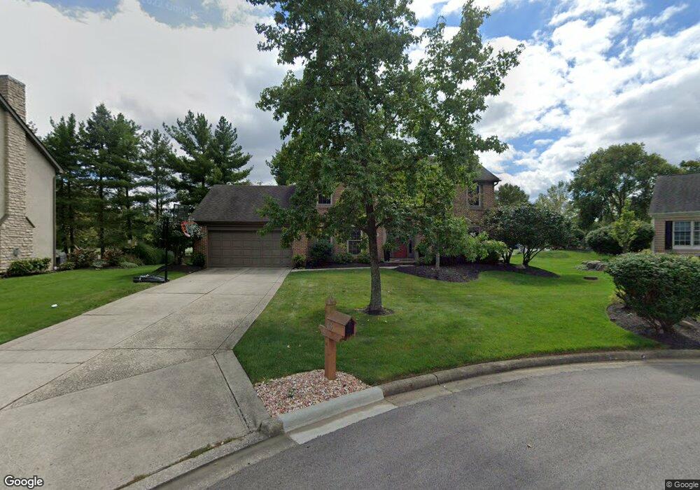
105 Wallsend Ct Powell, OH 43065
Liberty AreaEstimated Value: $523,000 - $556,000
About This Home
This home is located at 105 Wallsend Ct, Powell, OH 43065 and is currently estimated at $540,856, approximately $237 per square foot. 105 Wallsend Ct is a home located in Delaware County with nearby schools including Tyler Run Elementary School, Olentangy Liberty Middle School, and Olentangy Liberty High School.
Ownership History
We collect this data history from publicly available records. To have your information removed, we recommend requesting removal directly through your county’s website.
Purchase Details
Purchase Details
Purchase Details
Home Values in the Area
Average Home Value in this Area
Purchase History
We collect this data history from publicly available records. To have your information removed, we recommend requesting removal directly through your county’s website.
| Date | Buyer | Sale Price | Title Company |
|---|---|---|---|
| -- | None Available | ||
| $230,000 | -- | ||
| $187,000 | -- |
Mortgage History
We collect this data history from publicly available records. To have your information removed, we recommend requesting removal directly through your county’s website.
| Date | Status | Borrower | Loan Amount |
|---|---|---|---|
| Open | $105,300 | ||
| Closed | $35,600 | ||
| Closed | $25,000 |
Tax History
We collect this data history from publicly available records. To have your information removed, we recommend requesting removal directly through your county’s website.
| Year | Tax Paid | Tax Assessment Tax Assessment Total Assessment is a certain percentage of the fair market value that is determined by local assessors to be the total taxable value of land and additions on the property. | Land | Improvement |
|---|---|---|---|---|
| 2025 | $8,006 | $145,010 | $38,400 | $106,610 |
| 2024 | $7,598 | $145,010 | $38,400 | $106,610 |
| 2023 | $7,628 | $145,010 | $38,400 | $106,610 |
| 2022 | $7,273 | $109,630 | $25,730 | $83,900 |
| 2021 | $7,398 | $109,630 | $25,730 | $83,900 |
| 2020 | $7,425 | $109,630 | $25,730 | $83,900 |
| 2019 | $6,443 | $98,670 | $25,730 | $72,940 |
| 2018 | $6,518 | $98,670 | $25,730 | $72,940 |
| 2017 | $6,080 | $86,770 | $21,390 | $65,380 |
| 2016 | $6,150 | $86,770 | $21,390 | $65,380 |
| 2015 | $5,596 | $86,770 | $21,390 | $65,380 |
| 2014 | $5,671 | $86,770 | $21,390 | $65,380 |
| 2013 | $5,677 | $84,880 | $21,390 | $63,490 |
Map
- 83 Hartfield Ct
- 266 Oakham Ct
- 452 Sunridge Dr
- 267 Oakham Ct
- 340 Shale Ridge Ct
- 139 Kellys Ct
- 230 Cavenaugh Ct
- 499 Delaneys Cir
- 197 Chasely Cir
- 52 Beech Ridge Dr
- 374 Rosewood Ct
- 130 Barrington Place
- 150 Barrington Place
- 104 Encore Park Bend S
- 116 Encore Park Bend S
- 116 Encore Park Bend
- 45 Traditions Way
- 171 W Case St
- 121 Encore Park Bend N
- 122 Encore Park Bend N
- 115 Wallsend Ct
- 95 Wallsend Ct
- 125 Wallsend Ct
- 100 Wallsend Ct
- 90 Wallsend Ct
- 110 Wallsend Ct
- 135 Wallsend Ct
- 120 Wallsend Ct
- 286 S Liberty St
- 143 Wallsend Ct
- 130 Wallsend Ct
- 1164 Wallsend Ct
- 142 Wallsend Ct
- 155 Wallsend Ct
- 264 S Liberty St
- 152 Wallsend Ct
- 285 S Liberty St Unit G
- 285 S Liberty St Unit H
- 285 S Liberty St
- 285 S Liberty St Unit B
Ask me questions while you tour the home.