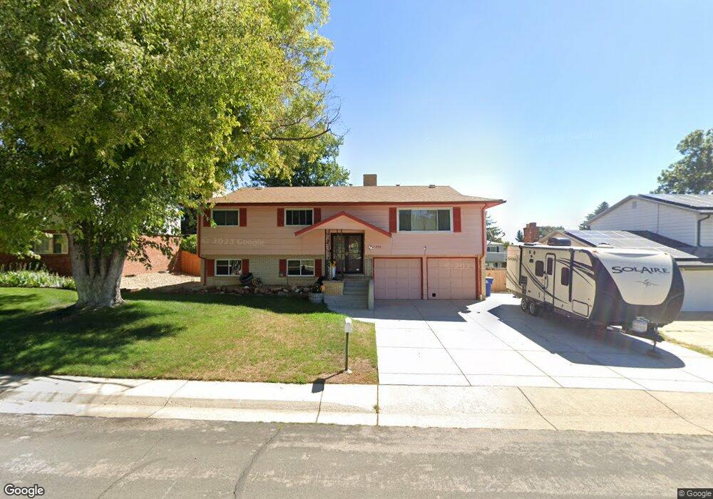
1050 Cedar St Broomfield, CO 80020
Northmoor Estates NeighborhoodEstimated Value: $558,000 - $627,000
4
Beds
3
Baths
2,224
Sq Ft
$267/Sq Ft
Est. Value
About This Home
This home is located at 1050 Cedar St, Broomfield, CO 80020 and is currently estimated at $593,506, approximately $266 per square foot. 1050 Cedar St is a home located in Broomfield County with nearby schools including Birch Elementary School, Aspen Creek K-8 School, and Broomfield High School.
Ownership History
Date
Name
Owned For
Owner Type
Purchase Details
Closed on
Dec 10, 2004
Sold by
Goodhead Robert and Goodhead Christine
Bought by
James Robert and James Christine
Current Estimated Value
Home Financials for this Owner
Home Financials are based on the most recent Mortgage that was taken out on this home.
Original Mortgage
$25,500
Outstanding Balance
$12,570
Interest Rate
5.7%
Mortgage Type
Credit Line Revolving
Estimated Equity
$580,936
Purchase Details
Closed on
Mar 14, 2001
Purchase Details
Closed on
Aug 27, 1981
Create a Home Valuation Report for This Property
The Home Valuation Report is an in-depth analysis detailing your home's value as well as a comparison with similar homes in the area
Home Values in the Area
Average Home Value in this Area
Purchase History
| Date | Buyer | Sale Price | Title Company |
|---|---|---|---|
| James Robert | -- | Fahtco | |
| -- | $210,000 | -- | |
| -- | $85,000 | -- |
Source: Public Records
Mortgage History
| Date | Status | Borrower | Loan Amount |
|---|---|---|---|
| Open | James Robert | $25,500 | |
| Open | James Robert | $204,000 |
Source: Public Records
Tax History
| Year | Tax Paid | Tax Assessment Tax Assessment Total Assessment is a certain percentage of the fair market value that is determined by local assessors to be the total taxable value of land and additions on the property. | Land | Improvement |
|---|---|---|---|---|
| 2025 | $2,646 | $37,240 | $10,720 | $26,520 |
| 2024 | $2,646 | $34,940 | $9,700 | $25,240 |
| 2023 | $2,641 | $40,060 | $11,120 | $28,940 |
| 2022 | $1,979 | $27,420 | $7,820 | $19,600 |
| 2021 | $1,968 | $28,200 | $8,040 | $20,160 |
| 2020 | $1,723 | $25,470 | $7,510 | $17,960 |
| 2019 | $2,392 | $25,650 | $7,560 | $18,090 |
| 2018 | $2,214 | $23,460 | $5,760 | $17,700 |
| 2017 | $2,181 | $25,940 | $6,370 | $19,570 |
| 2016 | $1,965 | $20,840 | $5,450 | $15,390 |
| 2015 | $1,897 | $17,290 | $5,450 | $11,840 |
| 2014 | $1,609 | $17,290 | $5,450 | $11,840 |
Source: Public Records
Map
Nearby Homes
- 951 E 10th Ave
- 1221 Dexter St
- 1110 E 9th Ave
- 286 E 12th Ave
- 1150 E 9th Ave
- 1296 Aspen St
- 1346 Dexter St
- 1356 Dexter St
- 12565 Sheridan Blvd Unit 116
- 12565 Sheridan Blvd Unit 115
- 12565 Sheridan Blvd Unit 308
- 1598 Aspen St
- 1118 Oakhurst Dr
- 4725 W 128th Place
- 1123 Oakhurst Dr
- 4560 Red Deer Trail
- 12575 Vrain St
- 37 E 14th Place
- 114 E 14th Ct
- 13378 King Lake Trail
- 1060 Cedar St
- 1040 Cedar St
- 1041 Cottonwood St
- 1031 Cottonwood St
- 1061 Cottonwood St
- 1080 Cedar St
- 1030 Cedar St
- 1021 Cottonwood St
- 1081 Cedar St
- 1081 Cottonwood St
- 1020 Cedar St
- 1011 Cottonwood St
- 1101 Cottonwood St
- 1102 Cedar St
- 1080 Birch St
- 1042 Cottonwood St
- 1032 Cottonwood St
- 1090 Birch St
- 1082 Cottonwood St
- 1121 Cedar St
Your Personal Tour Guide
Ask me questions while you tour the home.