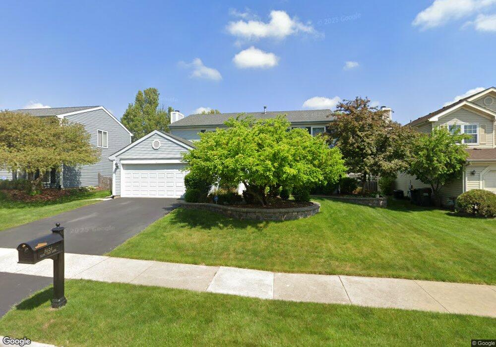
1051 Cliff View Ln Carol Stream, IL 60188
Estimated Value: $469,663 - $512,000
4
Beds
3
Baths
2,197
Sq Ft
$220/Sq Ft
Est. Value
About This Home
This home is located at 1051 Cliff View Ln, Carol Stream, IL 60188 and is currently estimated at $483,166, approximately $219 per square foot. 1051 Cliff View Ln is a home located in DuPage County with nearby schools including Heritage Lakes Elementary School, Jay Stream Middle School, and Glenbard North High School.
Ownership History
Date
Name
Owned For
Owner Type
Purchase Details
Closed on
Oct 30, 2001
Sold by
Doria Michael E and Doria Maria T
Bought by
Perri Gregg C and Perri Annette
Current Estimated Value
Home Financials for this Owner
Home Financials are based on the most recent Mortgage that was taken out on this home.
Original Mortgage
$219,000
Outstanding Balance
$85,344
Interest Rate
6.68%
Estimated Equity
$397,823
Purchase Details
Closed on
Jan 31, 1997
Sold by
Pollard Dennis J and Pollard Janet G
Bought by
Doris Michael E and Doris Maria T
Home Financials for this Owner
Home Financials are based on the most recent Mortgage that was taken out on this home.
Original Mortgage
$155,790
Interest Rate
7.73%
Mortgage Type
FHA
Create a Home Valuation Report for This Property
The Home Valuation Report is an in-depth analysis detailing your home's value as well as a comparison with similar homes in the area
Home Values in the Area
Average Home Value in this Area
Purchase History
We collect this data history from publicly available records. To have your information removed, we recommend requesting removal directly through your county’s website.
| Date | Buyer | Sale Price | Title Company |
|---|---|---|---|
| Perri Gregg C | $249,000 | -- | |
| Doris Michael E | $176,000 | Chicago Title Insurance Co |
Source: Public Records
Mortgage History
We collect this data history from publicly available records. To have your information removed, we recommend requesting removal directly through your county’s website.
| Date | Status | Borrower | Loan Amount |
|---|---|---|---|
| Open | Perri Gregg C | $219,000 | |
| Previous Owner | Doris Michael E | $155,790 |
Source: Public Records
Tax History
| Year | Tax Paid | Tax Assessment Tax Assessment Total Assessment is a certain percentage of the fair market value that is determined by local assessors to be the total taxable value of land and additions on the property. | Land | Improvement |
|---|---|---|---|---|
| 2024 | $10,324 | $128,373 | $35,469 | $92,904 |
| 2023 | $9,696 | $116,470 | $32,180 | $84,290 |
| 2022 | $9,434 | $108,250 | $29,910 | $78,340 |
| 2021 | $8,990 | $102,760 | $28,390 | $74,370 |
| 2020 | $8,796 | $99,680 | $27,540 | $72,140 |
| 2019 | $8,472 | $96,130 | $26,560 | $69,570 |
| 2018 | $7,974 | $91,990 | $25,420 | $66,570 |
| 2017 | $8,277 | $93,140 | $24,410 | $68,730 |
| 2016 | $8,125 | $88,970 | $23,320 | $65,650 |
| 2015 | $8,064 | $84,210 | $22,070 | $62,140 |
| 2014 | $7,977 | $82,070 | $21,510 | $60,560 |
| 2013 | $7,930 | $84,030 | $22,020 | $62,010 |
Source: Public Records
Map
Nearby Homes
- 1188 Brookstone Dr
- 892 Somerset Dr
- 745 Buffalo Cir Unit 5
- 733 Cypress Ln
- 1283 Rose Ave Unit 1
- 701 Buffalo Cir
- 1292 Lilac Ln Unit 1
- 725 Buffalo Cir
- 873 Hampton Dr
- 593 Iroquois Trail
- 1036 Pheasant Trail
- 1112 Pheasant Trail
- 1035 Quarry Ct Unit 9
- 854 Plains Ct
- 1425 Iris Ave
- 1421 Preserve Dr Unit 18
- 548 Alton Ct
- 1334 Coldspring Rd Unit 203
- 545 Alton Ct Unit 273
- 553 Alton Ct Unit 2113
- 1055 Cliff View Ln
- 1045 Cliff View Ln
- 1061 Cliff View Ln
- 1056 Brookstone Dr
- 1037 Cliff View Ln
- 1044 Brookstone Dr
- 1060 Brookstone Dr
- 1050 Cliff View Ln
- 1046 Cliff View Ln
- 1054 Cliff View Ln
- 1065 Cliff View Ln
- 1040 Cliff View Ln
- 1038 Brookstone Dr
- 1064 Brookstone Dr
- 1036 Cliff View Ln
- 1073 Cliff View Ln
- 1064 Cliff View Ln
- 1072 Brookstone Dr
- 1031 Big Eagle Trail
- 1053 Brookstone Dr
Your Personal Tour Guide
Ask me questions while you tour the home.